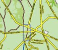
I see it as not bargaining in good faith. Offering us something that we can’t even use. As far as I know the DEP has no intention on fixing up that bridge. I’d be willing to bet the map proponents would push for it to stay closed as well and keep it solely for hiking trails.Ah, the West Mill Road question. A thoughtful strategy along with concentrated and sustained pressure must be used to resolve that issue.
Resistance Grows to the New Plan to Close 200 Miles of Roads in Wharton State Forest
- Thread starter Ben Ruset
- Start date
You are using an out of date browser. It may not display this or other websites correctly.
You should upgrade or use an alternative browser.
You should upgrade or use an alternative browser.
This whole thing is a joke. Many of the roads that they offer to keep open are impassible and some like Whitehorse and Tuckerton south of Carranza Road are a disaster. Wharton is being closed from lack of maintenance.
I thought they wanted to close firebreaks that were inadvertently turned into roads.
Some of the closures are almost spiteful. What about this tiny section of sand road (blue box) necessitates closure? All the other roads around it are acceptable, but this 2000 feet of sand road that isn't in a wetland or near anything other than the other roads around it must be closed?
Attachments
Last edited:
Referring to the quote the DEP claims that they “added” 10 miles of road that is not on any topos (which I find hard to believe). Bulldozed road started as a firebreak. Looking at the historic aerials in 1956 it wasn’t there and appeared in the 1963 aerials.I thought they wanted to close firebreaks that were inadvertently turned into roads.
On map 8 of the Wharton presentation it shows what they consider roads. It’s on that map that they show it as a road they “added”, even though it’s been there since at least the 1960’s.
Also as a side note. I’m not sure what they mean as “private” shown on this map as blue. How do we have private roads on public land?
Referring to the quote the DEP claims that they
Also as a side note. I’m not sure what they mean as “private” shown on this map as blue. How do we have private roads on public land?
I guess they are showing roads that cross onto private parcels, or maybe where the right of way becomes private. One example is the lower branch / original track of "West Mill Road" that enters the property boundaries of the Paradise Lakes campground. Another looks like Birches Rd which splits off from Moore's Meadow Rd and crosses private property on the cranberry farm there, although most of the road appears to be on public land. Moore's Meadow Rd itself has a gap in the public ROW in the middle and you can't drive through from Tuckerton/Carranza to 532, or vice versa, although they do not have that section colored light blue on the comparison map.
My bad. I confused light blue with dark blue. No it makes sense lolI guess they are showing roads that cross onto private parcels, or maybe where the right of way becomes private. One example is the lower branch / original track of "West Mill Road" that enters the property boundaries of the Paradise Lakes campground. Another looks like Birches Rd which splits off from Moore's Meadow Rd and crosses private property on the cranberry farm there, although most of the road appears to be on public land. Moore's Meadow Rd itself has a gap in the public ROW in the middle and you can't drive through from Tuckerton/Carranza to 532, or vice versa, although they do not have that section colored light blue on the comparison map.

