to the end of the land

whippoorbill

Explorer
Jul 29, 2003
675
121
65
Bridgeton
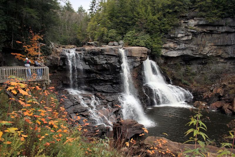
I'm posting a few photos, having just returned from a trip to West Virginia.

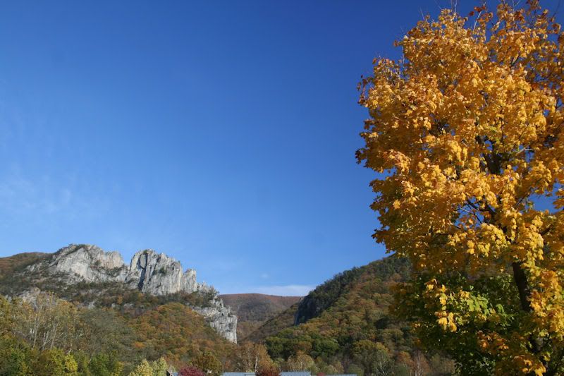
This batch was taken at Seneca Rocks.

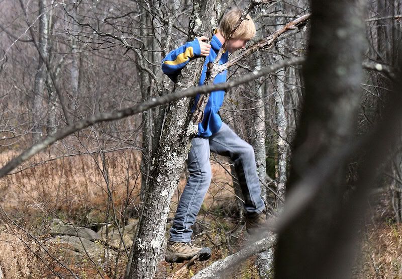
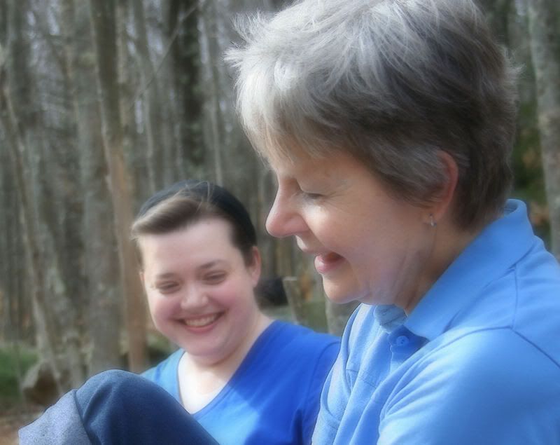
Gloria and her daughter Janelle joined my son Freddie and me for the duration of the trip. We lodged at a fine location adjacent to these beautiful rocks.

sIMG_5207s.jpg


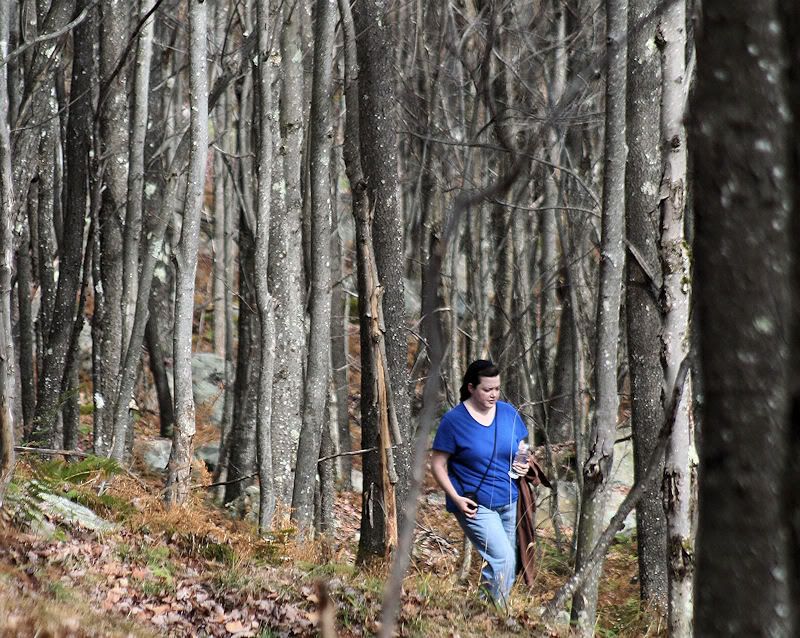
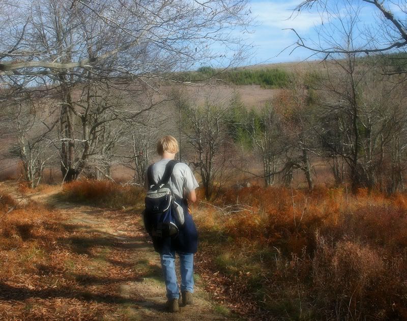
Monday morning we climbed the trail to the top of the rocks.

sIMG_5248.jpg

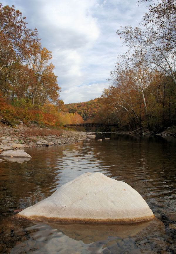
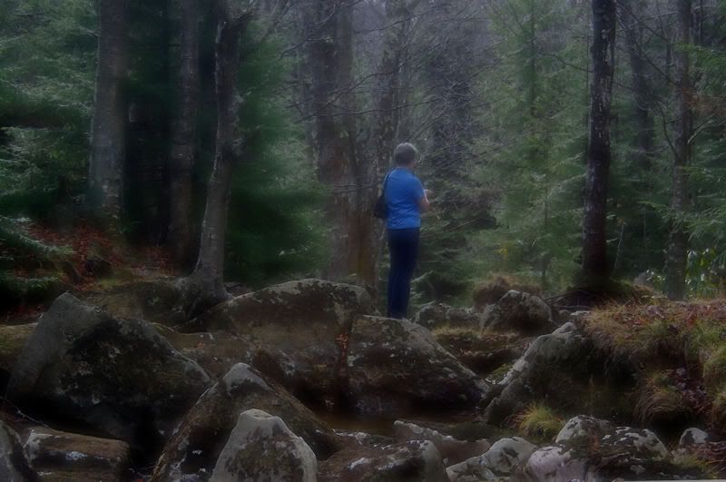
This was taken standing at the mouth of Seneca Creek looking downstream along the North Fork of the South Branch of the Potomac River.
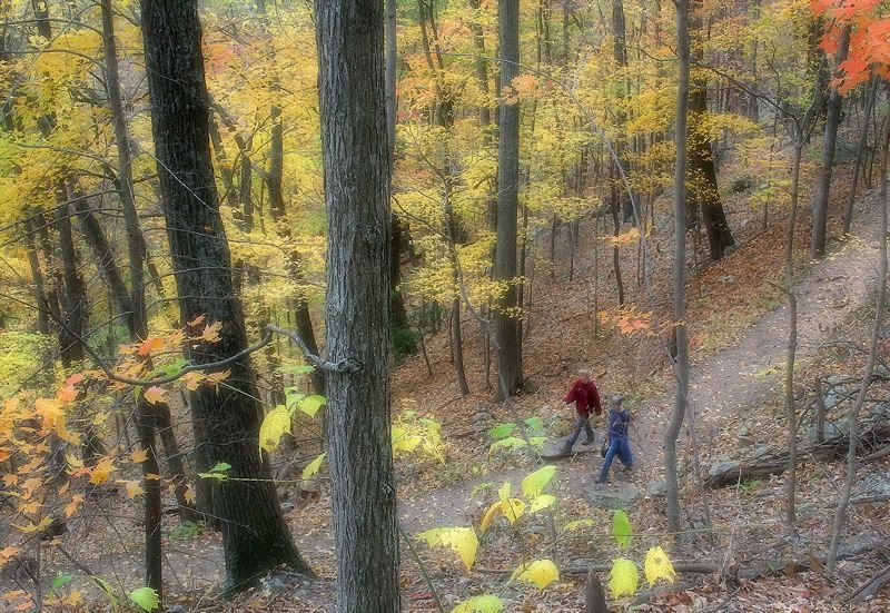
sIMG_5362.jpg

The trail up.

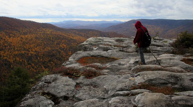
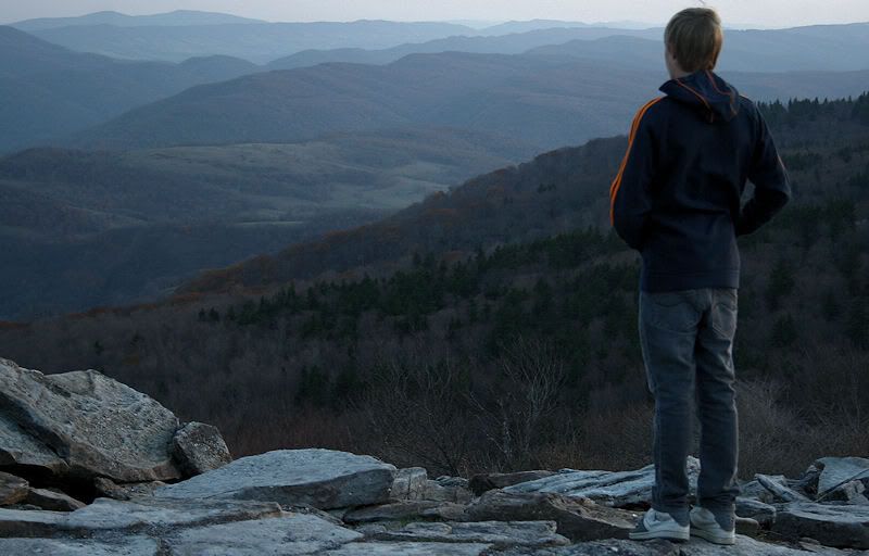
The trail concluded offering a breathtakingly sheer view downward, and an overlook in all directions.
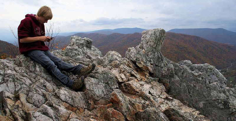
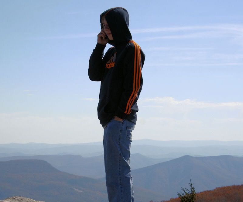
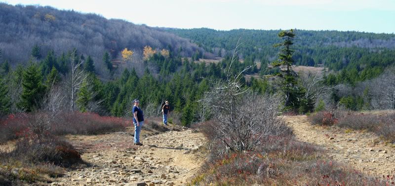
sIMG_5350.jpg

Freddie topped.

sIMG_5347.jpg

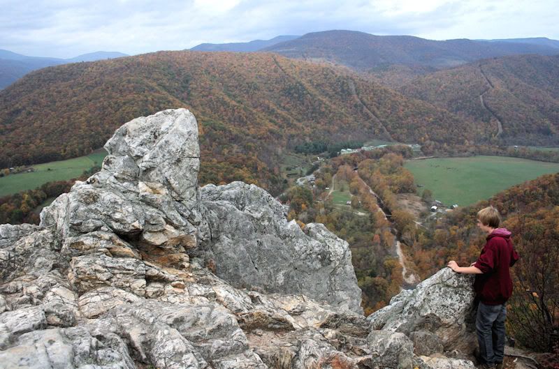
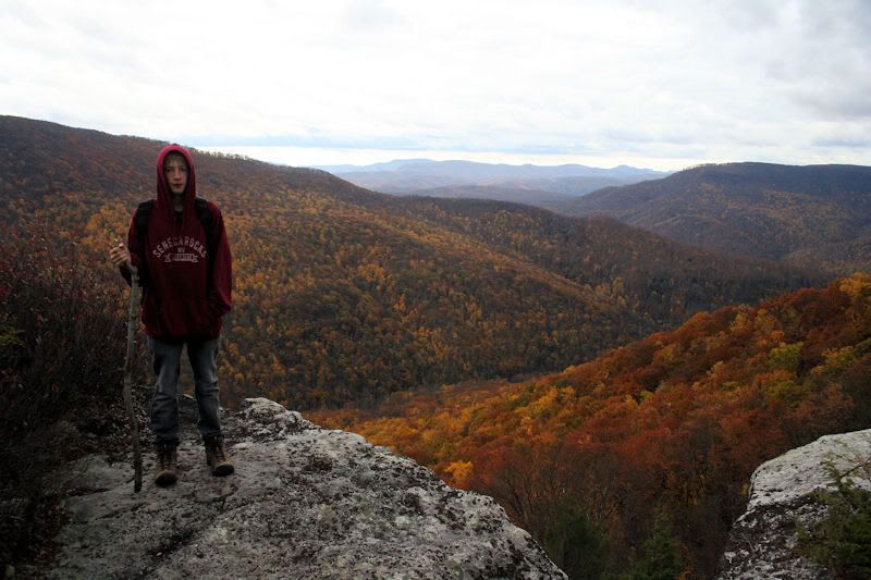
Freddie looking West, the photo view is North.

sIMG_5514.jpg

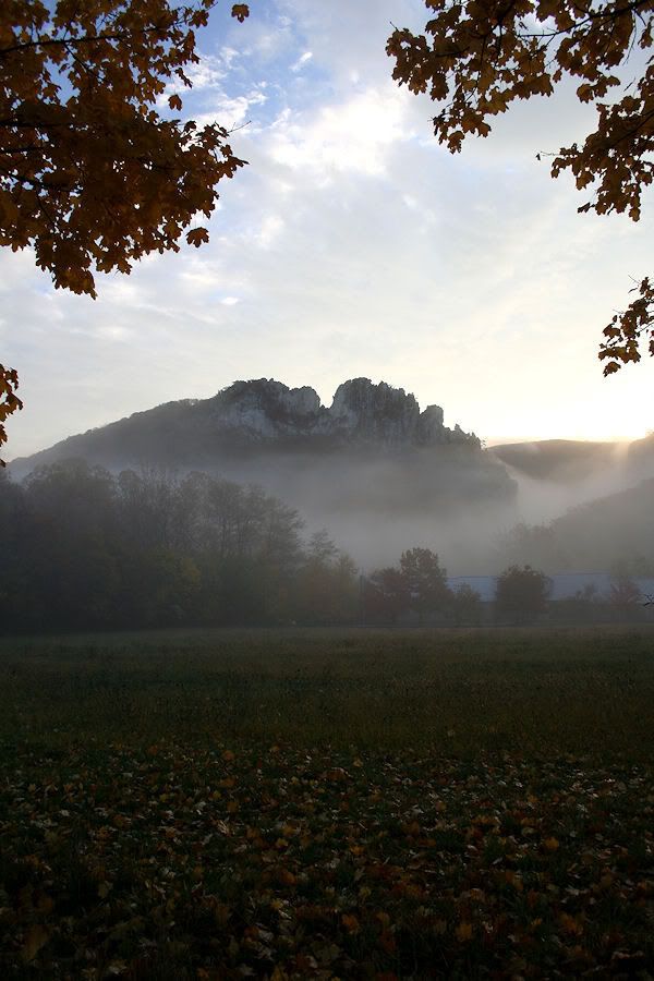
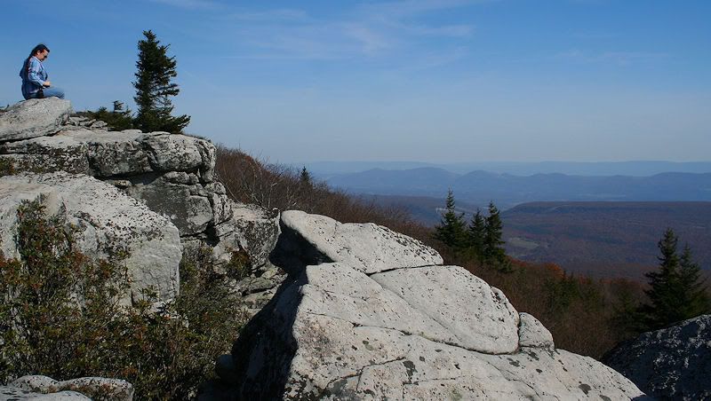
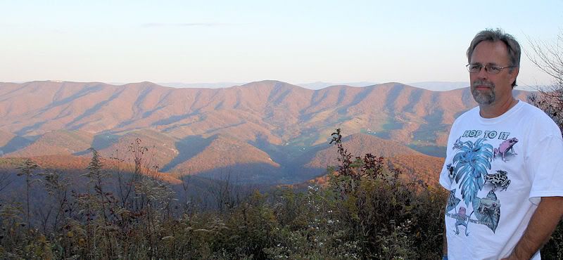
This photograph was taken this morning, just before it was time to leave.

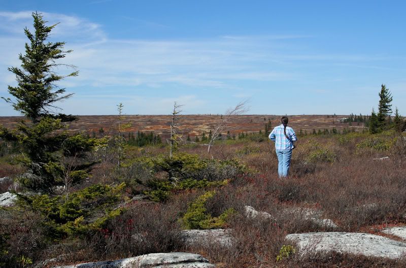
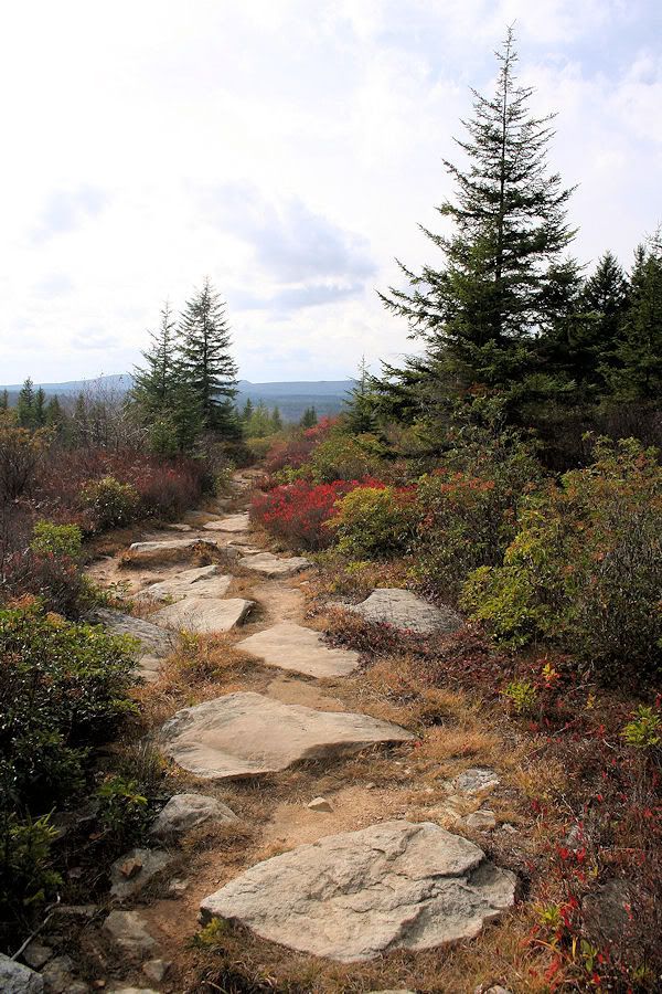
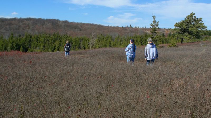
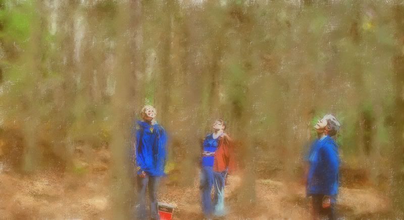
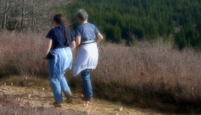
I have many more photos to sort through and hopefully will find more worthwhile for posting here, including some from two hikes taken on trails at Dolly Sods, possibly my favorite place in the universe; shared by my friends and son below.

sIMG_5313.jpg


sIMG_5317.jpg
 

woodjin

Piney
Nov 8, 2004
4,338
326
Near Mt. Misery
Cool! So much different than the pines. I really have to get down there. I have some inlaw cousins down that way. They make their own moonshine too.

Jeff
 

manumuskin

Piney
Jul 20, 2003
8,552
2,465
59
millville nj
www.youtube.com
I cannot believe Freddie is playing with a cell phone surrounded by Gods country.It;s a wonder he didn't fall over backwards into Germany Valley.If that was me it woulda been a GPS or a map.I remember that hike as a but kicker but then again i did it in summer.
Alfie
 

glowordz

Explorer
Jan 19, 2009
585
8
SC
www.gloriarepp.com
I cannot believe Freddie is playing with a cell phone surrounded by Gods country.It;s a wonder he didn't fall over backwards into Germany Valley.If that was me it woulda been a GPS or a map.I remember that hike as a but kicker but then again i did it in summer.
Alfie

There were only TWO (2) spots, as you may remember, in all those zillions of beautiful acres that we could get a decent signal: on the crest of Canaan Mountain and at Bear Rocks. Of course we whipped out our phones in case anyone was left on the planet. And in many places, we used our phones as cameras--which is what Freddie is doing there, perched high on Seneca Rocks.

Alfie, I wish you could have seen how Freddie lit up the whole trip! He tramped over those rocks like he was born there, outdid us in climbing higher and hanging lower (over cliffs), lugged all our food and water in his backpack, and kept us smiling. He also has a knack for noticing small living critters--a budding zoologist.

I've hiked with many guys. He's one of the best.

Glo
 

whippoorbill

Explorer
Jul 29, 2003
675
121
65
Bridgeton
There were only TWO (2) spots, as you may remember, in all those zillions of beautiful acres that we could get a decent signal: on the crest of Canaan Mountain and at Bear Rocks.
Glo

Freddie did do great, Gloria.

Here he is at Bear Rocks, using his phone to make a call to his mother.

IMG_5267.jpg


Can you read his lips? "Dad hasn't killed me yet, Ma."

It was nice having five days unexposed to cell-phone towers.

sIMG_5394.jpg


sIMG_5405.jpg

Canaan Valley
 

manumuskin

Piney
Jul 20, 2003
8,552
2,465
59
millville nj
www.youtube.com
that last pic listed as Canaan valley is actually the valley of the Dry Fork of the Cheat River and that is Valley View overlook your on.you are at the western edge of Canaan Mtn and if you could see around the shoulder of the mountain your on a little more to your right you could make out otter creek valley and the entrance to that wilderness.actually the ridge to your right would be the eastern edge of that wilderness.Canaan valley is the large flat bowl back where FS 13 started to your east and lies directly west of and below cabin mtn which is the western side of the sodds.
You were probably just geographically disoriented after all the good fixin's Janelle cooked for you.
Are you telling me a mere youth of fifteen can already outwalk the old man???guess that ain't saying much for me since the old man out walked me last time we were in wet virginia.
Alfie
 

whippoorbill

Explorer
Jul 29, 2003
675
121
65
Bridgeton
that last pic listed as Canaan valley is actually the valley of the Dry Fork of the Cheat River and that is Valley View overlook your on... You were probably just geographically disoriented ...
Alfie

Oh drat. Well, I knew I was on Canaan Mountain, and that I was looking into a valley. I also realized that Canaan Valley proper was the resort area East of the location. To be honest, I was tempted to describe the photos "Valley view from Canaan Mountain" but lazily shortened it.

fIMG_5266.jpg


sIMG_5269.jpg


fIMG_5494.jpg


sIMG_5282.jpg


fIMG_5456.jpg


sIMG_5298.jpg


fIMG_5451.jpg


fIMG_5458.jpg


fIMG_5483.jpg


ffIMG_5411_Painting2.jpg


Hello, Dolly!
 

turtle

Explorer
Feb 4, 2009
653
213
a village...in the pines
Bill,

I'm enjoying the early morning photo and the rock path leading down the mountain. Looks like you had good company, good weather, and good vittles. Your photos are always a treat!

turtle

P.S. thanks for keeping an eye on us today.
 

piker56

Explorer
Jan 13, 2006
640
53
67
Winslow
I enjoyed the pictures, they were great. My wife and I love that part of WV (Canaan Mtn and the Blackwater areas). This is the first year in 5 or 6 years we didn't go. The girls were too busy planning my daughters wedding. Your pictures will have to hold me over until next year.
Greg
 

whippoorbill

Explorer
Jul 29, 2003
675
121
65
Bridgeton
Appreciate the feedback, folks. It was a beautiful trip.

I enjoyed the pictures, they were great. My wife and I love that part of WV (Canaan Mtn and the Blackwater areas). This is the first year in 5 or 6 years we didn't go. The girls were too busy planning my daughters wedding. Your pictures will have to hold me over until next year.
Greg

We took a quick ride up to Blackwater Falls State Park, Piker. (Not enough time to do the multitude of hikes, etc., we wanted in the five days there.) Here's a shot of Blackwater Falls. There is much less water in the river than I've seen in the past. No complaints! The falls exposed much more awesome black rock.

IMG_5373.jpg
 

manumuskin

Piney
Jul 20, 2003
8,552
2,465
59
millville nj
www.youtube.com
always wanted to hike down blackwater canyon.was a real wilderness but from what i understand about 10 years ago the state agreed to let the lumber trucks go in and start pulling out logs.don't know who owns the land but it isn't designated wilderness.supposed to be large rattler dens down in there.been at the bottom where it joins dry fork and up top at the state park but never down the canyon.
Alfie
 

piker56

Explorer
Jan 13, 2006
640
53
67
Winslow
always wanted to hike down blackwater canyon.was a real wilderness but from what i understand about 10 years ago the state agreed to let the lumber trucks go in and start pulling out logs.don't know who owns the land but it isn't designated wilderness.supposed to be large rattler dens down in there.been at the bottom where it joins dry fork and up top at the state park but never down the canyon.
Alfie

I went part way down the canyon (foolishly, in retrospect) 2 or 3 years ago. I'm definitley a Jersey boy hiking wise, I'm too used to flat pinelands and cedar swamps. The terrain in the canyon was brutal for me. It was really beautiful, though.
Greg
 
Top