West Jersey Cranberry Meadow

Teegate

Administrator
Site Administrator
Sep 17, 2002
25,950
8,691
All,

It is really not new news but I figured you may want to know. The Brick family has been selling various pieces of their property recently, and in 2019 they sold their main tract of land in West Jersey Cranberry Meadow that has most of the bogs to Mansfield Properties LLC. I believe they are a Real Estate investment company.

9.01.jpg


9.01_.jpg


So this is the new owner.

 
  • Like
Reactions: Boyd

Teegate

Administrator
Site Administrator
Sep 17, 2002
25,950
8,691
My concern is that on that property, and not on the property lines, are these stones.

The 1824 Enoch Roberts stone.

IMG_4043.JPG


The pre 1805 Samuel Lippincott stone.

IMG_3980a.jpg


The 1856 Emmor Roberts stone.

IMG_4049.JPG


This sandstone.
IMG_4055.JPG


As well as others. These stones are off the grid and even the Brick family who sold the property did not know about them until I told one of them. Rare stones that I would hate to see get destroyed.
 
  • Like
Reactions: John and bobpbx

Slipkid

New Member
Mar 14, 2017
4
0
66
Medford,NJ
I have pedaled and run through there a few times. Reminds me of Franklin Parker. My understanding in speaking with one of the new Owner's caretakers is that it will remain essentially a private hunting ground. No access is tolerated.

FWIW my 2 cents is the DEP should have taken a harder look at buying this South Jersey parcel. Only conjecture but if this was up north DEP would have been motivated.
 

Teegate

Administrator
Site Administrator
Sep 17, 2002
25,950
8,691
The state did acquire parcels from Brick, just not this one for some reason.
 

bobpbx

Piney
Staff member
Oct 25, 2002
14,656
4,830
Pines; Bamber area
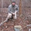
Well, that gent in the photo looks like he enjoys a good ramble through the briars carrying a shot gun. But really, they'll likely lure in duck and geese. Not quite sure how I feel about that.
 

PinesExplr

Scout
Dec 7, 2005
94
9
Medford, NJ
The state did acquire parcels from Brick, just not this one for some reason.

Hi, been a while since I posted. Interested in WJCB area history and future. Does anyone know if the area (parcel) beyond the gate (northern entrance), but before the southern most structure was sold to state? The blue outline above appears to exclude it in the private sale mentioned. The outline above would exclude the northern most structure, I think.
 

c1nj

Explorer
Nov 19, 2008
289
187
Boyd, is there anyway to make the colors on the map contrast better?
For instance, could I make the open space green greener or the black lighter?
Thanks so much for these maps. They are so helpful.
 
  • Like
Reactions: Boyd

PinesExplr

Scout
Dec 7, 2005
94
9
Medford, NJ
My new map includes the State's openspace data from March 2020 (green shaded areas). The dotted lines are parcels. Of course, it takes awhile for the state to update with new purchases, but these boundaries are much more up-to-date than my old map(s)

https://online.boydsmaps.com/#17/39.79984/-74.83522/pines2020
Got it, thank you. Great maps!

There was an app, think OnxHunt/OnXoffroad, that had the landowners names in the parcels. Free demo, but then paid. Not a hunter so I did not sign up and lost access. I guess only the paid apps have that level of detail?
 
  • Like
Reactions: Boyd

Boyd

Administrator
Staff member
Site Administrator
Jul 31, 2004
9,822
3,002
Ben's Branch, Stephen Creek
Thanks, glad you enjoy the maps. :)

I guess only the paid apps have that level of detail?

These maps have owner data for the larger parcels (where they fit), but the State doesn't list owners for many of the parcels. These were made from 2014 data.

online.boydsmaps.com/#17/39.78821/-74.83710/parcelsPro

online.boydsmaps.com/#17/39.78821/-74.83710/parcels


You can also use the NJGIN parcel viewer here. Zoom way in to see the parcels, then click on them for a pop-up with ownership data (if available). Click on the squares in the top right and you can choose an aerial for the background if you like. Unfortunately, this site does not allow you to link to a specific view, it always opens by showing the entire state.


Screen Shot 2020-11-27 at 11.38.28 AM.png


Boyd, is there anyway to make the colors on the map contrast better?

The colors are what they are. In the future I might make a light version of the map but that would be a big project that I won't tackle anytime soon. It's a challenge to find a color scheme that provides clarity while also offering such a high level of detail. And I wanted a dark theme for this map, have gotten rather bored with traditional topo's. This map looks best in a dark room - and should be a nice companion on evening trips to the pines when I get the new mobile site working. :)
 
Last edited:

PinesExplr

Scout
Dec 7, 2005
94
9
Medford, NJ
Thanks, glad you enjoy the maps. :)


These maps have owner data for the larger parcels (where they fit), but the State doesn't list owners for many of the parcels. These were made from 2014 data.

https://online.boydsmaps.com/#17/39.78821/-74.83710/parcelsPro

https://online.boydsmaps.com/#17/39.78821/-74.83710/parcels

You can also use the NJGIN parcel viewer here. Zoom way in to see the parcels, then click on them for a pop-up with ownership data (if available). Click on the squares in the top right and you can choose an aerial for the background if you like. Unfortunately, this site does not allow you to link to a specific view, it always opens by showing the entire state.


View attachment 14332


The colors are what they are. In the future I might make a light version of the map but that would be a big project that I won't tackle anytime soon. It's a challenge to find a color scheme that provides clarity while also offering such a high level of detail. And I wanted a dark theme for this map, have gotten rather bored with traditional topo's. This map looks best in a dark room - and should be a nice companion on evening trips to the pines when I get the new mobile site working. :)

Wow, those are great sources. Would have never found them. Thks again!
 
  • Like
Reactions: Boyd
Top