Who Owns What
- Thread starter bobpbx
- Start date
You are using an out of date browser. It may not display this or other websites correctly.
You should upgrade or use an alternative browser.
You should upgrade or use an alternative browser.
You threw me off there Boyd, you have a Y in the name in your narrative. Yes, I downloaded it a few years ago. I was along the Tuckerton RR right of way and a WMA game officer stopped and chatted with me. He showed me the App, so I tried it. I was not happy with it on my phone, but I forget the details why I didn't care for it.
Just click on BASEMAP on the viewer and click Imagery and an aerial will appear under the lines of state property.Works like a charm here.
You threw me off there Boyd, you have a Y in the name in your narrative.
Yes - you're right, it should have been "On X". I fixed that in my earlier post.
Last edited:
Just click on BASEMAP on the viewer and click Imagery and an aerial will appear under the lines of state property
That is what is shown in the screenshot that I posted from their website. Here are screenshots from the app, you can choose a topo or aerials as a basemap. They also have a "hybrid" map which is aerials with elevation contours.
FWIW, a couple hours after registering I got an e-mail from them offering a 30% discount on the first year of the full subscription ($70 for the version with property ownership or $21 for the regular version). If you just want to see public land, you don't need the expensive version, the cheaper one shows that but it doesn't show private land ownership. This is what the same map looks like without the private ownership.
I don't plan to subscribe, it's not something that I need and the user interface seems pretty awkward. However, others might find it useful.
Many of my friends have OnX and both of my sons use it. It is a powerful tool and has a lot of very cool mapping features. I signed on for a free trial but they bugged the piss out of me so much during the first two days with emails asking me to jump over to a full subscription that I deleted it.Here's something interesting that I just noticed. I am not recommending because I know nothing about it. Anyway, there's an app calledOnyx(sorry, the correct name is "OnX") that doesn't seem to be worried about showing property owner names. Have only spent about two minutes looking on their website, so I don't know how comprehensive the data is. But here's an example
View attachment 18845
You can't link directly to it, but just go to their website, scroll down to the bottom where it says "Powerful 3d Planning) and click the map. It took a little while to load for me. Then click the Satellite button and click 2d (this is a bit confusing). Zoom way out, drag the map to NJ and zoom back in. When you get close enough, it shows property owners. And it's free to do this on their website.

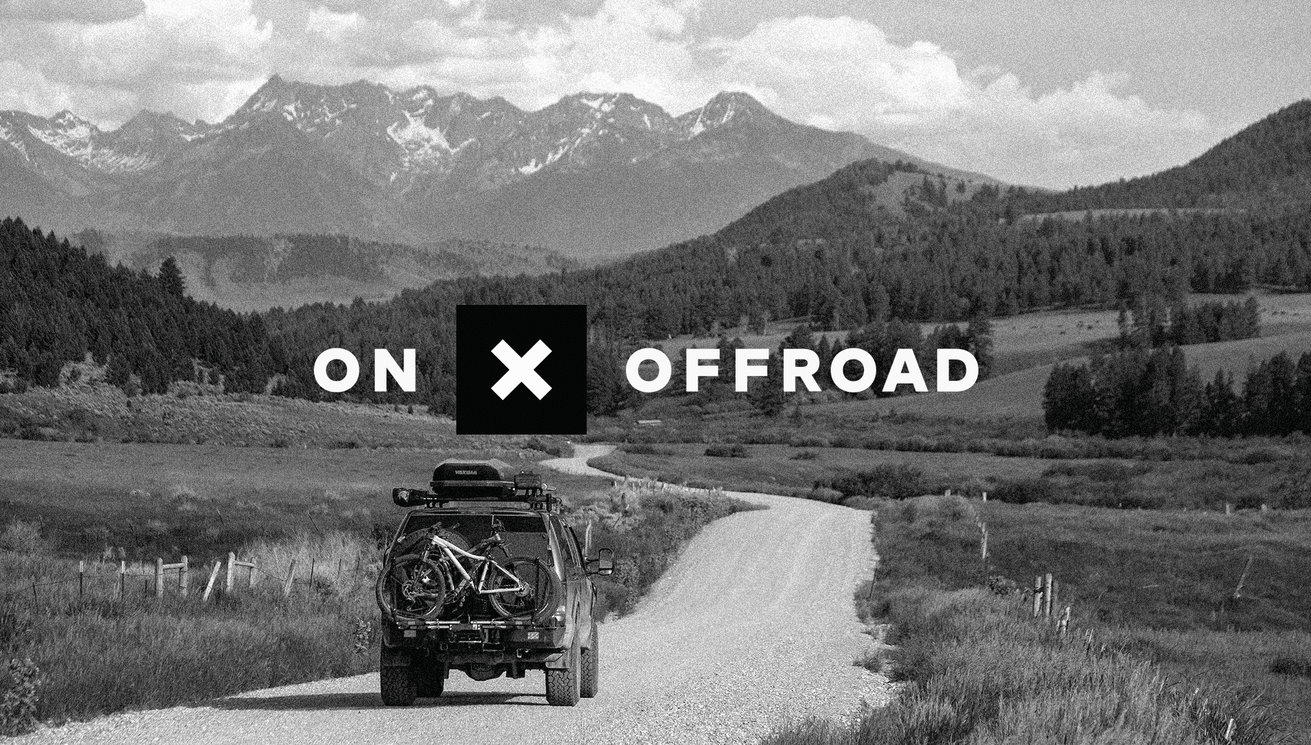
Off Road GPS Maps App: Find ATV, Dirt Bike, UTV, 4x4 Trails | onX
Join thousands of off-roaders in planning and discovering 650K+ miles of off-road trails. Keep all of your trails, tracks, campsites, and markups in one app.www.onxmaps.com
They have a 7-day free trial of the full app (iOS and Android), after that it's $100/year. You can decide for yourself whether that would be worthwhile. Who knows, they might end up pulling owner names in the future - after you have spent $100, LOL. They also have a version without the property names for $30/yr. I think there is also a free version with more limitations?
onX Offroad App Pricing & Options
Pricing for onX Offroad is $29.99 per year for Premium and $99.99 per year for Elite. You can also start a free trial and receive Premium features for seven days.
One interesting feature is that the app is compatible with Apple Carplay and Android Auto, so you can use it on your car's built-in screen (if available). Apparently you can also download maps to use with no cell signal.
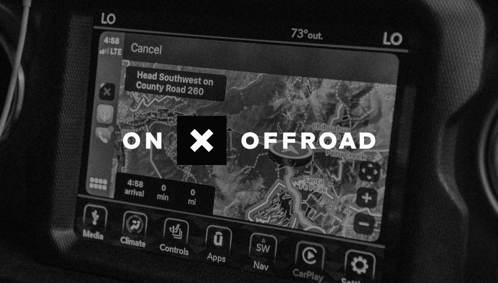
Apple Carplay Off-Road Navigation GPS Map App | onX Offroad
Experience onX Offroad on Apple CarPlay. Featuring in-dash off-road trail maps, Waypoints, offline maps, and more. Free trial.
Android Auto Off-Road Navigation GPS Map App | onX Offroad
Experience onX Offroad on Android Auto. Featuring in-dash off-road trail maps, Waypoints, offline maps, and more. Free trial.
Does anybody here use this already?
The redacted name issues that Bob is unhappy with can be worked around in just a few minutes in most cases. In Camden County, it's stupid easy to use the Camden County Board of Taxation free GIS. It has all very current names, direct link to the full and most current tax map plate that contains the lot you are viewing, environmental overlays, an aerial base option and the deed book and page for the current deed. One stop shopping for my work needs.
In other counties, I use the NJ Geoweb to get a block and lot then go to NJACTB. From there the Record Search tab lets you choose the county and that in turn links you to a an appropriate data source showing current ownership.
Last edited:
Yes, you jogged my memory, that's why I deleted it.Many of my friends have OnX and both of my sons use it. It is a powerful tool and has a lot of very cool features mapping. I signed on for a free trial but they bugged the piss out of me so much during the first two days with emails asking me to jump over to a full subscription that I deleted it.
I suppose if you bit the bullet and signed up right from the start it might not be as irritating. My buddy Randy loves it and has coverage for Delaware and NJ. I'm not sure if you have to get the whole US if you choose more than one State.Yes, you jogged my memory, that's why I deleted it.
I hunt a lot of State woods in NJ so I don't really need it here and where I hunt in PA, soup cans and taut string are the best means of communication because of the poor cell coverage. Without good cell coverage, OnX doesn't work.
I was at a WMA in Cumberland County about 4 years ago (Peaslee). The WMA was across the road from a home owner. I was about 15 yeards off the road opposite from him, looking at plants. This homeowner came out of his house, walked across the road, and confronted me with: "what are you doing here?'. I politely told him and he said: "well, I don't want anybody here". I told him I worked for the state and pulled out my badge, but he refused to look at it. That got me thinking that maybe I was no longer standing in the WMA. He was angry enough as he stormed into his house to worry about him making a rash decision so I left. Turns out I WAS on state property, and he got a visit the next day by a man with a badge to educate him.
My buddy Randy loves it and has coverage for Delaware and NJ. I'm not sure if you have to get the whole US if you choose more than one State.
You may be thinking of a different product. That same company makes at least three, their Hunt app is available for single states or the whole US. I know they also made individual state maps for Garmin GPS'es because they (basically) spammed GPSFileDepot advertising them. However I found this news on their website, which Bob ought to like.

"When onX was founded, smartphones were not capable of providing the experience we wanted for our customers. As a result, GPS handhelds were more prevalent in the hunting space. Now, phone technology provides a vastly superior experience and is where we are investing our time to innovate and provide world class features for hunters. Because of the innovation in smartphone technology, the onX Hunt Chip will be going away in 2022."
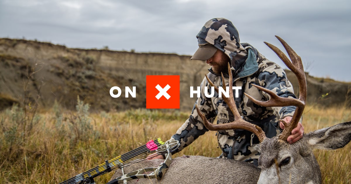
Best Hunting App | GPS, Land Maps, Aerial Imagery & Tracking | onX Hunt
Discover the best hunting app with advanced GPS tracking, detailed land ownership maps, and offline capabilities. Elevate your hunting experience with onX Hunt.
 www.onxmaps.com
Anyway, I have been talking about their off-road app, not their hunting app.
Without good cell coverage, OnX doesn't work.
Actually, that is not true with the off-road app (don't know about the others, but suspect they're the same). You can download maps in the off-road app and use them with no cell coverage (I posted this above already). This might be a new feature that wasn't available in the past?
So - if you're the sort of person that wants this kind of capability, it seems that this app could be useful (if you're willing to spend the $$). It's designed for mobile use, unlike the websites that Scott mentioned and it also works without cell service using downloaded maps. And the Apple Carplay/Android Auto is another important feature that makes it stand out. Ordinary app developers are not able to to access that capability, you need a special (expensive) type of developer account that is normally only available to large companies (boydsmaps is not likely to ever have that capability).
I really don't want to sound like I'm recommending this for anyone - I'm not. Just thought it might be worth looking at if you want property ownership info. But it only shows the name, not the taxes, street address, block/lot number, purchase price, etc.
Having said all of this... I have deleted the app from my phone and added the company to my spam filter (that's an easy way to avoid getting e-mail from them). I could not find any way to delete my account on their website. Just doesn't look like something I would use, and the user interface doesn't appeal to me. But I'm still interested to hear what others think.
Last edited:
My son sent me this article form the NYT. It is an amazing tale of some men using the OnX app and getting caught trespassing trying to access inaccessible public lands by "corner crossing". The property owner is seeking $7 million dollars in damages. It is triggering a lot of action. You might have trouble accessing the article.

 www.nytimes.com
It’s Public Land. But the Public Can’t Reach It. (Published 2022)
A navigation app that illuminates public land within privately held property has supercharged the question of who gets to go where.
Last edited:
Great article! You are right, it cannot be directly accessed. However, a trick I learned long ago is to simply paste an article title into Google. I guess the papers must have some deal with Google (?), but when you do that you can read the article. But you can't link directly to it. So, in this case, try pasting the following into the Google search box. You should then be able to click on the link in the search results.

This quote from the article explains how they are able to offer Carplay compatibility")
"Mr. Siegfried turned the project in the scrapbooking room into a company that just received more than $87 million from investors"
Code:
It’s Public Land. But the Public Can’t Reach It NY TimesApple Carplay/Android Auto is another important feature that makes it stand out. Ordinary app developers are not able to to access that capability, you need a special (expensive) type of developer account that is normally only available to large companies
This quote from the article explains how they are able to offer Carplay compatibility
"Mr. Siegfried turned the project in the scrapbooking room into a company that just received more than $87 million from investors"
Just got this from the PA game Commission. 30% off an OnX subscription. Probably PA only.
 content.govdelivery.com
30% Off OnX Hunt
Seems that they give you 30% off if you are living and breathing. Like I said, they sent me an e-mail with a discount right after registering. It is only for the first year of your subscription however
I can gift that article.
 www.nytimes.com
It’s Public Land. But the Public Can’t Reach It. (Published 2022)
A navigation app that illuminates public land within privately held property has supercharged the question of who gets to go where.
From the article: "Property data is often inaccurate and outdated, and early in the development of OnX Mr. Siegfried found himself asking, “Why is there no nationwide picture of land ownership, of public and private property boundaries, of who owns what?”
What I said, and further, we should not have to pay anyone for the privilege of seeing who owns what.
What I said, and further, we should not have to pay anyone for the privilege of seeing who owns what.
By the way, it's way over the top that the rich landowner sued because he thinks you can't even step over the corner line. He's saying he even owns the air above where the 4 lines meet. This country made a serious mistake in it's early founding by not giving us the freedom to roam.

 en.wikipedia.org
Freedom to roam - Wikipedia
Very interesting article
I hate eminent domain, but if there was ever a time I'd agree it would be there.
That "Richard" needs to lose 10' of that corner and given a check for $1.00
Crap, I can quit my job and just sue every helicopter, plane, jet, and drone that trespasses my airspace.
I hate eminent domain, but if there was ever a time I'd agree it would be there.
That "Richard" needs to lose 10' of that corner and given a check for $1.00
“Landowners don’t just own the land,” claimed Ashley Mayfield Davis, the Carbon County attorney. “You also own your airspace.”
Crap, I can quit my job and just sue every helicopter, plane, jet, and drone that trespasses my airspace.