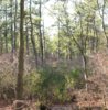
No, he owns all around it. The rectangle is part of Penn State. So, the bonfire was on state property and spread to private property, vise versa of what was reported.
Okay, so obviously the bonfire was not in that pit, right? Weird that the NJ tax map shows different locations for that border. I can't see the state making such a blatant charge, that it was on private property, unless it really was.