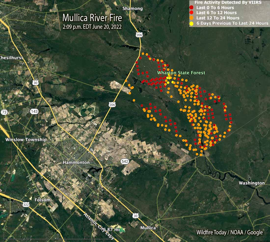
Does anyone know if there’s a map of the Wharton fire anywhere?
Found this with a quick search
![wildfiretoday.com](https://wildfiretoday.com/wp-content/uploads/2022/06/Mullica-River-Fire-209-p.m.-EDT-June-20-2022.jpg)
Mullica River Fire in New Jersey's Wharton State Forest could become state's largest in 15 years - Wildfire Today
Four miles northeast of Hammonton, NJ
![wildfiretoday.com](https://i0.wp.com/wildfiretoday.com/wp-content/uploads/2019/11/cropped-W-Icon_512x512.jpg?fit=32%2C32&ssl=1)
Does anyone know if there’s a map of the Wharton fire anywhere?
Understandably so. I was affected too, but the power of conversation and getting real facts is an amazing thing. Everyday speculation and made up nonsense runs wild and ends up getting twisted into ridiculous notions. People should try going to a source of the unexplained more...Back when the original MAP was being discussed they could have closed every road in Wharton and it wouldn't have really affected me. At the time, I drove a 2013 Ford Taurus, which kept me pretty much out of the woods in and of itself. However I fought really, really hard against it because it would affect a lot of other people that I know and care about and also because it was such a massive change in the status quo that was planned in secret between the Wharton Superintendent and the PPA and I was opposed to that on ethical reasons.
Sometimes you have to stand up against things that are wrong, even though you're not inconvenienced by them.
I was back behind Brooksbrae in February, and at that time the field right behind the ruins had recently been burned.
View attachment 17573
That's one hell of a back burn if so.I think they were concerned the fire would make it to Paradise Lake so they back burned putting an end to that issue.
I want to start off by saying I was’t there but I can kind of guess how the fire progressed. With the ignition point on the Mullica in the vicinity of Locks bridge and I believe the wind was north west the fire would have progressed to the south and east widening as it went. Once it crossed the Sleeper the only viable fire break would have been West Mills. Most of the green interior are areas where the ground is still wet or at least damp and wouldn’t support a hot fire.
Yes, it would have been backfired ahead of the main fire and where the two meet they draw each other together and burn very hot.So you are saying that West Mill Road would have been controlled burns as I believe? This would be to eliminate problems at Paradise Lake Campground.
Covid?It is a long walk and I am just starting to feel better. It has been a very very long week for me as well as two weeks for Jessica, and now Jennifer is suffering.