Cumberland County Stones
- Thread starter manumuskin
- Start date
You are using an out of date browser. It may not display this or other websites correctly.
You should upgrade or use an alternative browser.
You should upgrade or use an alternative browser.
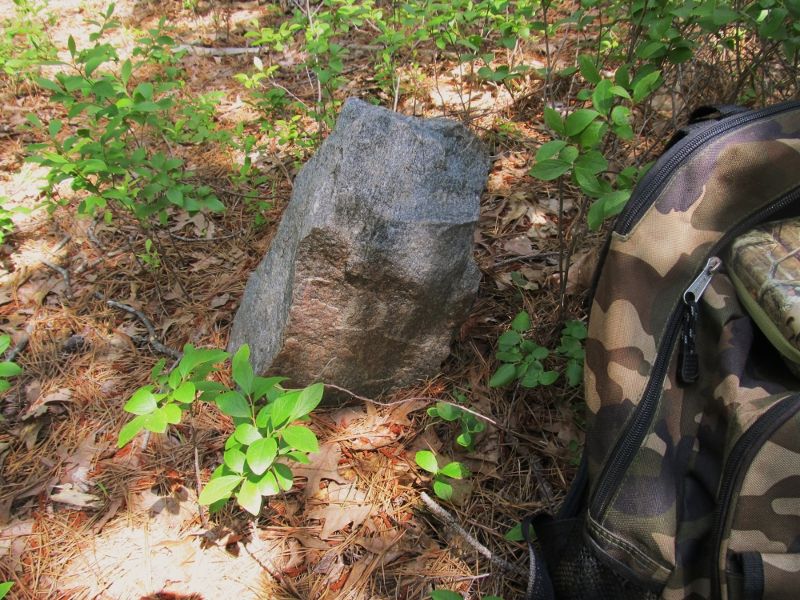
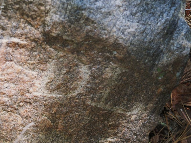
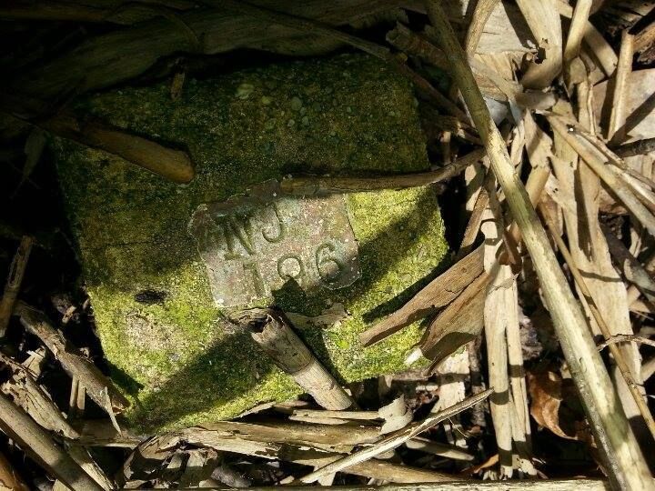
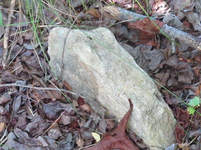
Went out on what i thought would be a fruitless stone search in manumuskin Preserve today. Fruitless because I had no hard info there were any stones along the line I was searching excepting two stones at either end I had already found.One of those I found from a Deed that outlined a new piece of property that had been added to the preserve maybe ten years ago and another I lucked out on from a very vague historical map of the Port Elizabeth area with absolutely no survey info just a dot on a mostly empty section of map and I guesstimated it and being a large stone near a trail in winter I happened to spot it.Also being full summer foliage and considering the NC bought the main piece back in the 80's I didn't figure on getting much help from survey clues I was basically just getting out into the woods on a whim with a potential stone possibility in the back of my mind. So out I headed and the first thing I had to do was relocate one of the end stones and then Nav to the other end stone and then do my best to stay on the pink line while mostly looking for signs on the trees since I knew the ground would be obscured bu huckleberry and such.I decided to head to the DL stone since I knew I could easily find it without the GPS and the parking was better to access this stone then the other end. So I grabbed my stuff at the parking area and turned on the GPS as I headed toward the stone.The GPS beeped that it had picked up just as i walked up to the stone,about a five minute walk from the car. Here is the DL stone and a closeup of the initials. DL stands for David Lore and He was a storekeeper/owner in Port Elizabeth back in the early 1800's.
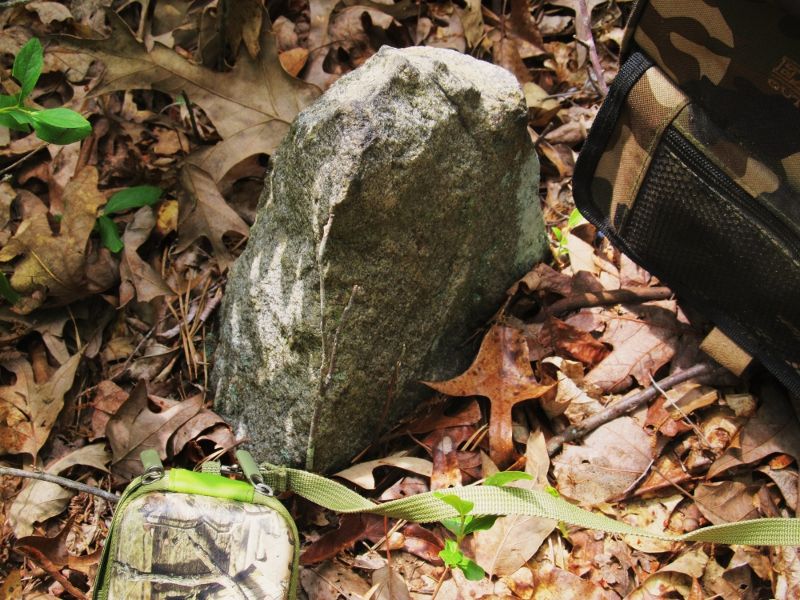
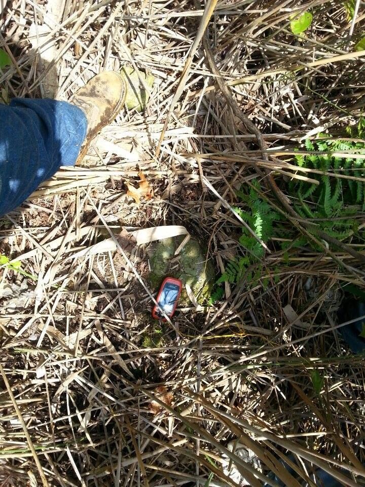
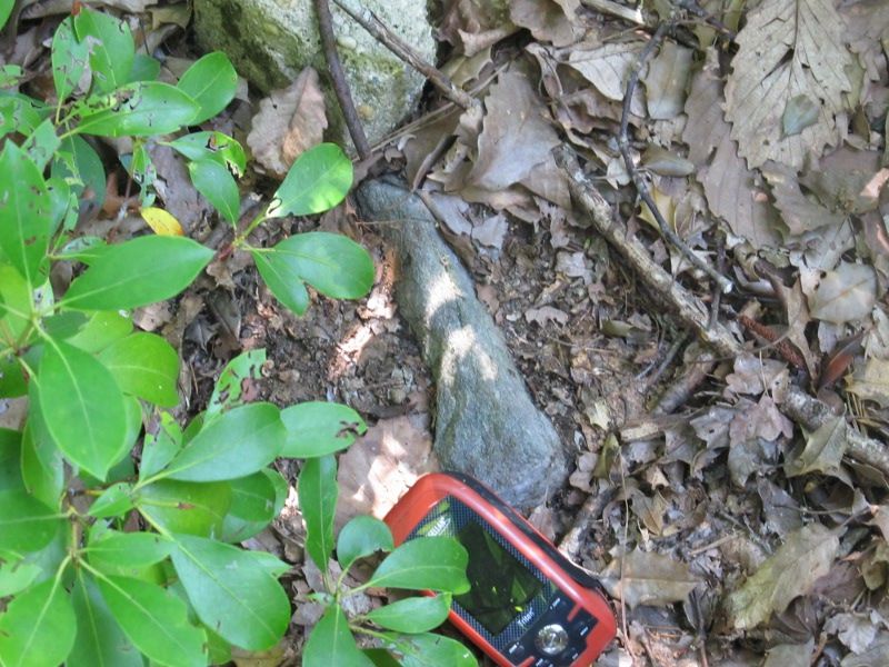
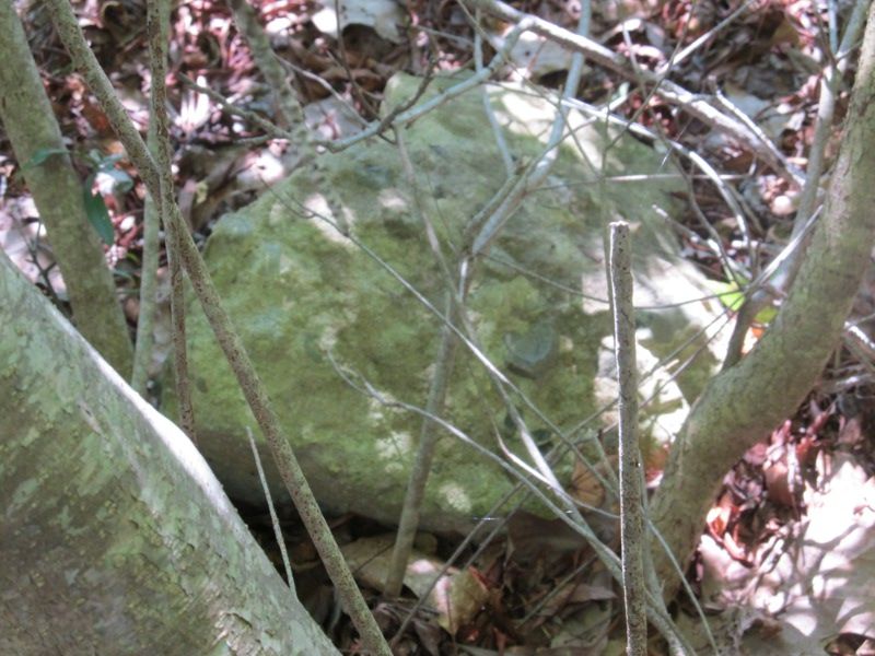
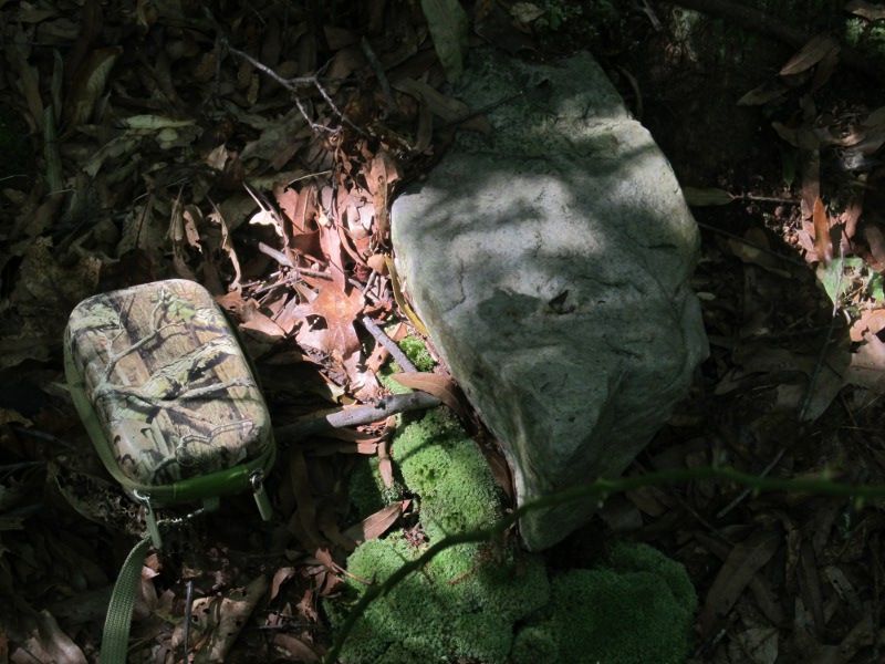
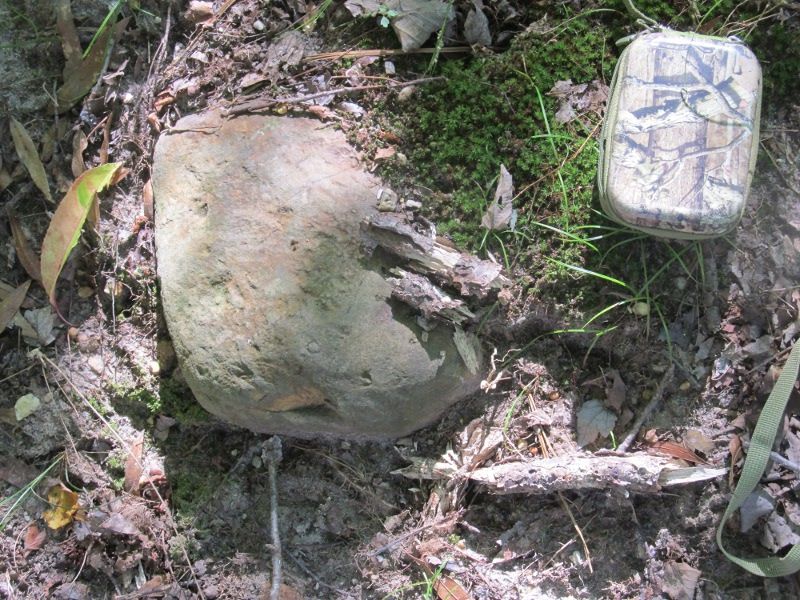
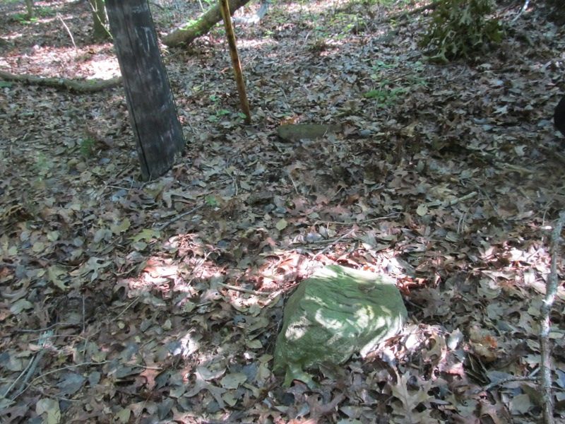
I then set my Nav to on the stone at the far end of the line which turned out to be some 4000 feet away and this just happened to be down the trail which I assumed might be the line but wasn't sure since the trail does not really show on the aerials. I knew it was there but not exactly sure of it's direction.Well I lucked out the trail was the line! Bad news for stone survival but good news for my survival.The trail lasted maybe 1500 ft and I found several stakes and old ribbons on several of the private property corners that intersect the main line of the Nature Conservancy. I was well back in the woods and not in view of any of the houses along the Highway. I saw not one posted sign along the trail.I did run into a deer stand. about 200 yards past where the trail disappeared at a small swamp.As I came up out of the swamp on the far side I went up a hill and popped out into some fairly open piney woods with a very nice clearing fifty feet in front of me. I thought Campsite! till I walked into it and started seeing brown corn cobs all over the place. I looked up right,nothing,left,there it was a portable deer stand with a nice aluminum ladder attached.If my pink line was correct the stand was on private land with his corncob bait pile being exactly on the line.No hunting on NC property.No camping either:-( From here on I was trying to stay on my pink line since there was no more trail and was looking at the trees since the huckleberry meant i would have to step on a stone to find one.I headed down into another vernal swamp,they are quite beautiful in here,black water with brilliant green hummocks of sphagnum and maple/gum trees spread throughout and some large patches of semi dry swamp that were very open but at one point my pink line went right through 100 yards of green haze hell and I of course went with it. On the other side I found myself in another small swamp and then beyond I climbed another small rise and was again in open Piney woods.I was strolling along when i noticed I had drifted considerably south of my pink line so I bared right and had to go about 200 ft to hit the line and a corner I picked off the Cumb. county property over lay which sometimes they can be 200 ft off or more.I was now 100 ft from the point and my line and coming up on another nice little campsite sized clearing and wading through knee high huckleberry when the last step as I went to step out into the clearing I stumbled into the clearing and recovered before I fell. I took another couple steps thinking "Damn stump" when I realized my toe hurt.I was wearing sneakers and stumps usually don't hurt my toes,my toes mostly bounce off of wood. This felt like a damn rock. I spun around and looked back and there it was.Peeking out from under the huckleberry at clearing edge just inches shorter then the knee high plants. Here is the north face
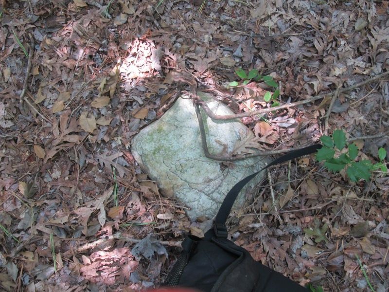
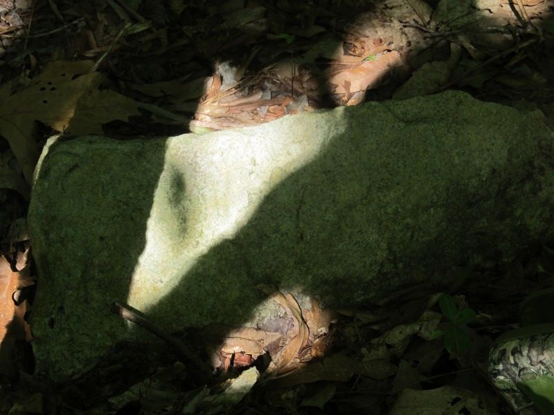
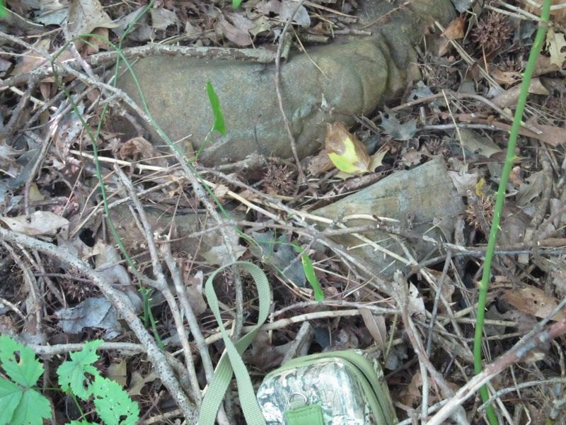
south face
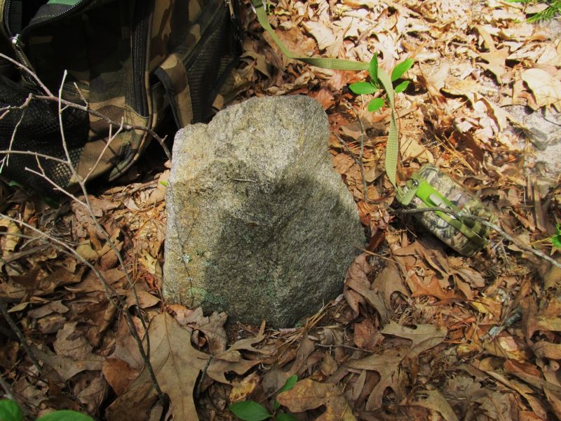
I was 108 feet south of my point but upon getting back to the computer where I could zoom in and measure better I was only about 20 ft off the line between the end stones which could just mean that one stone or the other at the ends may be off on my coords by just a little bit. Of course the stone had to have a name so I immediately christened it the "Stumble Stone"


I then set my Nav to on the stone at the far end of the line which turned out to be some 4000 feet away and this just happened to be down the trail which I assumed might be the line but wasn't sure since the trail does not really show on the aerials. I knew it was there but not exactly sure of it's direction.Well I lucked out the trail was the line! Bad news for stone survival but good news for my survival.The trail lasted maybe 1500 ft and I found several stakes and old ribbons on several of the private property corners that intersect the main line of the Nature Conservancy. I was well back in the woods and not in view of any of the houses along the Highway. I saw not one posted sign along the trail.I did run into a deer stand. about 200 yards past where the trail disappeared at a small swamp.As I came up out of the swamp on the far side I went up a hill and popped out into some fairly open piney woods with a very nice clearing fifty feet in front of me. I thought Campsite! till I walked into it and started seeing brown corn cobs all over the place. I looked up right,nothing,left,there it was a portable deer stand with a nice aluminum ladder attached.If my pink line was correct the stand was on private land with his corncob bait pile being exactly on the line.No hunting on NC property.No camping either:-( From here on I was trying to stay on my pink line since there was no more trail and was looking at the trees since the huckleberry meant i would have to step on a stone to find one.I headed down into another vernal swamp,they are quite beautiful in here,black water with brilliant green hummocks of sphagnum and maple/gum trees spread throughout and some large patches of semi dry swamp that were very open but at one point my pink line went right through 100 yards of green haze hell and I of course went with it. On the other side I found myself in another small swamp and then beyond I climbed another small rise and was again in open Piney woods.I was strolling along when i noticed I had drifted considerably south of my pink line so I bared right and had to go about 200 ft to hit the line and a corner I picked off the Cumb. county property over lay which sometimes they can be 200 ft off or more.I was now 100 ft from the point and my line and coming up on another nice little campsite sized clearing and wading through knee high huckleberry when the last step as I went to step out into the clearing I stumbled into the clearing and recovered before I fell. I took another couple steps thinking "Damn stump" when I realized my toe hurt.I was wearing sneakers and stumps usually don't hurt my toes,my toes mostly bounce off of wood. This felt like a damn rock. I spun around and looked back and there it was.Peeking out from under the huckleberry at clearing edge just inches shorter then the knee high plants. Here is the north face

south face

I was 108 feet south of my point but upon getting back to the computer where I could zoom in and measure better I was only about 20 ft off the line between the end stones which could just mean that one stone or the other at the ends may be off on my coords by just a little bit. Of course the stone had to have a name so I immediately christened it the "Stumble Stone"
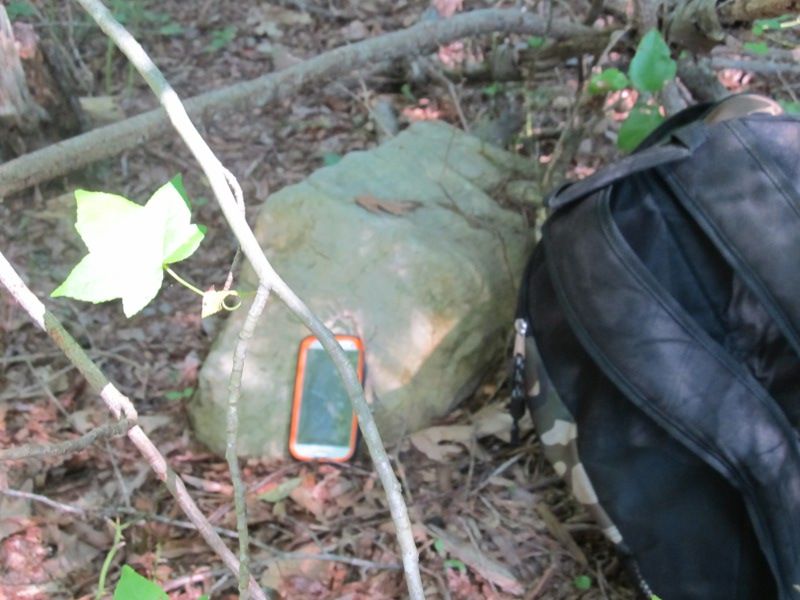
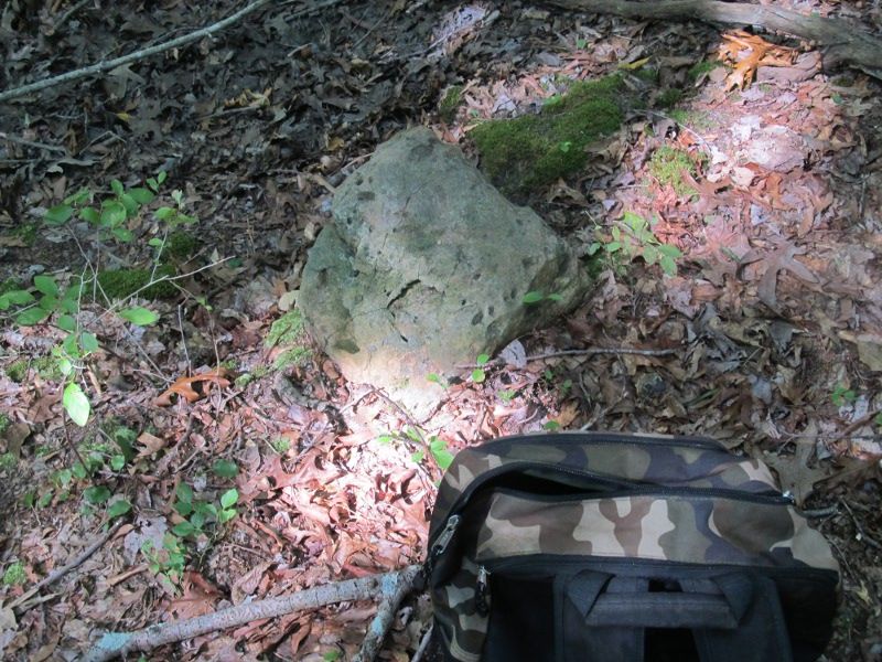
The amazing part was I wasn't even looking for a stone yet.I was 101 ft from my pick on the corner and I usually go straight to the point before I start circling and looking and I walked right into it. Not a surveyor sign visible either.You always tell me when we get about 150 ft from a coordinate to start looking because you never know,you could be off and this time you would've been right")


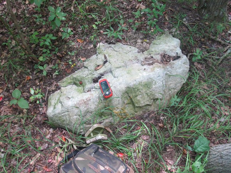
This is on the top of Pine Mount.I was up there today with a friend.It is private property and He had permission.The top of the hillnow is about 104 ft elevation but it was rumored to be at one time the highest spot in Cumberland County.The hill has obviously had it's top mined off for stone and it is actually a big crater on top like a volcano.We estimated if the slopes originally continued to the top at the angle they now slope at it would have been an additional 30 ft taller at one time which would have just about made it the highest spot in the county.I believe the monument may have actually set on top of the hill back then and they just quarried around it but left the monument out of possibly respect or maybe figured it was illegal to destroy it even though they had destroyed it's value by moving it? It was obviously a triangulation station and all other monuments were long gone.The monument is actually cut stone.I"d say it's marble,possibly granite? Anit is is concreted into a sandstone base.The concrete had large gravel in it of the very old sort. This monument is not in any database that I can find and is not shown on any topo.There was also a very strange sprawling vine growing on top of the hill.The man with me is a professional botanist and He did not know what it was.I am awaiting an ID from him now.He said He will get to the bottom of it
The plant has been ID'ed! Small burnet (Sanguisorba minor). The botanist had said it appeared to be in the rose family and He was right. It is a non native from Africa/ Asia and this is the first record in Cumberland county that He knows of.It has been sighted in a few middle and northern Jersey counties.
They were romantically involved and atop the mount, certain their spouses would never see them there, engaged in secret bliss. A cold picnic lunch and wine was the order of the day. While eating an exotic salad that still was in seed, she leaned over and teasingly spooned a forkful towards his waiting gaping mouth. She missed and hit his cheek. He yelled in surprise, and the seeds dropped to the ground, to bloom next spring.
There was nothing romantic going on at all,I swear! Oh, I see. This is how the invasive plant got there in the past
Okay I"m kinda cheating here since this stone trip was technically in Cape may County in dennis twp in the vicinity of Eldora.This was a very odd trip.I set out to find five stones. Three in one area and two more a couple miles away.I found all five stones plus two accompanied by monuments and I found about thirty other stones,most along known property lines and several not on any modern property lines but along the still visible lines of old fields turned to woods so possible old property lines now gobbled up by the state.Most of these stones were quartz and possibly native stone but these would normally be deep so I cannot imagine a plow turning them up and some were huge,they would not have been left in the field for sure so some of these stones not on lines are a mystery to me.Why there in what was once a field? Some were along ditches as well.I have never seen plowed ground down here turn stones up like this?Along one known property line there was a stone every thirty feet. Some I could pick up and throw (I didn't) and some outweighed me by several times. Here are the pics of maybe half of the ones I found.many were so close together I didn't even take coords or pics.
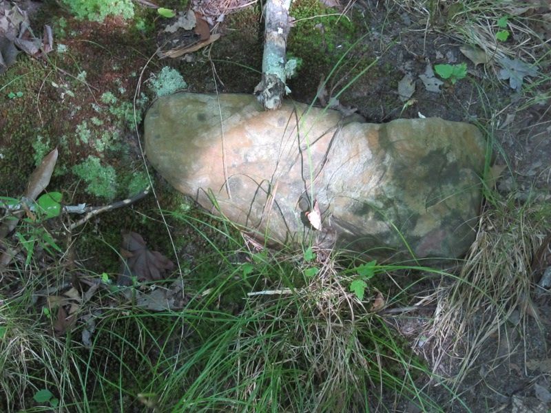
Once again not sure if some of these are legitimate property stones or not but many were along ditches and along a property line following the edge of a field.many appeared to be planted upright but some not.Stone city right here in Eldora.


Once again not sure if some of these are legitimate property stones or not but many were along ditches and along a property line following the edge of a field.many appeared to be planted upright but some not.Stone city right here in Eldora.
OK, this location is about 2 miles from the Cumberland County border, but it demonstrates an interesting surveying enigma. Any care to guess as to what is going on here?
Yes, crazy right of way lines for the railroad, the surveyor and/or the draftsman was drunk at the time or it's 5:30am and I'm not awake yet. haha
It looks like the railroad right-of-way on Block 700, lots 16 and 17 has been moved as far away from the buildings on lot 1 as possible and still maintain the required radius of the tracks. Maybe a court decision. Don't know why the R.O.W. on the other side is tangent and not curved. Maybe both R.O.W.s are straight hard to tell.
Don
Last edited:
Yes, crazy right of way lines for the railroad, the surveyor and/or the draftsman was drunk at the time or it's 5:30am and I'm not awake yet. haha
Don
Coffee won't help. This vignette is an based on a survey that the Pinelands Commission paid $35,000 for, and was here replicated for Pinelands Application #2009-0089.001. The original survey funds came directly from mitigation money earmarked for protecting Pinelands water quality when the Parkway widened their road footprint.
Is it upside down for a reason?
This survey was flipped to put Block 700 and my property into the upper left hand corner for convenience.
Provided below are two annotated copies depicting this precedent-setting location. Survey 1 shows the Pennsylvania-Reading Seashore Line as recognized by ConRail and NJ Transit. Survey 2 is an "existing conditions" map recently submitted to the Pinelands Commission for Application #2009-0089.001.
What legal decision occurred here that sets authoritative rule for similar land-use cases in the future? Why were the property lines oddly gerrymandered?
Last edited:
Is the second survey being used as proof of encroachment on the right of way?
The first excerpt is what the railroad used as its survey. The second excerpt is what Buena Vista Township used as its survey for a permit to its redevelopment project. I added annotations in red for interpretation.
I miss the days when property lines were marked by stones, white oaks, and double-trunked pines! Those delineations were unambiguous, even tactile. I understand why this group loves old survey stones. You knew just where your land began and ended by sight alone. Now we have to put trust into engineers and surveyors, and hope our land-use officials have the ability to assist when a measurement is questioned.
The Pinelands Commission insisted that the obviously flawed survey was correct as an engineer had certified it so, this despite the many pages of documentation that were provided to the contrary. When I sought due process to correct the Pinelands misinterpretation, their solicitor denied my request to have the matter reviewed at the Office of Administrative Law. Their council determined trespass of railroad development onto my land did “not raise a particularized property interest sufficient to require a hearing on constitutional grounds” (letter dated April 27, 2015, Roth to Demitroff).
More bad precedent was set. Nearly all of the land slated for Block 700 development adjoining my property was located in land designated as Forest Area. The Pinelands Commission approved redevelopment outside the Pinelands-approved redevelopment zone. Redevelopment is not a permitted use in Forest zoning under Pinelands rules or under State Redevelopment statute. Taking and forcing an illegal land use onto my property undermines basic property rights that go all the way back to King John and the Magna Carta.
S-M
Last edited: