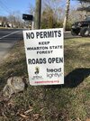
DEP Announces Virtual Public Meeting to Launch Wharton State Forest Visitor and Vehicle Use Survey

stiltzkin

Explorer
Feb 8, 2022
540
807
Medford
I am close to finished with a hand-annotated composite map. It is similar to the 2017 one prepared by the Pinelands Commission, except I stitched together the full resolution USGS topos using whichever quads were most recently updated, and then overlaid the new "visiting" vehicle use map ("VVUM") and highlighted all of the roads according to whether they are:

  • Included in both the VVUM and historic topo maps (would remain open)
  • Excluded from the VVUM, but appear as double-dashed lines on historic topos (would be closed if not already closed, or not actually roads to begin with)
  • Included in the VVUM, but do not appear on historic topos (relatively new roads that would remain open)
  • Included in the VVUM, but currently inaccessible (would need action by state/local government to restore access - I only know of one so far)
The end result is almost the same as what the state came up with in this new comparison map, but there are some differences, and I like having it overlaid onto the topos instead.

I mostly did this for my own benefit, to better understand what exactly is being excluded in comparison to the "1997" baseline that is often referenced, but if there is interest from others, I can post it here when it's done.
 

stiltzkin

Explorer
Feb 8, 2022
540
807
Medford
I'd like to see it.

I'll link to it, as it's probably much too large to upload here at full resolution: https://ibb.co/mNgMHvc

Some further notes:
  • It is basically a guarantee that I missed things and that this contains mistakes. This was done as a quick learning exercise rather than a serious attempt at producing a high quality map (for those, stick with Boyd's Maps).
  • This does not include road names, which are quite confusing and contradictory and would have taken a lot longer to sort out.
  • This does not include closures of roads which may have been created after the topo maps were printed.
  • I did not include 100% of Wharton. Technically, this is missing some small parcels at the extreme west. Since there were no roads listed there on any of the maps, I did not bother to include them.
I found this to be an illuminating exercise. I would certainly not argue (and I'm not sure if anyone is arguing) that everything marked in red should be open to vehicles. There are clearly some red marks on this map that indicate:
  • Roads that have already been closed by previous administrative action
  • Roads that have effectively been closed by disuse and completely reclaimed by nature in the decades since these maps were produced
  • Roads that were never actually navigable by vehicle (footpaths, natural geographic features that merely looked like roads, etc)
  • Roads that never existed as a path in any form (outright mistakes)
DEP acknowledges this in the new proposal, and honestly I don't think I have much quarrel with things in this non-road category being explicitly closed off on the map. If it isn't a road, then it isn't a road closure.

On the other hand, at least in my limited experience, there are a lot of lines on this map that are real roads today, with all the characteristics of a road and history of use as a road. I think there is a good faith debate to be had about whether closing those off to vehicles entirely is the best way to protect the environment that they pass through or lead to.

It seems to me that determining this would require a more intensive case-by-case approach than has been applied. Alternative measures, such as blocking off locations rather than entire roads, do not seem to have been given much consideration.
 

bobpbx

Piney
Staff member
Oct 25, 2002
14,658
4,834
Pines; Bamber area
That's comprehensive, well done. This missing link below has quite an impact, and there are others. I wonder if the yellow can be a color that has more contrast. It blends too well into the map colors.

1707059492012.png
 
  • Like
Reactions: stiltzkin

bobpbx

Piney
Staff member
Oct 25, 2002
14,658
4,834
Pines; Bamber area
I drove most of this road last year. It's open and well-used. I wonder if farmers had any say in whether they wanted some of the closures?

1707060263633.png
 

stiltzkin

Explorer
Feb 8, 2022
540
807
Medford
Yes, I can definitely come back to this later and easily update the line color. You're right, the contrast is not great.
 

enormiss

Explorer
Aug 18, 2015
607
409
Atco NJ
Anyone else see a problem with map 7?
They claim 1610 surveys submitted but no area gathered more than 18people who enjoyed the same area.
Did the respondents who said all/every road or circled the whole map get tossed in the can :(
 
  • Like
Reactions: TommyP and bobpbx

Rooftree

Explorer
Mar 24, 2017
390
617
79
Haddon Township
I was in retirement when I started roaming the Pines back in 2008; only during the weekdays at least once a week between 9AM and 3PM. Even up today, I never saw an illegal off-road vehicle of any kind, except once when I stayed until 4PM. (The fishing was good at day in an old cranberry bog.) Besides that, many times I don't see anyone at all, on foot or in a vehicle. I question myself, am I the only one who goes to the Pines during the weekdays? In addition, I probably only saw law enforcement presence 5 or 6 times. Believe it or not, one was the Superintendent of Wharton State Forest. He gave me a ride back to my car.

On three occasions, I went to the Pines in the evening to see if I can find a Pine Barren Tree frog. I parked my car along Carranza Rd near the Skit Branch. I hiked in from the road to a spung and waited to hear the call of the frog. On all tree occasions as I waited, Carranza Road sounded like a speedway/dragstrip.. All I could think was my car was going to be vandalize, or coming back seeing that I had a flat tire.

It's my opinion, most all of this off-road destruction happens during the evening hours and the weekends. (Which I believe everyone already knows.) Having additional law enforcement presence at this time would resolve the issue, not closing roads to all.

In case you are wondering. I have not seen a tree frog.
 
Last edited:

Scroggy

Scout
Jul 5, 2022
86
123
Delaware
That's comprehensive, well done. This missing link below has quite an impact, and there are others. I wonder if the yellow can be a color that has more contrast. It blends too well into the map colors.

View attachment 21939
I noticed that one. I remember driving partway to Wescoat Bogs on a field trip with Ted years ago; I don't remember at what point we started walking account of sugar sand, although we might have gotten all the way up Dave's Road to Atsion-Batsto. When I checked it out last winter, it was in much worse shape with some large holes, although the occasional Jeep still drives along it. At the fork shown on the map, the northern branch (highlighted in brown) has essentially captured a stream and is carrying it away from the Mechesetauxin toward the Sleeper. The south branch is a bit better, but not much--just past the fork there was over a foot of water on the go-around! (Admittedly, it was wet at the time.)

I dunno. It doesn't have a long history, not showing up in the 1949 topo. (If it's to be believed, the main road out of Wescoat Bogs was the Batsto Fireline Road.) And it definitely traverses wetlands and would take quite a bit of fixing (although I don't remember noticeable tracks from people offroading along the way). On the other hand, if they're going to maintain it as "Dutchtown Firebreak", letting vehicles bypass some of the sugar sand between Wescoat and Locks Bridge might be a good thing for the overall condition of that stretch.
 

bobpbx

Piney
Staff member
Oct 25, 2002
14,658
4,834
Pines; Bamber area
I noticed that one. I remember driving partway to Wescoat Bogs on a field trip with Ted years ago; I don't remember at what point we started walking account of sugar sand, although we might have gotten all the way up Dave's Road to Atsion-Batsto. When I checked it out last winter, it was in much worse shape with some large holes, although the occasional Jeep still drives along it. At the fork shown on the map, the northern branch (highlighted in brown) has essentially captured a stream and is carrying it away from the Mechesetauxin toward the Sleeper. The south branch is a bit better, but not much--just past the fork there was over a foot of water on the go-around! (Admittedly, it was wet at the time.)

I dunno. It doesn't have a long history, not showing up in the 1949 topo. (If it's to be believed, the main road out of Wescoat Bogs was the Batsto Fireline Road.) And it definitely traverses wetlands and would take quite a bit of fixing (although I don't remember noticeable tracks from people offroading along the way). On the other hand, if they're going to maintain it as "Dutchtown Firebreak", letting vehicles bypass some of the sugar sand between Wescoat and Locks Bridge might be a good thing for the overall condition of that stretch.
Yes, in our days we could go across that small bridge and head to Atsion or downstream to cross Constable Bridge. And yeah, the holes are deep and scary, but they have a hard bottom.

1707076858684.png
 

Scroggy

Scout
Jul 5, 2022
86
123
Delaware
I found the GPS trace from that trip in 2010. Looks like we drove down the south branch of the road to the junction in Bob's aerial above, then parked in that sort of wide spot on the firebreak and crossed the tributary of the Sleeper to get into Wescoat Bogs. Somehow I don't remember it being so big as it is now...I thought there was just a board across it or something but maybe my memory is playing me false. I think the highlight was the Xyris in the east corner.
 

Teegate

Administrator
Site Administrator
Sep 17, 2002
25,951
8,694
I found the GPS trace from that trip in 2010. Looks like we drove down the south branch of the road to the junction in Bob's aerial above, then parked in that sort of wide spot on the firebreak and crossed the tributary of the Sleeper to get into Wescoat Bogs. Somehow I don't remember it being so big as it is now...I thought there was just a board across it or something but maybe my memory is playing me false. I think the highlight was the Xyris in the east corner.
There was just a board across at one time.
 

bobpbx

Piney
Staff member
Oct 25, 2002
14,658
4,834
Pines; Bamber area
I am close to finished with a hand-annotated composite map. It is similar to the 2017 one prepared by the Pinelands Commission, except I stitched together the full resolution USGS topos using whichever quads were most recently updated, and then overlaid the new "visiting" vehicle use map ("VVUM") and highlighted all of the roads according to whether they are:

  • Included in both the VVUM and historic topo maps (would remain open)
  • Excluded from the VVUM, but appear as double-dashed lines on historic topos (would be closed if not already closed, or not actually roads to begin with)
  • Included in the VVUM, but do not appear on historic topos (relatively new roads that would remain open)
  • Included in the VVUM, but currently inaccessible (would need action by state/local government to restore access - I only know of one so far)
The end result is almost the same as what the state came up with in this new comparison map, but there are some differences, and I like having it overlaid onto the topos instead.

I mostly did this for my own benefit, to better understand what exactly is being excluded in comparison to the "1997" baseline that is often referenced, but if there is interest from others, I can post it here when it's done.
By the way, and I don't know how this happens, but it also happens in Ben's historical maps; if you want to really zoom in, "right click on the map and choose open image in new tab". Suddenly it's zoomed in properly on the new tab (for those who don't know).
 

Teegate

Administrator
Site Administrator
Sep 17, 2002
25,951
8,694
By the way, and I don't know how this happens, but it also happens in Ben's historical maps; if you want to really zoom in, "right click on the map and choose open image in new tab". Suddenly it's zoomed in properly on the new tab (for those who don't know).
Must be a windows things. Mine zooms in fine.
 
  • Like
Reactions: Ben Ruset
Top