Fix Our Parks

Teegate

Administrator
Site Administrator
Sep 17, 2002
25,653
8,265
I don't know what proportion of the illegal dirt bike riding is on plow lines, compared to how much is on newly-created dirt bike trails, but, regardless, illegal is illegal. Eliminate, no, but there are ways to get it better under control. And yes, I do blame the bikers. They are violating state regs. And the damage they do has not been evaluated, but the noise, visual stimuli, air pollution, and other impacts are undoubtedly a big problem for wildlife. Is it a lesser amount, compared to the ATV traffic and the illegal 4WD traffic (i.e., people leaving the road system to drive in wildlife habitat)? That may be true.

I don't see how you ever will get it under control. It is what it is and will continue to be that way.

Everything you and others are concerned with is wildlife and plants. I am not saying that I don't agree, I am just saying in order to protect them as you want will require now legal roads to be closed. I am against that and always will be. As you can tell I am a one issue voter.
 

G. Russell Juelg

Explorer
Jul 31, 2006
284
51
Burlington County
I don't see how you ever will get it under control. It is what it is and will continue to be that way.

Everything you and others are concerned with is wildlife and plants. I am not saying that I don't agree, I am just saying in order to protect them as you want will require now legal roads to be closed. I am against that and always will be. As you can tell I am a one issue voter.
We can agree to disagree on the possibility of getting better control of illegal dirt bike traffic.

What I'm hoping we can agree on is that there needs to be a map showing the legal lanes of travel on state lands. That would facilitate better enforcement--assuming we get state authorities to make enforcement a priority. Better enforcement would, as I think we have agreed in the past, would make it less likely that authorities would choose to close up areas like the WMA areas we saw recently, effectively punishing the law-abiding users along with the violators. Personally, I think they should adopt the Pinelands Commission map for Wharton, but hold off on strict enforcement of it, for maybe three months, until they make acceptable revisions based on input from the public. It's a "baseline" not a final product. It seems, however, that they are inclined to start from scratch, and do a kind of crowd-sourcing exercise--which is probably the least efficient way to go about it.
 
  • Like
Reactions: NJCoastal

Boyd

Administrator
Staff member
Site Administrator
Jul 31, 2004
9,549
2,809
Ben's Branch, Stephen Creek
  • Like
Reactions: NJCoastal

bobpbx

Piney
Staff member
Oct 25, 2002
14,236
4,331
Pines; Bamber area

Boyd

Administrator
Staff member
Site Administrator
Jul 31, 2004
9,549
2,809
Ben's Branch, Stephen Creek
Well I certainly don't approve of it, I am just responding to this:

Yeah, it's essentially a compilation of all the USGS topo maps (various recent iterations) that cover Wharton. Maybe Boyd could help?

That map seems to fit the description that he posted earlier in this thread.

The DEP and the Pinelands Commission both consider the Pinelands Commission map created in 2017 for WSF as the "baseline" for an official map.

If he has some other map, then he should post it. Surely all the different public entities involved in this project have enough resources to make it available without my "help". As I posted earlier, I am not going to get involved with this and don't want any related maps on my site.
 
  • Like
Reactions: NJCoastal

Boyd

Administrator
Staff member
Site Administrator
Jul 31, 2004
9,549
2,809
Ben's Branch, Stephen Creek
Apparently this is it?

"The map, the first of the forest, derives from four U.S. Geological Survey topographical maps made between 1972 and 1997. Department of Environmental Protection spokesman Larry Hajna said that limits the map’s usefulness. The map may be useful as a guide, but it is based on maps that are many years, even decades, old and should not be relied upon as a definitive map of all the roads and trails within the state forest,” Hajna said. No printed editions of the map yet exist. Here's a copy from the Pinelands Commission meeting documents."


NJCoastal

Scout
Oct 19, 2021
43
19
69
Mount Laurel, NJ
My favorite camping area is at the Mullica River Wilderness Campsite. NJ Wharton State Forest Route Atsion To Mullica River Road (video link).

So far, to the best of my knowledge, no vehicles have traveled into this campsite area with the exception of the rangers and maintenance crews. "Wilderness Area No Motor Vehicles" are posted within the orange and green squares.

WSF Mullica River Rd.png


WSF_wilderness_area_no_motor_vehicles.jpg
 
  • Like
Reactions: G. Russell Juelg

G. Russell Juelg

Explorer
Jul 31, 2006
284
51
Burlington County
Apparently this is it?

"The map, the first of the forest, derives from four U.S. Geological Survey topographical maps made between 1972 and 1997. Department of Environmental Protection spokesman Larry Hajna said that limits the map’s usefulness. The map may be useful as a guide, but it is based on maps that are many years, even decades, old and should not be relied upon as a definitive map of all the roads and trails within the state forest,” Hajna said. No printed editions of the map yet exist. Here's a copy from the Pinelands Commission meeting documents."

Yes, that's it. I think I can get a full-sized copy, but it's a huge file. I don't know why anyone would say it "derives from four U.S. Geological Survey maps...". It obviously draws from 15. Anyway, if both the Pinelands Commission and the DEP continue to agree that this is the "baseline," then, presumably, if they ever produce an official version, it will resemble this. The issue is that, people who want to optimize on the side of legitimate forms of motorized recreation, will probably advocate for more roads, and those who want to optimize on the side of conservation will probably advocate for less. That's what we do in a democratic republic. Maybe neither side will be entirely happy with the ultimate outcome. But, hopefully, the process will be one of studying the facts, science, and logic.
 
  • Like
Reactions: NJCoastal

Boyd

Administrator
Staff member
Site Administrator
Jul 31, 2004
9,549
2,809
Ben's Branch, Stephen Creek
So, according to this article dated September 14, 2017:

"The Pinelands Commission unanimously approved a resolution Thursday designating which roads in Wharton State Forest are 'appropriate for recreational use by motor vehicles.'”

And we sit here now, five years later, and this "unanimously approved" map is still not available to the public? So much for "transparency"....
 

NJCoastal

Scout
Oct 19, 2021
43
19
69
Mount Laurel, NJ
And we sit here now, five years later, and this "unanimously approved" map is still not available to the public? So much for "transparency"....
IMHO, we’re not privy to the entire dialogue within the governing parties. Reasons, or a reason, exist but we’re not in the loop.
 

tsqurd

Explorer
Jul 29, 2015
180
137
South Jersey
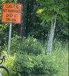
Guy mentioned VT earlier in this thread. We spend a lot of time up there and are starting to know the area pretty well. VT does something that should be explored as an option here - they designate some old roads as Class 4, Unmaintained. Basically the road is left open to the public but the government doesn't have the cost/ responsibility of fixing it - its travel at your own risk. Obviously sensitive areas are off limits. My daughter and I have started exploring them on gravel bikes. Some of the roads are almost as good as the maintained roads, some are quite overgrown, others are almost completely washed out/rutted up with big puddles I avoid. At times a mountain bike would be much easier, but that is part of the fun. You can encounter a mix of users - motorcycles, trucks/jeeps, subarus, horseback riders and bicycles and it seems for the most part everyone sees these roads as a valuable public resource.

C0858095-A146-41CB-ACCD-10D23F2E3503_1_201_a.jpeg
 

Boyd

Administrator
Staff member
Site Administrator
Jul 31, 2004
9,549
2,809
Ben's Branch, Stephen Creek
But this is just a naked USGS topo map with the Wharton boundaries marked. I don't understand how the Pinelands Commission "unanimously approved a resolution designating which roads in are appropriate for recreational use by motor vehicles" based on this. Is there some newer version that shows the "designated" roads?
 
Top