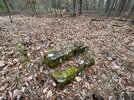
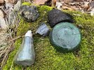
So Manumuskin means "To Drink Swamp water at this place"? I LIKE IT! Fits me perfectly for I have been known to drink swamp water on purpose and accidently.Page 20 gives meaning for the names Menantico “covered swamp” and Manumuskin(a few meanings put together)
Fries Mill
- Thread starter stiltzkin
- Start date
You are using an out of date browser. It may not display this or other websites correctly.
You should upgrade or use an alternative browser.
You should upgrade or use an alternative browser.
A mans gotta drink...So Manumuskin means "To Drink Swamp water at this place"? I LIKE IT! Fits me perfectly for I have been known to drink swamp water on purpose and accidently.
So Manumuskin means "To Drink Swamp water at this place"?
I'd rather drink muddy water, sleep in a hollow log.
"Than to stay here in the Peaslee, be treated like a dog...."I'd rather drink muddy water, sleep in a hollow log.
It seems Manumuskin was a settlement centered around the Fries Mill (where the workers lived etc.) I wonder if Manantico was a settlement similar to Manumuskin was centered around Clark's Mill and was abandoned after Clark's Mill was abandoned Manantico was too. Just a theory. I believe present day Menantico where Clarks Mill was located began being mined for sand in at least 1927 and possibly earlierInteresting that Cook, Vermeule and the USGS all called it "Manantico" in the 19th century. Then, after that it disappears from the map.
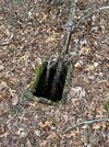
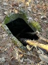
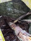
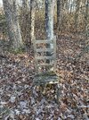
I often wonder about the Bennetts Mill area. And what went on there. I’ve explored a little bit of it and found what looks like a vent or something. It feels like there should be more ruins there for some reason.
Attachments
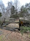
Btw, the bridge is out on Bennetts Mill roadI often wonder about the Bennetts Mill area. And what went on there. I’ve explored a little bit of it and found what looks like a vent or something. It feels like there should be more ruins there for some reason.
Attachments
Were these pictures taken of this Bennetts Mill? https://boydsmaps.com/#15.00/39.423706/-74.908410/pines1949/0.00/0.00 I believe that pic you took of that what I always thought was an old well is south of Bennetts here https://boydsmaps.com/#15.00/39.414158/-74.908667/pines2023/0.00/0.00 At first you confused me.I"m thinking I never seen that at Bennetts Mill of which I know that whole area quite well then I remembered that hole is south down at the old home site a mile below the Mill.I often wonder about the Bennetts Mill area. And what went on there. I’ve explored a little bit of it and found what looks like a vent or something. It feels like there should be more ruins there for some reason.
Looks like the bridge is down for the count.I doubt they will ever replace it.Btw, the bridge is out on Bennetts Mill road
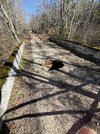
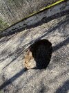
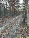
These were taken down a long jeep trail that starts from Bennetts Mill road and heads south. At the end is the trail there is what seems to be a circle turnaround and then this area with the pit. Just south of this is a stream that I thought was the Big Neil. I’m truly uncertain about the actual names of any of these places. They were just always the places we went to be away from the parents when we were up to no good. Here’s where I park on Bennetts Mill road. Any history you can give me I’d be grateful. I have always appreciated Bennetts Mill road as the last wild and untamed road in Vineland. Even though it’s most likely Milmay. Ha ha.Were these pictures taken of this Bennetts Mill? https://boydsmaps.com/#15.00/39.423706/-74.908410/pines1949/0.00/0.00 I believe that pic you took of that what I always thought was an old well is south of Bennetts here https://boydsmaps.com/#15.00/39.414158/-74.908667/pines2023/0.00/0.00 At first you confused me.I"m thinking I never seen that at Bennetts Mill of which I know that whole area quite well then I remembered that hole is south down at the old home site a mile below the Mill.
Attachments
At the end is the trail there is what seems to be a circle turnaround and then this area with the pit.
That sounds like the place in Al's link above. That building on the map has always fascinated me, have meant to check it out for years but never get around to it.
https://boydsmaps.com/#15.00/39.414158/-74.908667/pines2023/0.00/0.00
It shows on the 24k legacy topo but not the 1930's aerials. The road shows on the 1980's aerials but not the building.
I know Al or someone will chime in with some more detailed history, but check out the LiDAR here https://boydsmaps.com/#16.82/39.424752/-74.913100/midatlidar/0.00/0.00
The last thing Bennett’s mill was used for was a cranberry bog which you can see by the hash marks shown here on the LIDAR and even the aerials. Same is true for Leamings Mill you can see the hash marks on the map there too.
The last thing Bennett’s mill was used for was a cranberry bog which you can see by the hash marks shown here on the LIDAR and even the aerials. Same is true for Leamings Mill you can see the hash marks on the map there too.
Yes this is the exact spot where his well photo was taken.That sounds like the place in Al's link above. That building on the map has always fascinated me, have meant to check it out for years but never get around to it.
https://boydsmaps.com/#15.00/39.414158/-74.908667/pines2023/0.00/0.00
View attachment 22182
It shows on the 24k legacy topo but not the 1930's aerials. The road shows on the 1980's aerials but not the building.
The Stream you were looking at at the party spot was Manumuskin River,same creek that runs under the bridge only downstream. Big Neal branch meets the Manumuskin at the Bridge in what used to be the backed up pond.There is often no water in it. and 66C10 us correct bennetts Mill was a Cranberry bog at one time.My uncle told me there used to be a graveyard also behind the field but if so all the stones are gone.I thought i could barely deiscern sunk in spots where he told me it was but it could have been my imagination.These were taken down a long jeep trail that starts from Bennetts Mill road and heads south. At the end is the trail there is what seems to be a circle turnaround and then this area with the pit. Just south of this is a stream that I thought was the Big Neil. I’m truly uncertain about the actual names of any of these places. They were just always the places we went to be away from the parents when we were up to no good. Here’s where I park on Bennetts Mill road. Any history you can give me I’d be grateful. I have always appreciated Bennetts Mill road as the last wild and untamed road in Vineland. Even though it’s most likely Milmay. Ha ha.
Looks like I've got some more exploring to do...
These new muck boots are going to be gear purchase of the year I think. I really want to walk up and down some streams. And I want to look for the site of the YMCA camp [as long as I'm not tresspassing]
These new muck boots are going to be gear purchase of the year I think. I really want to walk up and down some streams. And I want to look for the site of the YMCA camp [as long as I'm not tresspassing]
Note that any kind of stickers will shred the neoprene shaft on Muck Boots.
I’ve been doing neoprene bootie and boots for years and I wanted to switch to something more substantial. I didn’t even think about the briars affecting them. Thank you for the heads up. I’ll stick to my usual method.Note that any kind of stickers will shred the neoprene shaft on Muck Boots.
LaCrosse Grange is a fan favorite of PBX.I’ve been doing neoprene bootie and boots for years and I wanted to switch to something more substantial. I didn’t even think about the briars affecting them. Thank you for the heads up. I’ll stick to my usual method.
That bridge is fine. i walked across it a few months ago and I dont even want to tell you how much I weigh.enough to be the bridge tester. The barricade is to stop dirt bikes not hikersCurrent location. I am not taking a chance on this bridge though.

