Jose, Maria

Read "Condominium" a novel by John D. MacDonald published 1977. Best description ever written of 1) what hurricane wind/storm surge does 2) Florida barrier island ecology 3) how shoddy construction can bypass building code 4) history of greed-based developement fostering coastal construction. Story includes a detailed view from an engineering perspective of how concrete foundations piers often were built to fail under surge load.

John D MacDonald was one of the major opponents of developements affecting the Everglades.

There are few highrises along the Cape May county coastline, but similar history of massive developement .
 

46er

Piney
Mar 24, 2004
8,837
2,144
Coastal NJ
Watching the destruction from Irma in the Keys of FL; reports are saying 25% of all homes in the keys are gone. Seeing these images it is also pretty obvious, at least to me, that a goodly number of those gone will probably be mobile homes. Powerful stuff.
 

Boyd

Administrator
Staff member
Site Administrator
Jul 31, 2004
9,826
3,005
Ben's Branch, Stephen Creek
It's early, but that one looks like it has a chance of heading towards us...

For awhile it looked like this was turning away, but just heard a report on CNN that there's a possibility it could hit NYC as a category 1 or tropical storm....

145928_5day_cone_no_line_and_wind.png
 

smoke_jumper

Piney
Mar 5, 2012
1,606
1,164
Atco, NJ
I've been watching it. The models keep pushing it closer to us. If the high pressure that set up in the north is strong enough it could make landfall on Long Island.
 

Boyd

Administrator
Staff member
Site Administrator
Jul 31, 2004
9,826
3,005
Ben's Branch, Stephen Creek
Today's version shows limited impact on NJ. They also removed the language about tropical storm conditions from the Tuesday NWS forecast and it now just mentions a "chance of showers" with 1/10 to 1/4 inch possible.

145546_5day_cone_no_line_and_wind.png
 

46er

Piney
Mar 24, 2004
8,837
2,144
Coastal NJ
Possible that Maria may become a concern heading into Oct.

Maria continues to move west-northwestward, or 290/13 kt, and that
trajectory is expected to continue at least for the next four days
while a mid-level high is centered over the western Atlantic Ocean.
However, the track guidance has generally slowed down since the
high is not very expansive or strong, and the new NHC track
forecast follows that trend, ending up a little slower than the
previous forecast. The official forecast also continues to hedge
toward the southern side of the track guidance envelope, closest to
the ECMWF and HCCA models, which have been doing very well this
hurricane season.

Until the reconnaissance aircraft investigates Maria, the initial
intensity will be a little uncertain. Regardless, the storm is
within an environment of very low shear and over sea surface
temperatures around 29 degrees Celsius, so steady strengthening is
expected during the next few days. Due to this seemingly ideal
environment, the NHC intensity forecast is higher than the
statistical-dynamical guidance and closely follows HCCA and the ICON
intensity consensus through the entire forecast period. Maria is
likely to become a hurricane later today and could become a major
hurricane in 2 to 3 days. No major changes to the intensity
forecast were necessary compared with the previous cycle, and I'd
rather wait anyway until we have a better handle on Maria's
intensity and structure.
- NHC

aal15_2017091706_track_gfs.png
 

Boyd

Administrator
Staff member
Site Administrator
Jul 31, 2004
9,826
3,005
Ben's Branch, Stephen Creek
They also removed the language about tropical storm conditions from the Tuesday NWS forecast and it now just mentions a "chance of showers" with 1/10 to 1/4 inch possible.

The NWS really can't make up their minds, now this is showing on their website. If you click on the ( i ) button, it just says "Tropical Storm Warning until further notice". WTF does that mean? Notice how they capitalized NOW... Is it coming tonight? :siren:

http://forecast.weather.gov/MapClick.php?lon=-74.62420625477718&lat=39.71546373406045#.Wb74Eq2ZPog

storm.png
 

lj762

Explorer
Feb 18, 2017
358
227
Bass River State Forest
The NWS really can't make up their minds, now this is showing on their website. If you click on the ( i ) button, it just says "Tropical Storm Warning until further notice". WTF does that mean? Notice how they capitalized NOW... Is it coming tonight? ...

It's a watch, not a warning. Watch and see which way it turns and how far, I guess. But Tuesday looks bad. Details here:
Tropical Storm Watch.

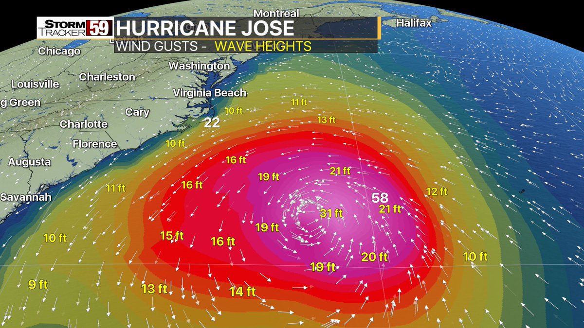
Hurricane Jose will move north, east of the Delaware and New Jersey coasts Tuesday. Rain, gusty winds, beach erosion, and coastal flooding are expected, but the severity is unknown. This is dependent on the evolving track and size of Jose as it passes off the coast.

The highest risk of coastal flooding will be with the high tide cycles Tuesday morning through Tuesday night. Astronomical tides are already running high with the approach of the new moon.
 

Boyd

Administrator
Staff member
Site Administrator
Jul 31, 2004
9,826
3,005
Ben's Branch, Stephen Creek
But Tuesday looks bad. Details here:

I guess there's still a lot of uncertainty. This morning the tropical storm language is gone from the NWS forecast again and the current briefing only says "a period of heavy rain is possible"...

http://www.weather.gov/media/phi/current_briefing.pdf
__________________

Tonight
A chance of showers, mainly after 10pm. Mostly cloudy, with a low around 66. Northeast wind 10 to 14 mph. Chance of precipitation is 50%. New precipitation amounts between a tenth and quarter of an inch possible.

Tuesday
Showers likely. Cloudy, with a high near 73. Breezy, with a north wind 18 to 25 mph. Chance of precipitation is 70%. New precipitation amounts between a quarter and half of an inch possible.

Tuesday Night
Showers likely. Mostly cloudy, with a low around 64. Breezy, with a northwest wind 15 to 23 mph. Chance of precipitation is 60%. New precipitation amounts between a quarter and half of an inch possible.
 

46er

Piney
Mar 24, 2004
8,837
2,144
Coastal NJ
Amazing how the weather sites differ and both under NOAA :worms: That's goobermint :rolleyes:

Prepare for the worst and hope for the best ;) It all depends on where one lives.

From the NHC;

Heavy rain is possible Tuesday afternoon and evening, and could
result in freshwater flooding, mainly for coastal New Jersey.
Between 1 and 2 inches of rain is forecast for eastern New Jersey
from Monday night through Wednesday, but locally heavier amounts are
possible, especially Tuesday evening. There is also the potential
for the storm to shift a bit farther west, and this would bring
heavier rain into much of New Jersey as well. If the heavier rain
falls at the time of high tide, it could worsen the coastal flooding
issues.
 

46er

Piney
Mar 24, 2004
8,837
2,144
Coastal NJ
it appears Toms River is preparing;


Monday September 18, 2017, 10:58 AM

Toms River Township Office of Emergency Management


Advisory: Free sandbags are available. Call (732) 341-3267 to reserve yours M-F 8:30am-4:30pm. Sand available in the TR Golf Course parking lot.


Free sandbags are available. Call (732) 341-3267 to reserve yours M-F 8:30am-4:30pm. Sand available in the TR Golf Course parking lot on North Bay Avenue.

For full details, view this message on the web.
 

Boyd

Administrator
Staff member
Site Administrator
Jul 31, 2004
9,826
3,005
Ben's Branch, Stephen Creek
We must be reading different statements :confused:

I guess so....

Your post said: "Heavy rain is possible Tuesday afternoon and evening".
My post said: "a period of heavy rain is possible"

Your post said: "Between 1 and 2 inches of rain is forecast"

If you add the upper estimates of rain in my post you get .25 + .50 + .50 = 1.25 inches (which is between 1 and 2 inches).

Then if you read the current briefing link in my post, it pretty much covers the other issues in the quote you posted.
 
Top