Lawrence Line Survey

johnnyb

Explorer
Feb 22, 2013
474
200
96
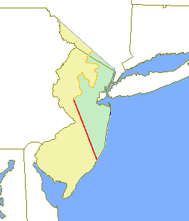
Some questions regarding the Lawrence Line.
From what I’ve read, the stones on the Lawrence line were placed long after John Lawrence did his survey. Who placed the stones? When were they placed? How did those placing the stones know exactly where to put them? Were there remaining marks from Lawrence’s survey, or was there a re-survey to place the stones? If re-surveyed, how did they reconcile it with Lawrence’s surveyed points?
I’ve read that the Lawrence line is the reference for today’s property surveys. If so, how does a surveyor today find the line to use it as his reference? When our property, in Springfield Twp, Burlington County, was surveyed by Frank Commercio in 1984, the corners were referenced to a nail in the center of the intersection of Oxmead and Smithville Roads. Was that nail referenced to the Lawrence line, and if so, how?
When the surveyor group went out in the 1990’s to re-survey the Lawrence line, did they issue a report that showed the deviations between Lawrence’s line points and where they/GPS says the points ought to be?
I’ve been told that Province line road, between Burlington and Ocean Counties, is the demarcation line between East and West Jersey. Yet in what I’ve read, the only municipal boundaries defined by the Lawrence line are a bunch of townships - the Burlington and Ocean County line isn’t mentioned. If the Burlington - Ocean County line isn’t defined by the Lawrence line, I have more questions. What does define the counties’ boundary? Why then is the road still called Province Line Rd.? How are deed descriptions rationalized with the Lawrence line on one hand and the counties’ boundary line on the other?
Another question. Google Earth provides coordinates for a position on the earth to hundredths of a second. Do measurements of the Lawrence line points using Google agree with those from GPS? How do the Google measurements agree with the North American Datum 83?
As a matter of interest, almost 50 years ago while I was with RCA we became involved in answering the question: where is Bermuda? The location coordinates of our radar there had been supplied to the U.S. Air Force and us by the U.S. Army Corps of Engineers. The location data, along with an accurate measurement of local time, and accurate calibration of the radar, were used to help determine a missile’s flight trajectory, which was also measured by RCA’s precision tracking radars at Patrick AFB, FL, and Antigua. There were errors in the Bermuda supplied trajectory that were ascribed to site location errors, The Army was tasked to re-do the Bermuda site survey. Their subsequent survey had a larger circle of uncertainty, I think it was by a factor of 2, due to the identification of newly discovered possible errors, and didn’t intersect the original circle. Use of the new site location data continued to result in missile flight trajectory data errors. The final solution was to derive the site location from simultaneous radar measurements of missile position from the three radars with the Patrick site coordinates being selected as the true origin, i.e., radar data and timing were more accurate than other island survey methods at that time.
 

Teegate

Administrator
Site Administrator
Sep 17, 2002
25,602
8,180
Quite a few question to answer. I will start with a few.

As you mentioned Lawrence did not place stones while doing his survey. All he did was mark trees and mention homeowners and locations in his report as well as links and chains. Before he was even done surveying there were complains about the accuracy of it, but for the most part he apparently did quite well. In 1815 the southern end of the line was resurveyed by Thomas Debow and in 1839 the first 40 miles were again surveyed by Thomas Gordon and Francis Brinley. They made a map showing mile points, land features, and land owners.

As for when the stones were placed that depended on the landowner. Nobody just went down the line and placed the stones, it was up to the landowner to put one there if he/she wanted. There are a few stones where the exact date of placement is known. The one you can visit is along Route 9 at the Getty gas station in West Creek. That stone was placed there on January 19 1865. That will be 149 years ago in two Wednesdays. George Sykes and Edward Brinley placed it there and noted it was exactly 5 miles, 2 chains, and 40 links from the Northerly cape of old Little Egg Harbor inlet. There had been concerns in later years that the stone had been moved during the widening of Route 9 years ago. However, the consensus was the stone is still in the exact spot it was originally placed and was not moved.

The Lawrence Line location is well known by modern surveyors and it is mentioned on most likely every survey where property is along it. Every survey I have along the line shows it.

John Taylor for Taylor Wiseman and Taylor was in charge of the mid 1990's Lawrence Line Committee who looked for the stones and checked their accuracy. He made up a report but I believe it never went past being preliminary.

And, I have never mentioned this before but John Taylor actually wrote a book on the Lawrence Line complete with a CD that included a pdf file of every piece of evidence they found in the archives. This basically was his final report. It was a limited run of 50 books and I was unbelievably fortunate to learn about it and acquired it. Unfortunately, the CD was not in the book and I had to make a few phone calls to finally have it delivered to me. It is a treasure trove of information concerning much more than the Lawrence Line.


IMG_4116.JPG


The Lawrence Line in blue passing through Whiting.


whiting.jpg


Above Whiting to near Great Adventure.


northwhiting.jpg


Guy
 
  • Like
Reactions: Boyd and bobpbx

Teegate

Administrator
Site Administrator
Sep 17, 2002
25,602
8,180
The Burlington/Ocean county line basically is the George Keith Line, and just like the Lawrence line there have been stones placed along it. George Keith ran his line in 1687 but for some reason he strayed too far south and his survey was never adopted as the East West Division line. Province Line Road is on the Keith line and not the Lawrence Line so it is not the "demarcation" line between East & West Jersey.

Here is the Lawrence Line and the Keith Line. They both start at the same location along the coast.


Lawrence_Keith.jpg
 
  • Like
Reactions: Boyd

johnnyb

Explorer
Feb 22, 2013
474
200
96
Many thanks Guy, several issues now understood. This is a fascinating bit of Jersey history/lore: a road called Province Line Road which is the boundary between two counties in opposite portions of the two provinces but which road does not mark the division between the provinces. "Who da thunk it?"
As to Keith's diversion: I can picture him, all alone, whacking thru virgin brush, forest, and swamps, finding out he's swerving off his line, throwing his equipment on the ground in exhausted frustration and yelling into the wilderness: "I QUIT!"
 

Teegate

Administrator
Site Administrator
Sep 17, 2002
25,602
8,180
He traveled with quite a few individuals. He had chain men for measuring and others helping him.
 

Teeman

New Member
Jul 9, 2014
3
0
60
I'm not sure where you got the figure of 5 miles, 2 chains and 40 links south from the Route 9 monument but that distance falls somewhere in the middle of the bay. Just about half way between the mainland and LBI. ??

Does the Taylor book/CD give coordinates for the northerly point, Station Rock? Are there any pictures of it? Another site claims it still exists but gives very few detail as to its location.
 

Teegate

Administrator
Site Administrator
Sep 17, 2002
25,602
8,180
When I get a minute I will check the book and see if it shows the rock. I concentrated on the southern section and can't remember if it showed it or not. One thing I can say is he needed a better camera then he had.
 

Teegate

Administrator
Site Administrator
Sep 17, 2002
25,602
8,180
Since I never was really interested in the line up that far I never read that portion to know the answer. So tonight I quickly looked it over and it is confusing. However, where his line met the Delaware apparently is not the end of the line.

First, the line where it meets the Delaware is exactly one mile below the Dingman's Ferry Bridge. The heap of stones that were put there at a later date (1819) are long gone.

Second, from what I can gather the actual location of "Station Rock" was changed after Lawrence ran the line. It is now believed to be at:

41.712133°
-75.058133°

Just so you know these are the correct cords from the book. I did not make a mistake.


There are photo's and I will try to get them up later. I have a busy weekend ahead so it may be during the week.
 

Teeman

New Member
Jul 9, 2014
3
0
60
Thanks again. Very interesting that the coordinates for the Station rock is almost 3 miles north of latitude 41°40', where it was supposed to be. I expected some deviation but not that much. It does seem to fit the one mile south of Dingman's Ferry Bridge.

Being a land surveyor and having come across the marker at Route 9 recently this has become a pet project of mine. There is no rush and once again I appreciate the assistance. I should probably look into getting my own copy of the book from somewhere.
 

bobpbx

Piney
Staff member
Oct 25, 2002
14,153
4,257
Pines; Bamber area
Guy, you know about this area, correct? They have orange tape there that seems more recent than 2016. I'm surprised they even did this. Do you think they needed to do it for some reason?

1599451025213.png
 

Teegate

Administrator
Site Administrator
Sep 17, 2002
25,602
8,180
The put it up after fixing up the old Cedar Bridge Tavern. That is a semi replica of the one on Route 9 in West Creek which is also a replacement from the original which was stolen years ago.

They most likely just surveyed from stone 15 to stone 14 which would cross the road there. Stone 15 is really close to there.
 

ninemileskid

Explorer
Sep 14, 2014
218
138
So fill me in here. Were East and West Jersey two different entities at one time? (Pardon my lack of knowledge on the subject)
 

bobpbx

Piney
Staff member
Oct 25, 2002
14,153
4,257
Pines; Bamber area
So fill me in here. Were East and West Jersey two different entities at one time? (Pardon my lack of knowledge on the subject)

Yes, for a short time. From Wiki:

"West Jersey and East Jersey were two distinct parts of the Province of New Jersey. The political division existed for 28 years, between 1674 and 1702. Determination of an exact location for a border between West Jersey and East Jersey was often a matter of dispute."


bobpbx

Piney
Staff member
Oct 25, 2002
14,153
4,257
Pines; Bamber area
Yes, for a short time. From Wiki:

"West Jersey and East Jersey were two distinct parts of the Province of New Jersey. The political division existed for 28 years, between 1674 and 1702. Determination of an exact location for a border between West Jersey and East Jersey was often a matter of dispute."


I was born in the capital of East Jersey, and have lived the better part of my life in East Jersey. My daughter would rather I move to West Jersey, but I've demurred. :)
 

bobpbx

Piney
Staff member
Oct 25, 2002
14,153
4,257
Pines; Bamber area
Speaking of stones Guy, I was botanizing near Cedar Bridge Tavern Saturday, and found a rather large, flat stone behind the property. I have doubts as to it's use as a marker, but I just don't know. I don't know who owns the property. When I was there, I assumed it was part of the Cedar Bridge Property.

1599483800959.png


1599483637341.png
 

Teegate

Administrator
Site Administrator
Sep 17, 2002
25,602
8,180
Bob,

I have the various survey's of that property and I don't see anything back there. However, maybe years ago the property lines were different.
 

Teegate

Administrator
Site Administrator
Sep 17, 2002
25,602
8,180
So fill me in here. Were East and West Jersey two different entities at one time? (Pardon my lack of knowledge on the subject)

Because of all the issues with the division, John Lawrence was asked to resurvey it which he did around 1745. There still were complaints even after he was finished. So again in 1839 the lower 40 miles were surveyed again.

So the county when surveying at the signs Bob posted, really only needed to go to the mile 14 stone and the mile 15 stone. Mile 14 is semi remote but 15 is much closer.


Mile 14

Lawrence14_.jpg


Mile 15

15.JPG


I have visited every known stone up to mile 40 and #15 is the most impressive. A few others are nice, and one of them since I first visited it has cracked open from the heat of a fire and is almost impossible to find anymore. And many were missing as early as the mid 1990s and long before.
 
Top