Thats because as you said they haven;t been revised since the 70's.Such ashame.I love the old 24k USGS topo's, they are what got me interested in maps when I was just a kid. But they really don't reflect the current reality in many cases. For example, Bulldozed Road should be familiar to most people, it is on all my maps, it's on OpenStreetMap and even on the new USGS National Map. It shows on the aerials back to the 1980's, but it's not on the old 24k topo map.
https://mobile.boydsmaps.com/#16.00/39.734361/-74.649052/pines1999/0.00/0.00
Devious-Mount Road is another well-known road on current maps like my topo's, OpenStreetMap and the USGS National Map. But it's not on the old 24k Topo's either.
https://mobile.boydsmaps.com/#16.00/39.737909/-74.632272/pines1999/0.00/0.00
These are just a couple examples, there are plenty of others.
New ORV Plan Ideas
- Thread starter Ben Ruset
- Start date
You are using an out of date browser. It may not display this or other websites correctly.
You should upgrade or use an alternative browser.
You should upgrade or use an alternative browser.
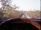
Those big old topo maps were what i used when hiking and backpacking in the Pines in the 60s and 70s. I coated them to make them water resistant, but that also made them even harder to fold up. That and an Esso or Mobilgas road map and a compass was all i had. Chatsworth, Woodmansie, Oswego Lake, Whiting, Atsion, Jenkins, Indian Mills, familiar names to me.
I did two years work for the Earth Science Corps volunteer updating the Dividing Creek Topo. I walked every street in Laurel Lake deleteing houses and trailers gone and adding new ones.It took two years to finish the updating.Then they wrote me a letter back Good Job! and said they were going to urbanize laurel Lake and turn it pink.This highly PO'ed me.I do not live in an urban jungle like Millville or Vineland.I live in a really big campground that just happens to have a few crack heads living in abandoned trailers and turkeys running the streets.Someone even hits a deer walking through the campground once in awhile.We are not urban.Then they ended up never updating the thing anyway unless you call those new Topo/Aerial hybrids maps.Quite the ugliest thing I"ve ever seen. Yes their very outdated (the old topos) but I still love em.I remember when I first found them at age 14 in the Millville Library NJ Room.They would not let you take out reference material so I copied them on the machine for a dime a copy which left them black and white and hit the woods with them,even then I soon realized the roads were out of date,some already gone (many more since then) and many new ones.I sometimes walk foot trails with my grandson and when I tell him I used to drive them he is amazed.he walked up to a tree that he thought was quite old in the road about the size of my leg and said how old is this tree.I told him older then you but younger then me") It was probably about 30 because thats how long that road has been shut down by the nature conservancy.
It was probably about 30 because thats how long that road has been shut down by the nature conservancy.
It was probably about 30 because thats how long that road has been shut down by the nature conservancy.Then they ended up never updating the thing anyway unless you call those new Topo/Aerial hybrids maps.Quite the ugliest thing I"ve ever seen.
Topo+aerials is a just one of the options, they also have a plain topo map. These were really horrible when they introduced them, there were very few features at all. But they've improved a lot recently here in the Pines, they now have green forest shading (NJDEP landcover data?) and buildings (Microsoft?). The biggest problem now is mostly cosmetic IMO, they seem to have bought into the same faded low-contrast style that Google favors.
https://boydsmaps.com/#15.00/39.332437/-75.019714/usgsTopo/0.00/0.00
https://boydsmaps.com/#15.00/39.332437/-75.019714/pines1999/0.00/0.00
And look at the buildings, they are almost invisible! The major highways look thinner than little neighborhood streets too. But the data seems to be there and this is just a simple issue of how it's being presented. The good news is that they are obviously still working on the topo's and improving them, hopefully they will look better in the future.
BTW - no pink shading, but the green area has gotten a lot smaller!

Last edited:
I have seen these maps and did not realize they were intended to replace the old topos. Not as ugly as the hybrids but something you can't see has a hard time being ugly. "Google your the reason are maps are ugly, little Google:" Wasn't that a song?
I do believe that is a yesWasn't it discussed the 1st time they tried the MAP that they couldn't use federal fuel tax for maintenance and prohibit legal vehicle access?
The problem with signs is they will be like the plastic posts blocking all the roads. We will constantly see new signs showing up until all the roads are closed. Give them an inch and they take a mile.
I'm retiring on May 27,
Glad to hear about your retirement. I hope you enjoy it. I will be 65 very soon and I am deciding what to do and when. When I do I plan on doubling my efforts towards exploring the pines as well as researching.
"prohibit legal vehicle access?"
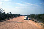
When i used to haunt the NJ Pine Barrens, from the late 1960's thru the 70's and 80's and early to mid 90's, and then occasionally into the early 2000's and even a couple of times since, there was pretty much nobody at all driving on those roads except me in my VW and Subaru. No off road vehicles at all. Nobody. The vast woods were all mine. I could hike and camp for days on end without seeing a soul, sometimes an occasional Piney who was never unfriendly to me, except one man who i inadvertently camped practically in his back yard. I had walked down a trail thinking i was far away from everything but unbeknownst to me the trail came right up to his house (not nearly as bad as what I did once in Fahnestock State Park in NY, tho!) Now there are off road vehicles out here in the desert too, kicking up dust.
When i used to haunt the NJ Pine Barrens, from the late 1960's thru the 70's and 80's and early to mid 90's, and then occasionally into the early 2000's and even a couple of times since, there was pretty much nobody at all driving on those roads except me in my VW and Subaru. No off road vehicles at all. Nobody. The vast woods were all mine. I could hike and camp for days on end without seeing a soul, sometimes an occasional Piney who was never unfriendly to me, except one man who i inadvertently camped practically in his back yard. I had walked down a trail thinking i was far away from everything but unbeknownst to me the trail came right up to his house (not nearly as bad as what I did once in Fahnestock State Park in NY, tho!) Now there are off road vehicles out here in the desert too, kicking up dust.
Attachments
Good For You!Glad to hear about your retirement. I hope you enjoy it. I will be 65 very soon and I am deciding what to do and when. When I do I plan on doubling my efforts towards exploring the pines as well as researching.