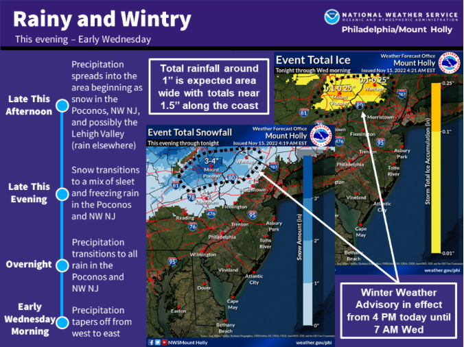
That map doesn't look quite right IMO. It shows me in the 3 to 4 inch zone. There was about 3" of rain in my wheelbarrow Sunday morning, then we had steady rain for many hours from late afternoon thru overnight.
RAIN?
- Thread starter dogg57
- Start date
You are using an out of date browser. It may not display this or other websites correctly.
You should upgrade or use an alternative browser.
You should upgrade or use an alternative browser.
This lets you zoom in and click an area for total
https://www.iweathernet.com/total-rainfall-map-24-hours-to-72-hours
Says 5.39" for me. Other than it being over the weekend I was happy to get it!
https://www.iweathernet.com/total-rainfall-map-24-hours-to-72-hours
Says 5.39" for me. Other than it being over the weekend I was happy to get it!
Says 4.01 inches for me, still think that's too low. Rainfall data like that usually is based on radar which is low resolution - each pixel is about 1400x1400 feet. But anyway... it was a lot of rain!
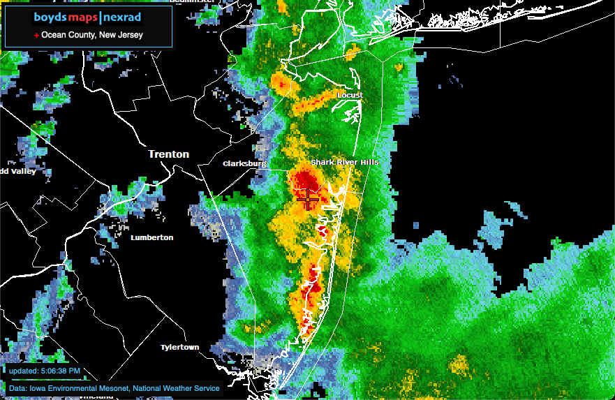
Some people have been getting rain today but hardly any here (yet). But I've been busy writing code - just updated my nexrad app to add geodata - as you move the map, the county and state are now shown at the top left. This is the first test of a new technique I've developed to encode data in a map and decode it quickly in realtime. As before, the radar imagery automatically updates every three minutes and the time of the latest update is now shown at the bottom left.
Am working on some bigger geodatasets to use in the main boydsmaps app in the future.
https://boydsmaps.com/nexrad/#9.00/40.0680/-74.1914

Am working on some bigger geodatasets to use in the main boydsmaps app in the future.
https://boydsmaps.com/nexrad/#9.00/40.0680/-74.1914
Last edited:
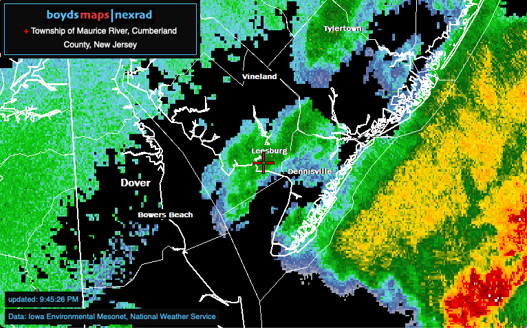
Working on the nexrad app some more... it now includes USGS boundaries of 77,046 continental US Incorporated Places, Unincorporated Places and Minor Civil Divisions which stream in realtime as you move the map around. This is definitely still beta software but seems to work pretty well. You'll see names of cities in other states sometimes as you move but it's usually correct when you stop. Every now and then it throws an obvious error though, it tends to work better when you zoom in farther.
Anyway, welcome to my ongoing experiment in embedding lots of data in a map and accessing it quickly.
https://boydsmaps.com/nexrad/#9/39.2188/-74.9988

Anyway, welcome to my ongoing experiment in embedding lots of data in a map and accessing it quickly.

https://boydsmaps.com/nexrad/#9/39.2188/-74.9988
Last edited:
As much as one to two inches of rain is forecast for tonight, into tomorrow morning. And the Poconos are supposed to get some significant snow and ice!

Snow to the North and West, but we are getting rain again - which is fine by me 
Sunday: Chance of precipitation is 90%. New precipitation amounts between a tenth and quarter of an inch possible.
Sunday Night: Chance of precipitation is 100%. New precipitation amounts between a half and three quarters of an inch possible.
Monday: Chance of precipitation is 50%. New precipitation amounts between a tenth and quarter of an inch possible.

