Signs along Highways

Jerseyman,

A nice bit of info. Thanks! I lived a three blocks away in Magnolia for a few years, and that park was in bad shape. I believe they have fixed it up but I will have to ride by soon and see. They must have changed the names of the streets because Magnolia and Albertson Ave are not near each other today.

Here is the park.

http://maps.google.com/maps?f=q&sou...495,-75.039722&spn=0.006079,0.013068&t=h&z=17

Guy

My mistake, Guy—the land devised for the park stood at Albertson and Evesham avenues, as your map so clearly delineates. My bifocals interferred with the proper viewing of the source material: the word “Magnolia” was located immediately underneath “Evesham” in the newspaper article and I read the wrong word as I typed. My bad!

Best regards,
Jerseyman

P.S. I’ve corrected my original posting!
 

Pine Baron

Explorer
Feb 23, 2008
480
25
Sandy Run
What a terrific post, Jerseyman, thank you . Mr. Albertson was apparently quite the entrepreneur, although I don't support his Quaker principles. The sign in your postcard of Big Timber Creek is the same as in Rednek's link, but unfortunately is no longer there. And Ashbrook's Landing is now Timber Creek Liquors!
The different highway signs are interesting , also. Looks like some were rather elaborate with cast iron posts. Curious that there are no rail-crossing signs, though.
I have a good idea where Chew's Landing bridge is. I'll check it out, and PM you if I need a hint.

John-
 
What a terrific post, Jerseyman, thank you. The different highway signs are interesting , also. Looks like some were rather elaborate with cast iron posts. Curious that there are no rail-crossing signs, though.

John:

Glad you enjoyed the information!

You did not see any railroad crossing signs in the display of New Jersey State Highway Department official signs because the state required the various railroad companies to manufacture these signs and erect them at their own expense. By law, the state did more or less dictate the phrase, “Stop, Look and Listen,” appear on each crossing sign.

I have a good idea where Chew's Landing bridge is. I'll check it out, and PM you if I need a hint.

The bridge I am referring to is no longer in use and sits in the woods. If this span sounds intriguing, I will provide you with the details via PM.

Best regards,
Jerseyman
 

Pine Baron

Explorer
Feb 23, 2008
480
25
Sandy Run
The bridge I am referring to is no longer in use and sits in the woods.

Jerseyman (and all)-

The bridge was right where you said it would be. Excellent directions, although parking was a little dodgy with all the snow. The parapets are still intact (with no span) and the plaque is still there and in great shape. The image on the left is of this bridge stone while the right is a photo of the plaque on the Chews Landing Rd bridge crossing the same branch of the Big Timber Creek. This one is made of the usual poured concrete, while yours is much nicer. The construction appears to be Pennsylvania fieldstone. Haven't seen too many like this!

Chews_Landing.jpg


John-

Fabulous, John—just fabulous that you found the bridge and photo-documented the dedication plaque from this remnant of the old road system in Chews Landing!! I’m glad you didn’t have any trouble other than parking.

Prior to 1936, this bridge provided a crossing over the North Branch of Big Timber Creek for Somerdale Road so it could intersect with Floodgate Road, once a section of the ancient Irish Road. A second bridge at the mouth of Otter Branch allowed the roadway to continue its route into Somerdale.

The bridge you photographed is the last reminder of a place known locally as “Buttonball.” Here is Bill Farr’s paragraph on this toponym:

BUTTONBALL

This is an enlargement of the North Branch of Timber Creek where Somerdale Road crosses and where it is joined by Otter Branch near Chews Landing. It was an informal bathing and fishing spot for local youngsters until water pollution took its toll, probably so named for the buttonwood trees, some of which still thrive nearby. The late John D. F. Morgan told the writer that it was so called before he was born. Ivy Chew, in her article "A Forgotten Road..." (West Jesey Press, 6 August 1936), refers to "the bathing beach at ‘Buttonball’."


Buttonball proved very popular with the local youth, who delighted in jumping from the bridge into the creek, but only from the west or downstream side as the floodgates and sheeting occupied the creekbed on the east side of the bridge. The floodgates prevented the creek’s tidal flow from extending any further up the creek and provided somewhat deeper water for flatboats and deck scows coming into the landing. I have a log/account book from one of these flatboats in my collection operated by a member of the Sickler family. The sandy bathing beach for Buttonball, which measured approximately 12 feet by 30 feet, stood on the Glendora side of the creek, but the young people from Chews Landing could gain easy access to it by crossing the bridge you photographed. Swimming remained popular here until the 1950s, when the discharge from a sewage treatment plant constructed upstream polluted the creek.

I am so glad you made the trek, despite the snow and the parking situation.

Best regards,
Jerseyman
 

Pine Baron

Explorer
Feb 23, 2008
480
25
Sandy Run
Thanx for the additional info, JM. It's hard to believe there was a swimming beach in that area. Seemed too wooded, but I suppose it was much more open years ago with the landing in use and all.

I wanted to get some pics of the bridge remains, but the westering sun was casting odd shadows. It would make for some nice pics, with the bridge crossing right at the Otter's mouth.

John-
 

MarkBNJ

Piney
Jun 17, 2007
1,875
73
Long Valley, NJ
www.markbetz.net
Jerseyman, you never cease to amaze me. So much so, in fact, that my saying "you never cease to amaze me" has taken on the flavor of a cliche :). It's not within my abilities to continue to unearth superlatives to heap on the topic. You're a master of your craft, and it's a craft I have lately come to appreciate the challenges of, for various reasons.

I am struck by the movement of the League of American Pen Women to place the signs identifying watercourses. I have long mused on the idea that modern transportation systems have completely disconnected the average human (among those living in developed countries) from the geography around them. Prior to the invention of smooth roads and high-speed travel it seems to me that we labeled the land around us in terms of its geographical features. So someone might think of a neighbor as living "over the next ridge" or "in the saddle between two hills." A town would be connected with a river ford, or a valley, or a pass between mountains. When people traveled from one place to another they had an intimate sense of the features they encountered, and the route they took became at least partially identified by those features.

Now we think in terms of the graph that is the highway system, and the vertices that exist on that graph; the places where roads connect. Not that connecting trails and roads weren't always an important and noted feature, but today they have become almost the only identifying feature, and directions only occasionally include reference to something like a hill or a stream. My own daughters, all in their teens, have lived in the same town most of their lives and are hard pressed when questioned to tell me how it lies with respect to other nearby towns, which direction principal roads travel, where nearby rivers originate and where they go. They do know, for example, that you can take Naughright road and make a few turns and get to Chester, but have no idea at all that the general direction of that journey is southeast, or that it crosses Stony Brook Creek, the south branch of the Raritan, and the Lamington all in the space of four or five miles.

I think the question those women of the Pen league were trying to answer perhaps sprang from a feeling of disconnection and maybe disorientation that early motorists felt as they whizzed across a landscape that they could remember once knowing well. I like to imaging that "Wait! What was that creek we just crossed?" was an impulse that regularly occured to the people who were among those experiencing 40 or 60 miles per hour for the first time. Had they been on horseback they would have had time to figure it out before the crossing was over.
 
Mark:

Thank you for your kind words, but I am ever the student. I really enjoy imparting historical information to others, fostering a greater understanding of the past that surrounds us all.

I enjoyed reading your thoughts about how modern transportation systems have disconnected people from the geography that surrounds them. To a certain extent, the historical record confirms your thesis. Without going into a full blown discussion about the history of cartography, an examination of John Ogilby’s road maps from his 1675 published volume, Britannia, illustrates just how important stream crossings and hills played as landmarks in navigating from one location to another in seventeenth-century England:

Ogilby.jpg


The ribbon map on this page depicts only stubs of crossroads at intersections, but the streams and hills are named and prominent along the route.

Likewise, Christopher Colles, who published the first road maps of the new United States of America in 1789, also followed the same formula in aiding his patrons who sought to travel from Point A to Point B:

Colles_49.jpg


I think both of these examples convincingly illustrate and reinforce your narrative on the subject.

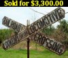
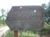
While you may be correct on the motivation of the League of Pen Women, I also suspect that auto-tourism, a huge phenomenon at that time, played a significant role in why the members of the organization proposed such informative signage. Back-to-nature interests, geography, and even a contiunation of the Reform Movement likely entered into the campaign to establish a marker system for water courses.

Thank you for sharing your thesis with us all. I find many of your postings well composed and thought-provoking.

Best regards,
Jerseyman
 

Pine Baron

Explorer
Feb 23, 2008
480
25
Sandy Run
Mark, that was a great post about the nature of the road system in the past, and how it seems to have been lost in recent years. It brought to mind a scene from the Pixar movie CARS that I watched with my children. It's premise is that a little southwestern town on Route 66 had been forgotten after the building of Interstate 40. The scene goes like this:

"Back then, cars came across the country a whole different way...
The road didn't cut through the land like that Interstate.
It moved with the land. It rose, it fell, it curved.
Cars didn't drive on it to make great time.
They drove on it to have a great time."


I thought this was kind of deep for a kids movie, aiming more at the parents. It struck me because I've always been the one to slow down and take the "long way" on back roads instead of highways and Interstates, whenever possible.

John-
 

MarkBNJ

Piney
Jun 17, 2007
1,875
73
Long Valley, NJ
www.markbetz.net
Thanks, Pine Baron. That snippet of dialog from Cars captures it perfectly. I think I love a country lane because it shrinks my world. It lets me fool myself for a time into thinking life still revolves around small communities joined by dirt roads full of mystery and promise.

Of course, you couldn't move an army quickly along those old dirt roads if you were invaded, but as the Romans eventually discovered, roads don't care whose army uses them. They were as pleased to make the way smoother for the sandaled feet of Alaric's Goths as for the booted legions.
 

Ben Ruset

Administrator
Site Administrator
Oct 12, 2004
7,616
1,863
Monmouth County
www.benruset.com
The following was emailed to me by a member who was having problems posting.

Lookout for the Locomotive: By R. Mitchell Deighan

Love this site! Began exploring the Pine Barrens realm in the mid-60's. I had a VW and a passion for abandoned sites. Still have the passion, but many magical places I found have been wiped clean by the ravages of time, which as this thread illustrates are relentless. In the summer of 1967 I worked for the Department of Agriculture on the gypsy moth survey, and was assigned the Pine Barrens. Just me, the moth traps, and four wheels. Many adventures, but I'm reminded of one in particular by this thread about old cast iron signs.

One hot summer day in '67 I was following a remote sand road in the heart of the Pine Barrens and came to an intersection with an abandoned railroad line. At the point where the sand road intersected the tracks stood a magnificent cast iron "X" on a tall cast iron pole..."Lookout For The Locomotive" in white letters on black background. The sign was amazing to see, "in the middle of nowhere". (Don't get me wrong, the Pines are the heart of Somewhere Very Special). Giant, proud, and beautifully proportioned. I marveled at the fact that the sign was still there, in its spot. I remember walking along part of the edge of the pine forest along the tracks (finding a spot for one of the moth traps) under fragments of old electric poles which had paralleled the tracks, and found one of the glass insulators that had been up on one of the pegs on the poles. It was a really fine glass insulator, very "Frank Lloyd Wright" in design, and I carried it off and had it for years, during my college years in southwest Ohio. Lost track of that dude back then and hope someone still treasures it. The glass insulator - as the great cast iron sign - embodied a style and proportion of design well above the "norm". Very fine.

When my gypsy moth chores caused me to revisit the spot where the great "Lookout For The Locomotive" sign had stood, it was gone. Musta taken a whole crew and a hefty truck to haul it outta there and into someone's backyard or an antique shop or maybe a railroad museum. Glad I got to see it in its natural habitat, but wish I knew it was still right where it ought to be.

I have other stories from those adventures and may post as logic deems appropriate.

I was hoping to include a pic I found on the net of a somewhat similar (but by no means as magnificent) "Lookout For The Locomotive" sign, but couldn't figure how to post the photo.
 

Attachments

  • Lookout.For.The.L&.jpg
    Lookout.For.The.L&.jpg
    66.4 KB · Views: 361

Teegate

Administrator
Site Administrator
Sep 17, 2002
25,602
8,177
There still are quite a few of the old poles with insulators on them to be found along the tracks. There is still even an old steel sign that when I found it was laying on the ground. I believe someone has uprighted it since then.

IMG_5717.JPG


I believe there was a sign like he mentioned at Bullock in the mid 70's. There were I believe two at 206 in Atsion and up until a few years ago the large switch boxes were still there. I was going to get a photo but they were gone soon after.


Nice to see he was able to get his message to us. I hope he figures out how to post. It would be nice to hear more. Especially where one was abandoned in 1967. I suspect it was not in Wharton where he saw it since the trains there ran until 1978.

Guy
 

Pine Baron

Explorer
Feb 23, 2008
480
25
Sandy Run
There is still even an old steel sign that when I found it was laying on the ground. I believe someone has uprighted it since then. Guy

This sign was standing the last time I saw it. Glad to see someone took the time to make it right.

John-
 

Attachments

  • RR Xing..jpg
    RR Xing..jpg
    204.4 KB · Views: 384

GermanG

Piney
Apr 2, 2005
1,111
434
Little Egg Harbor
Yep. I read your post too quickly, and thought the pic was taken at Bullock. Now I can stop scratching my head, wondering how I missed it at Bullock! :)
 

mitchdeighan

New Member
Feb 28, 2010
2
0
Ben: test

Ben, thanks for the help, appears I can now post via the forums...
most interesting to read about the other Lookout For The Locomotive signs in the Barrens, and the damaged sign that was re-erected..
in my mind, I can still see the great X-on-a-stick sign from back in '67...
many has been the time I've wondered who took it and where it is..
such an air of mystery throughout the Pine Barrens, which I find so extremely appealing!
 
Top