Upper reaches of the Webbs Mill Branch

Spung-Man

Piney
Jan 5, 2009
1,000
729
65
Richland, NJ
www.researchgate.net
Hinch,

Not as guilty as first thought – at least here! I just did a forum search for “katabatic” and BobPBX is the clear winner with its use in posts. The geek! This term’s roots are Greek for “going down hill,” not unlike recent puns. When the Laurentide Ice Sheet was parked at times as far south as NJ Turnpike Exit 11, cold air would pool atop the one-, two-, and perhaps three-mile thick plateau of ice that enveloped northern North America (and Europe). If the Antarctic ice sheet is a fair analog, then that rampageous thug thinned to about 900-feet high at its terminus, say at Perth Amboy 22,000-years ago.

Glacial density-driven winds are sort of like opening an upper freezer door on a hot day to get your Samuel Adams Summer Ale, before it freezes, and feeling the trapped cold air roll out. The Foehn of the Alps or the Chinook of Canada are but weak cousins to what once poured off continental ice sheets in the past. Frigid, dense, dry air roared down nature’s sliding board perhaps as much as 9-months of the year. Everywhere Ice Age Earth was a much windier, dustier place than the current interglacial pussy-cat of an orb we enjoy today.

Katabatic winds are a potent geomorphic agent. Sea levels dropped as much as 400-feet during glacial maximas, draining aquifers, which left the Pine Barrens high and dry. We suggest such winds were responsible for eroding sandy sparsely-vegetated tundra terrain into spungs.

S-M
 

Spung-Man

Piney
Jan 5, 2009
1,000
729
65
Richland, NJ
www.researchgate.net
Hinch,

So sorry! I only gave you the cold-episode story! The saga continued. Of course all good things have to come to an end, so tens of millions of square miles of ice melted in short geologic time, over about 10,000 years. Sea level quickly rose, which drowned the mouths of rivers that used to easily drain into the Atlantic Ocean many miles off our modern shoreline - nearly to the continental shelf.

Ocean rise increasingly backed up Pinelands streams making them ever more sluggish. It became harder and harder to drain the Pine Barrens of its lifeblood water, and this dynamic is an important factor in keeping between 25% and 35% of the region’s land surface in wetlands. So, yes, about a third of the Pines became waterlogged as the climate ameliorated.

Pitch pines are the cockroach of local conifers, surviving both wet and dry conditions. They thrive in uplands and lowlands. Large tracts of Pinelands wetlands are pitch-pine lowlands. To the casual observer some areas of pitch pine forest look dry, but the seasonal high water table might be just below the surface, or at least that’s the way it used to be... Don’t get me started.

S-M
 
  • Like
Reactions: Hinchman's Hill
Apr 6, 2004
3,624
565
Galloway
Awesome posts, Spung-Man!

Ocean rise increasingly backed up Pinelands streams making them ever more sluggish. It became harder and harder to drain the Pine Barrens of its lifeblood water, and this dynamic is an important factor in keeping between 25% and 35% of the region’s land surface in wetlands.

Do we have any idea how deep and wide our rivers were at the point where they met the ocean prior to sea level rise?
 

Spung-Man

Piney
Jan 5, 2009
1,000
729
65
Richland, NJ
www.researchgate.net
Hinch, Gabe,

It’s refreshing to find interest with the subject. Much of the Pinelands scientific literature is hopelessly mired in obscure journals not readily available to the general public. Worse yet academics have not done a very good job of disseminating work outside their discipline. I, like botanist Jack McCormick nearly a half-century ago, suggest that the Pine Barrens is one of the truly great outdoor classrooms of North America, open to everyone. We have to clue folks in on that message! That is why it is so important to protect, preserve, and enhance this place for the future.

Ancient cold climate rivers would have had very wide but shallow braided channels. Most of streamflow occurred during brief snowmelt floods. Discharge would have occurred over frozen ground, either perennially frozen year round in permafrost, or early enough in the season that sediments were still frozen during deep seasonal frost. Also see Davis & Autin (1997), “Buried periglacial channels on the New Jersey continental shelf.” Good luck finding a copy of Glaciated Continental Margins: An Atlas of Acoustic Images, which includes the paper. You are welcome to use my library.

At many wetland parcels, the groundwater never quite reaches the surface, so in these cases there is little impediment to fire spread at any time. In other cases groundwater can pond, but only seasonally. When temperatures warm, sunlight is strong, and vegetation is growing the near-surface water table can drop by feet leaving wetlands high and dry, amenable to wildfires. And finally, Pinelands wetlands are often shallow features. A permanent water-table drop of only four to eight inches (Roman & Good, 1983) is sufficient loss to dry one up. During droughts, even the wettest of ground (short of larger waterways) has been known to dry up – I’m afraid a more and more frequent occurrence as regional water tables drop.

S-M
 
  • Like
Reactions: Hinchman's Hill

Hewey

Piney
Mar 10, 2005
1,042
110
Pinewald, NJ
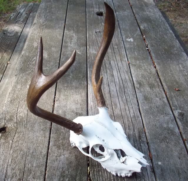
I brought the buck home and had some time last weekend to fix him up. Looks good on my bookshelf.
008-1.jpg


Chris
 
Apr 6, 2004
3,624
565
Galloway
Take a look at Google Earth and turn on the oceans layer. The last frontier and true wilderness on earth.

Indeed, it is. That Hudson River Canyon is really something. Unfortunately, whatever channels were cut into the now submerged continental shelf by ancient Pinelands rivers have disappeared beneath the sand.
 
Top