Wet Forest - Formerly Known as Dry Forest

Boyd

Administrator
Staff member
Site Administrator
Jul 31, 2004
10,054
3,152
Ben's Branch, Stephen Creek
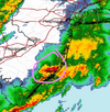
Rain is starting here. The weird thing is, the stong wind suddenly stopped when the rain started, now it's just light rain and light wind.

The alert ends at 6:00 PM, so hoping the worst is over, it was really intense for awhile here.

URGENT - WEATHER MESSAGE
National Weather Service Mount Holly NJ
205 PM EST Wed Mar 5 2025

Ocean-Cumberland-Atlantic-Cape May-Atlantic Coastal Cape May-
Coastal Atlantic-Coastal Ocean-Southeastern Burlington-
Including the cities of Long Beach Island, Atlantic City,
Millville, Hammonton, Wharton State Forest, Cape May Court House,
Ocean City, and Jackson
205 PM EST Wed Mar 5 2025

...WIND ADVISORY REMAINS IN EFFECT UNTIL 6 PM EST THIS EVENING...

* WHAT...South winds 20 to 30 mph with gusts up to 50 mph expected.

* WHERE...Atlantic, Atlantic Coastal Cape May, Cape May, Coastal
Atlantic, Coastal Ocean, Cumberland, Ocean, and Southeastern
Burlington Counties.

* WHEN...Until 6 PM EST this evening.

* IMPACTS...Gusty winds will blow around unsecured objects. Tree
limbs could be blown down and a few power outages may result.

PRECAUTIONARY/PREPAREDNESS ACTIONS...

Winds this strong can make driving difficult, especially for high

profile vehicles. Use extra caution.
 
  • Like
Reactions: Teegate

Boyd

Administrator
Staff member
Site Administrator
Jul 31, 2004
10,054
3,152
Ben's Branch, Stephen Creek
It is moving slow. The really intense part just moved in here, looks like it will dump a lot of rain before it leaves. But its raining straight down, with no wind.

Screen Shot 2025-03-05 at 5.31.18 PM.png
 

Teegate

Administrator
Site Administrator
Sep 17, 2002
26,184
8,993
We got 1.48 inches, about what the news said Philly received.
 
  • Like
Reactions: Boyd

Teegate

Administrator
Site Administrator
Sep 17, 2002
26,184
8,993
Yesterday morning Jessica's weather station was saying it was -40 degrees. She checked and the batteries in the outside unit were very low. So I climbed up on the ladder and replaced the batteries which are located next to the lightning strike sensor. I didn't touch it or go near it but last night no spikes were detected and we had them. So it looks like I will have to go back up and see if something happened when replacing the batteries.
 

Boyd

Administrator
Staff member
Site Administrator
Jul 31, 2004
10,054
3,152
Ben's Branch, Stephen Creek
Right now, winds are wicked.

That's interesting, because the wind hasn't been bad this morning in Atlantic County. Was up early, went to the shore and back on errands. There were gusts on and off - and they felt cold - but not very intense in terms of wind speed. But the day is still young... :)
 

Boyd

Administrator
Staff member
Site Administrator
Jul 31, 2004
10,054
3,152
Ben's Branch, Stephen Creek
Special Weather Statement
National Weather Service Mount Holly NJ
316 AM EDT Thu Mar 27 2025


Sussex-Warren-Morris-Hunterdon-Somerset-Middlesex-
Western Monmouth-Eastern Monmouth-Mercer-Salem-Gloucester-Camden-
Northwestern Burlington-Ocean-Cumberland-Atlantic-Cape May-
Atlantic Coastal Cape May-Coastal Atlantic-Coastal Ocean-
Southeastern Burlington-
Including the cities of Newton, Washington, Morristown,
Flemington, Somerville, New Brunswick, Freehold, Sandy Hook,
Trenton, Pennsville, Glassboro, Camden, Cherry Hill, Moorestown,
Mount Holly, Jackson, Millville, Hammonton, Cape May Court House,
Ocean City, Atlantic City, Long Beach Island,
and Wharton State Forest
316 AM EDT Thu Mar 27 2025

...Increased Risk of Rapid Fire Spread Later Today...

There is an increased risk for rapid fire spread later today
across portions of New Jersey. Minimum relative humidity values
will be around 20 percent combined with west to northwest winds of
10 to 20 mph with gusts up to 25 mph. High temperatures today
will be in the mid to upper 50s. These conditions, along with the
continued drying of fine fuels, could support the rapid spread of
any fires that ignite, which could quickly become difficult to
control.

Outdoor burning is strongly discouraged. Be sure to properly
extinguish or dispose of any potential ignition sources, including
smoking materials such as cigarette butts.
 

bobpbx

Piney
Staff member
Oct 25, 2002
14,858
5,088
Pines; Bamber area
Special Weather Statement
National Weather Service Mount Holly NJ
316 AM EDT Thu Mar 27 2025


Sussex-Warren-Morris-Hunterdon-Somerset-Middlesex-
Western Monmouth-Eastern Monmouth-Mercer-Salem-Gloucester-Camden-
Northwestern Burlington-Ocean-Cumberland-Atlantic-Cape May-
Atlantic Coastal Cape May-Coastal Atlantic-Coastal Ocean-
Southeastern Burlington-
Including the cities of Newton, Washington, Morristown,
Flemington, Somerville, New Brunswick, Freehold, Sandy Hook,
Trenton, Pennsville, Glassboro, Camden, Cherry Hill, Moorestown,
Mount Holly, Jackson, Millville, Hammonton, Cape May Court House,
Ocean City, Atlantic City, Long Beach Island,
and Wharton State Forest
316 AM EDT Thu Mar 27 2025

...Increased Risk of Rapid Fire Spread Later Today...

There is an increased risk for rapid fire spread later today
across portions of New Jersey. Minimum relative humidity values
will be around 20 percent combined with west to northwest winds of
10 to 20 mph with gusts up to 25 mph. High temperatures today
will be in the mid to upper 50s. These conditions, along with the
continued drying of fine fuels, could support the rapid spread of
any fires that ignite, which could quickly become difficult to
control.

Outdoor burning is strongly discouraged. Be sure to properly
extinguish or dispose of any potential ignition sources, including
smoking materials such as cigarette butts.
Very interesting to see Long Beach Island in here. Have to think about that one.
 

dragoncjo

Piney
Aug 12, 2005
1,597
334
43
camden county
Was down in cape may yesterday at some spots and there was actually a lot of water at ponds. I went in expecting to see very low levels and was surprised it was the opposite. They must have gotten far more from some of the winter snows then we did up here in burlco. Think Boyd mentioned this and I believe it.
 
  • Like
Reactions: bobpbx and Boyd

Boyd

Administrator
Staff member
Site Administrator
Jul 31, 2004
10,054
3,152
Ben's Branch, Stephen Creek
It's dry at my place but I've certainly seen worse. I have a creek on my land and am down there every day, so I'm pretty aware of local conditions. But just yesterday I was thinking that we're right on the cusp of foliage emerging and that will suck up a lot of water, so we could be headed for trouble.

We could get some significant rain tomorrow night though.

Screen Shot 2025-03-30 at 8.23.14 AM.png

W
 

Boyd

Administrator
Staff member
Site Administrator
Jul 31, 2004
10,054
3,152
Ben's Branch, Stephen Creek
Updated summary this morning. But there seems to be a lot of variability in the actual forecast. For example, my local forecast calls for 3/4 to 1 inch of rain, but if I go North, around the center of Wharton, they forecast 1 to 2 inches. Both of these forecasts are only calling for 20 mph maximum wind gusts, which seems pretty mild compared to other recent storms.

Screen Shot 2025-03-31 at 7.57.41 AM.png
 
  • Like
Reactions: Teegate

Teegate

Administrator
Site Administrator
Sep 17, 2002
26,184
8,993
It was raining here about 6:45 this morning. Didn’t last long. Hoping to get through the early afternoon without any more. Was going to try for an afternoon walk.
 
  • Like
Reactions: Boyd
Top