What's the statute of limitations on swiping cranberries in NJ?

Pan

Explorer
Jul 4, 2011
600
273
Arizona
Then somehow you went over the dams at Sim Place. That's likely.
View attachment 23850


I'll tell you one thing, the sand road i got stuck on showed no sign of having been used in many years. My skeleton might still be there today, under a 1999 Mitsubishi rented car with a big seashell in its hand. It would be quite a mystery. It wouldn't even be visible from the air because of the tree cover.

That rented car was so filled up with sand. I stopped at a car wash to vacuum it out
 
  • Like
Reactions: Boyd

Boyd

Administrator
Staff member
Site Administrator
Jul 31, 2004
9,889
3,046
Ben's Branch, Stephen Creek
All my waypoints are saved in Garmin's .gdb format. Is there a way to change them en masse to .gpx?

The only way I know would be to save each waypoint file in .gpx format using Mapsource. I never bothered to install Mapsource when I changed computers in 2000, but saving as .gpx should be an option in the file menu. If you have a bunch of files, maybe consolidate them all into a single one before saving. Mapsource is one of those old programs that can run as multiple instances on Windows. So, open your first .gdb file in one instance and then open the next .gdb file in another instance. You should be able to copy all the waypoints from the second file, go back to the first instance and paste them into the waypoint list. Repeat until you get everything into one file, then save it as .gpx.

There might be utilities for converting .gdb to .gpx, not sure. Since it's a proprietary format, AFAIK only Garmin has used it. But be careful, because ArcGIS also uses .gdb files that are something completely different. Just like using decimal degrees, I suggest that you always use .gpx files to save your Garmin waypoints.
 
Last edited:
  • Like
Reactions: Pan

Boyd

Administrator
Staff member
Site Administrator
Jul 31, 2004
9,889
3,046
Ben's Branch, Stephen Creek
There might be utilities for converting .gdb to .gpx, not sure.

Was thinking about that, and should have mentioned GPS Visualizer, which is the online version of the GPSBabel app. Don't have any .gdb files handy, but think this will convert them.

 
  • Like
Reactions: Pan

Pan

Explorer
Jul 4, 2011
600
273
Arizona
Was thinking about that, and should have mentioned GPS Visualizer, which is the online version of the GPSBabel app. Don't have any .gdb files handy, but think this will convert them.


Thanks!

 
Jul 12, 2006
1,364
352
Gloucester City, NJ
Years ago, my wife (who loves cranberry sauce from a can) swiped a few for a big close to harvest time and had to spit it out. She said it tasted nothing like the processed stuff she's been eating for decades.
 

bobpbx

Piney
Staff member
Oct 25, 2002
14,721
4,908
Pines; Bamber area
I was near the bombing range. When i hiked out the next day - a dismal day threatening to rain - i had to go past signs saying "Bombing Range - all persons are forbidden to enter". Same when i finally made it to the road and then hiked to a gas station that i spotted in the distance hoping to be able to buy new AA batteries for my GPS on which i had marked the spot where i left the car as the batteries were almost dead, but the gas station was closed. When the police car came (in response to the calls i had been trying to make in the barrens with virtually noncell phone reception - I kept climbing hills to try) and summoned the tow truck, the tow truck had to enter the barrens through a fence with a sign saying ENTRY FORBIDDEN BOMBING RANGE, something likethat. I was afraid he wouldn't go in, but he barreled right through that and everything, including the marks i had carefully placed at every turn i took on the way out.

I'll check my computer because i saved the coordinates for the spot i was stuck.
The more I read this, the more I want to find out where you came out. There is no possible place you'd come out on 539 to see "a gas station in the distance". I'm just curious is all. I can see you walking 'towards' the bombing range, and seeing those signs, and then changing direction as a result. Did you maybe come upon 539 very close to (if not in) Warren Grove?
 
  • Like
Reactions: Boyd

Pan

Explorer
Jul 4, 2011
600
273
Arizona
The more I read this, the more I want to find out where you came out. There is no possible place you'd come out on 539 to see "a gas station in the distance". I'm just curious is all. I can see you walking 'towards' the bombing range, and seeing those signs, and then changing direction as a result. Did you maybe come upon 539 very close to (if not in) Warren Grove?


Boyd - When I entered the decimalized coordinates for the place i got stuck on your map, how do I mark the spot so when i move the map it remains in place and visible?

No, I walked right into and through the bombing range. There was no alternative. I think I was going by compass - or was I briefly turning on my GPS just to get my bearings? - I forgot. trying to get to the nearest road, 539 I believe. The batteries on my GPS was almost dead (I had been using it plugged into the car's cig. lighter) and I wanted to save the spot where I left the car in case I couldn't get batteries for it - and it's lucky I did that because the tow truck's cig. lighter didn't work! Maybe the bombing range I walked through was more extensive in 2000 than is shown on your map and changed into a state forest - tho I don't know about that because who knows what dangerous ordnance they left behind! The restricted government area extended right up to the fence separating the barrens from the road. I remember the do not enter warning sign on the gate entrance - that the tow truck driver barreled through!

I was constantly changing direction as the sandy paths zigzagged and ended. I marked each turn on the ground as best i could, mostly just with scratches in the sand and branches as I recall because there were no rocks.

And yes I believe I was close to Warren Grove. I remember emerging on the road - it was raining lightly by then. There was nothing around, but way off to the south I saw a gas station sign and I hiked there. I found it closed. When I was at the gas station a police car pulled up. They had been looking for me because of the 911 calls I had been making in the woods hoping to summon a tow truck, but they'd been looking only on the outside roads. There was no cell phone reception in the woods, but I found that when I climbed up hills I could get a slight bit of reception and called 911 but the connection quickly shut down before I could say anything. I did that every time I saw a hill. The officer called the tow truck company.
 
Last edited:

Pan

Explorer
Jul 4, 2011
600
273
Arizona
Years ago, my wife (who loves cranberry sauce from a can) swiped a few for a big close to harvest time and had to spit it out. She said it tasted nothing like the processed stuff she's been eating for decades.


The stuff in the can has a lot of sugar in it. Costco seasonally sells real good cranberry sauce, right now. That's all I was swiping, a handful. There's a photo of me doing it on here someplace and u can see I don't even have anything with me, let alone a giant sack. Anyway, your wife is lucky that SOB in the crop duster didn't see her!
 
  • Like
Reactions: this_is_nascar

Boyd

Administrator
Staff member
Site Administrator
Jul 31, 2004
9,889
3,046
Ben's Branch, Stephen Creek
Boyd - When I entered the decimalized coordinates coordinates for the place i got stuck on your map, how do I mark the spot so when i move the map it remains in place and visible?

Just click the crosshairs (or tap on a phone) to create a new waypoint at the current location, enter any name you want.

wp1.png


The Save and Edit button lets you enter more information, choose symbols, etc

wp2.png
 
  • Like
Reactions: Pan

bobpbx

Piney
Staff member
Oct 25, 2002
14,721
4,908
Pines; Bamber area
Boyd - When I entered the decimalized coordinates for the place i got stuck on your map, how do I mark the spot so when i move the map it remains in place and visible?

No, I walked right into and through the bombing range. There was no alternative. I think I was going by compass - or was I briefly turning on my GPS just to get my bearings? - I forgot. trying to get to the nearest road, 539 I believe. The batteries on my GPS was almost dead (I had been using it plugged into the car's cig. lighter) and I wanted to save the spot where I left the car in case I couldn't get batteries for it - and it's lucky I did that because the tow truck's cig. lighter didn't work! Maybe the bombing range I walked through was more extensive in 2000 than is shown on your map and changed into a state forest - tho I don't know about that because who knows what dangerous ordnance they left behind! The restricted government area extended right up to the fence separating the barrens from the road. I remember the do not enter warning sign on the gate entrance - that the tow truck driver barreled through!

I was constantly changing direction as the sandy paths zigzagged and ended. I marked each turn on the ground as best i could, mostly just with scratches in the sand and branches as I recall because there were no rocks.

And yes I believe I was close to Warren Grove. I remember emerging on the road - it was raining lightly by then. There was nothing around, but way off to the south I saw a gas station sign and I hiked there. I found it closed. When I was at the gas station a police car pulled up. They had been looking for me because of the 911 calls I had been making in the woods hoping to summon a tow truck, but they'd been looking only on the outside roads. There was no cell phone reception in the woods, but I found that when I climbed up hills I could get a slight bit of reception and called 911 but the connection quickly shut down before I could say anything. I did that every time I saw a hill. The officer called the tow truck company.
I vaguely (very vaguely mind you) recall that some of the land north of Sim Place was purchased by the Federal Government to hold as part of the Range. I remember asking about it, and in fact part of the pertinent discussion may be on the forum history.

1732573642888.png
 
  • Like
Reactions: Pan

Pan

Explorer
Jul 4, 2011
600
273
Arizona
I had a 1970 VW bug.....yellow. I owned it in 1979-1983. I went everywhere in the pines in that thing. Very fun to drive.


They were the best down there! Good ground clearance, good traction, and narrow so they could get through the narrow roads ( a Hummer would be almost useless wide as it is).
 

Pan

Explorer
Jul 4, 2011
600
273
Arizona
On a straight case of theft/larceny of Cranberries there is a statute of limitations of 5 years in NJ. This assumes that the theft did not involve Blueberries or pine cones or some other types which may have limitations a few years more or less depending on the specific nature (and also which may lead to Federal charges, with differing statutes of limitations).

The only thing to remember is that the 5 years runs from any subsequent covering activities as well. For example, if you stole something 7 years ago, but provided paperwork 3 years ago to cover up that theft, then you can still be charged. The 5 year statute of limitations did not run out on the theft before you continued the crime with the attempt to cover it up. Since 5 years have also not yet passed since that continuing act, you could still be on the hook for 2 more years, assuming no more continuing acts.

If you are really concerned, you should sit down and talk to The Jersey Devil. Just about everywhere in the pines there are Pineys that you could sit down with for $50 to $100 just for a consultation to see exactly what your liability is. Remember, just because criminal prosecution may not be possible, it doesn't mean that you would be clear from some forms of civil prosecution.

"If you are really concerned, you should sit down and talk to The Jersey Devil."


The Jersey Devil is my friend but we never discussed this little matter.
 

Pan

Explorer
Jul 4, 2011
600
273
Arizona
The cost of a tow is pretty steep back there. I busted a ball joint on my Chevette in the woods east of Atco many years ago, and I think it cost me over $100 to get yanked out and hauled home even then.


I did get off very cheap for that tow - and what he put his poor tow truck through! That's why when the boss called me I agreed to pay extra, maybe it came to 200 or maybe 250. He was very nice on the phone too, and they saved me.
 

bobpbx

Piney
Staff member
Oct 25, 2002
14,721
4,908
Pines; Bamber area
There is an abandonded gas station here, but that's the best I can do. I'd love to see your waypoints, but if they are gone, so much for that.

1732574172120.png
 
  • Like
Reactions: Pan

Pan

Explorer
Jul 4, 2011
600
273
Arizona
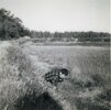
Here are the two photos I have of me "borrowing" some cranberries back around 1973. What's next to me in the second photo? I don't remember. Maybe it was a "giant sack" uh oh! That was not the day the biplane strafed me. I was alone that day. Yeah, like one of the bosses once said to me on my job, "You've done this before, my friend." (I actually did become friends with that boss later on). In the background of the 1st photo is the getaway car, my good old VW Beetle.
 

Attachments

  • Cranberry bog in Pine Barrens 2.jpg
    Cranberry bog in Pine Barrens 2.jpg
    51.6 KB · Views: 25
  • Cranberry bog in Pine Barrens.jpg
    Cranberry bog in Pine Barrens.jpg
    131.1 KB · Views: 28
Last edited:

Pan

Explorer
Jul 4, 2011
600
273
Arizona
Just click the crosshairs (or tap on a phone) to create a new waypoint at the current location, enter any name you want.

View attachment 23857

The Save and Edit button lets you enter more information, choose symbols, etc

View attachment 23859


Thanks, Boyd. I'll mess with it again a little later. Your maps are so awesome. I wish I had them back when I used to prowl those "wild and windswept woods". I just had geological survey maps and a compass.

PS Good thing those "Flying Saucer" bad guys in Alaska didn't have maps like that!
 
  • Like
Reactions: Boyd

Pan

Explorer
Jul 4, 2011
600
273
Arizona
There is an abandonded gas station here, but that's the best I can do. I'd love to see your waypoints, but if they are gone, so much for that.

View attachment 23861


Where do u see an abandoned gas station, that little mark in the fork between 539 and 610?

Which waypoints are u referring to? I still have all my waypoints saved on Garmin Mapsource, all 7 hundred and something of them, including some in the NJPB, including the one that's the subject of this thread. But most of my years down there were pre GPS, tho I was an early adopter of GPS with the Garmin model 2, back when hardly anyone knew what GPS was. My knowledge of GPS is less than pathetic tho when compared to Boyd's.
 
  • Like
Reactions: Boyd

bobpbx

Piney
Staff member
Oct 25, 2002
14,721
4,908
Pines; Bamber area
Where do u see an abandoned gas station, that little mark in the fork between 539 and 610?

Which waypoints are u referring to? I still have all my waypoints saved on Garmin Mapsource, all 7 hundred and something of them, including some in the NJPB, including the one that's the subject of this thread. But most of my years down there were pre GPS, tho I was an early adopter of GPS with the Garmin model 2, back when hardly anyone knew what GPS was. My knowledge of GPS is less than pathetic tho when compared to Boyd's.
That orange circle on the map, close to route 554 and 72. I'm sure they closed it because of tank leakage, which is why it's not up and running. It's in a great location for people leaving LBI and Barnegat area.

You could send all your GPS points to me in a file, and I'd try to get them converted.

1732582165380.png
 

Pan

Explorer
Jul 4, 2011
600
273
Arizona
That orange circle on the map, close to route 554 and 72. I'm sure they closed it because of tank leakage, which is why it's not up and running. It's in a great location for people leaving LBI and Barnegat area.

You could send all your GPS points to me in a file, and I'd try to get them converted.

View attachment 23864


Oh that wldnt hv been mine. I wasn't by 72 (my usual entry point to the Pines). I vaguely remember a gas station sign sticking out that I could see from far off, maybe Esso.
 
Top