
bay days
- Thread starter whippoorbill
- Start date
You are using an out of date browser. It may not display this or other websites correctly.
You should upgrade or use an alternative browser.
You should upgrade or use an alternative browser.
Thompson's Beach (Tuesday with Alfie)
I'll be leaving trip comments to a minimum here ... it's been a long (though wonderful) day.
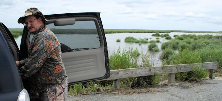
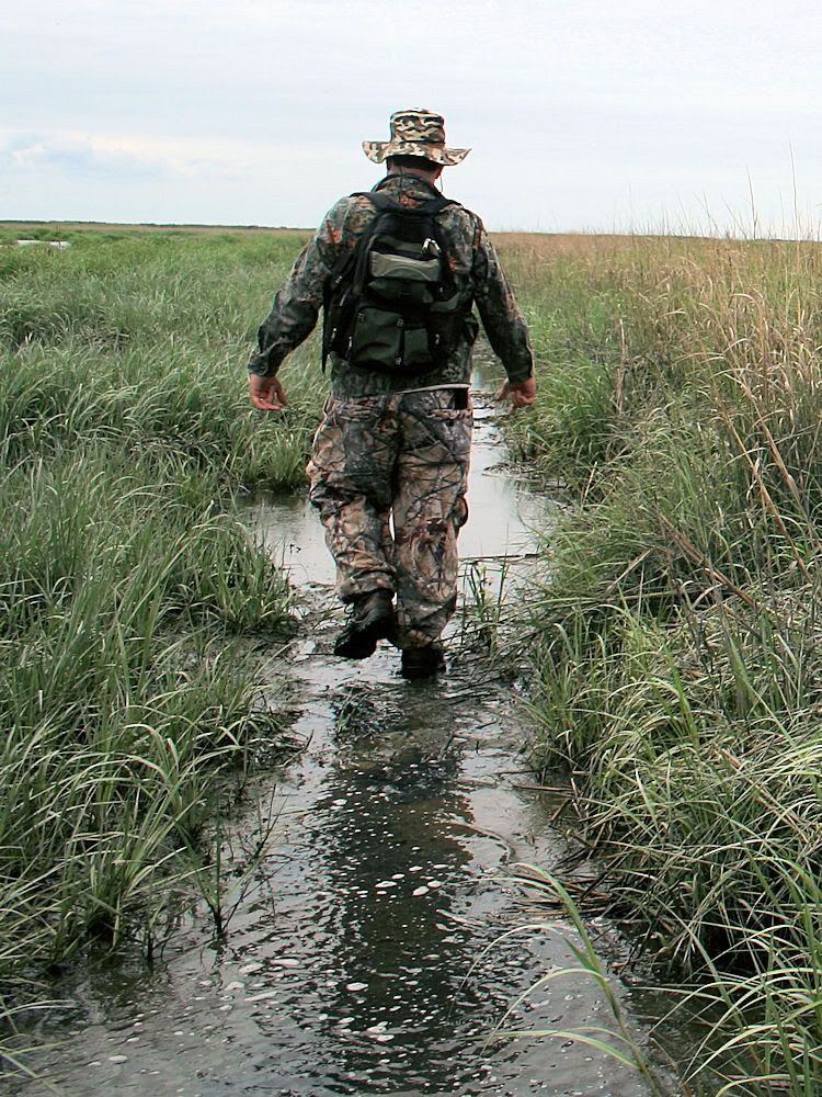
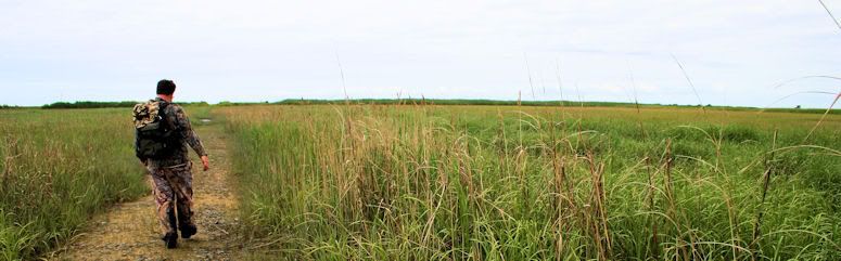
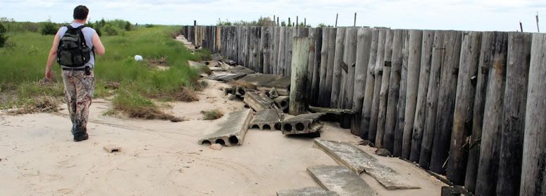
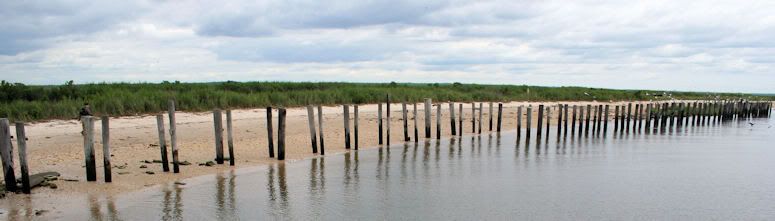
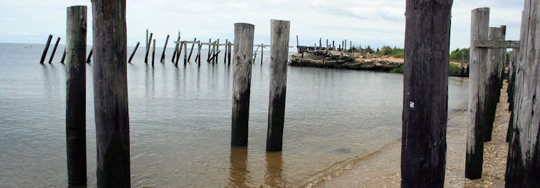
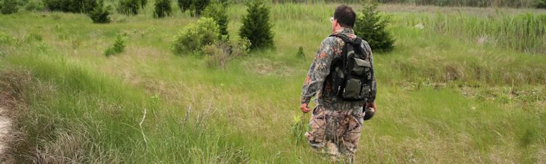
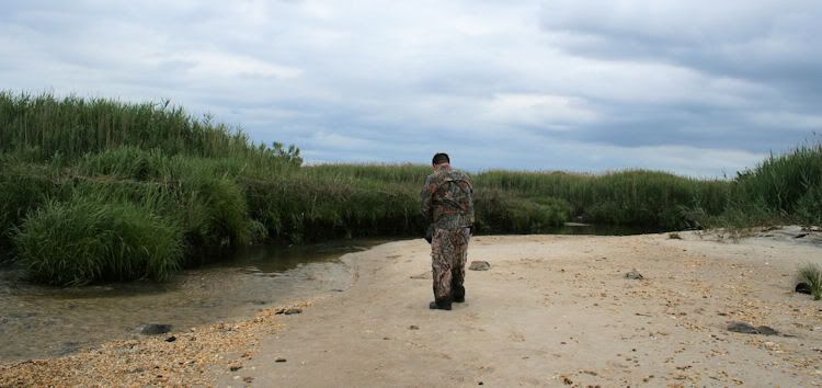
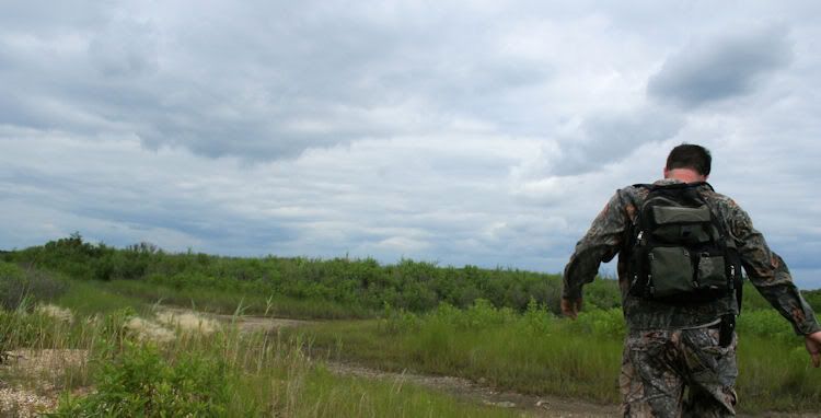
Alfie and I finally took the walk out to the Delaware Bay abandoned community of Thompson's Beach this afternoon; yeah, the bugs feasted in drenching humidity... but watching all the horseshoe crab sex kept us going. (Photos of these critters in action have been withheld). Here we are embarking from the parking lot, past the gate, and hiking the old road (now a mud slog) to the bay and Thompson's Beach.
Thompson's Beach accessed
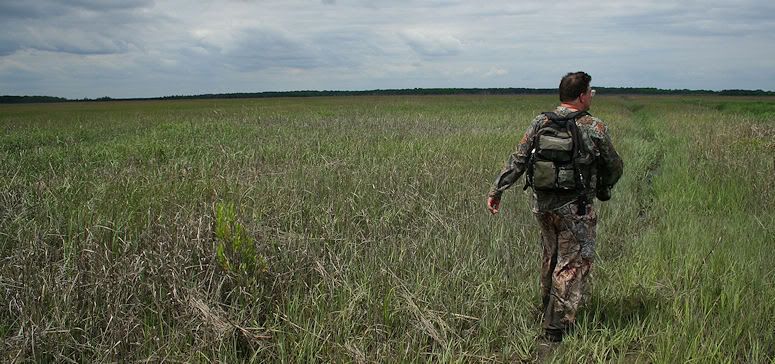
The old road entered Thompson's Beach at the center of the community. We walked south first.
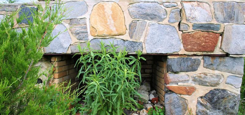
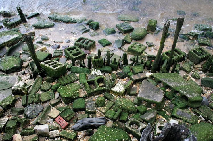
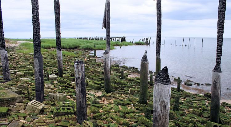
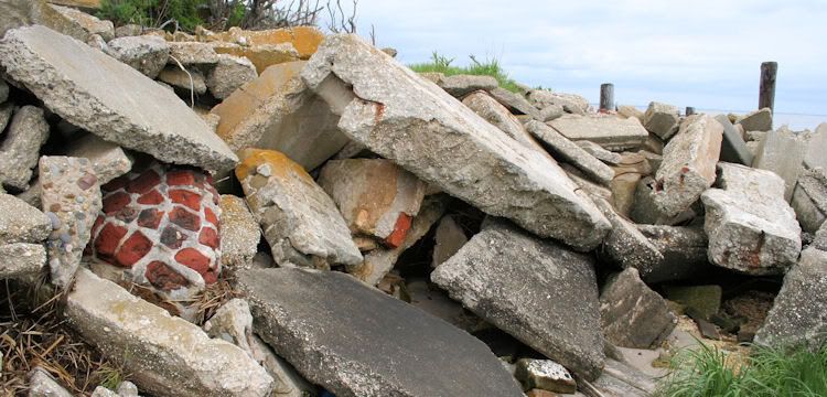
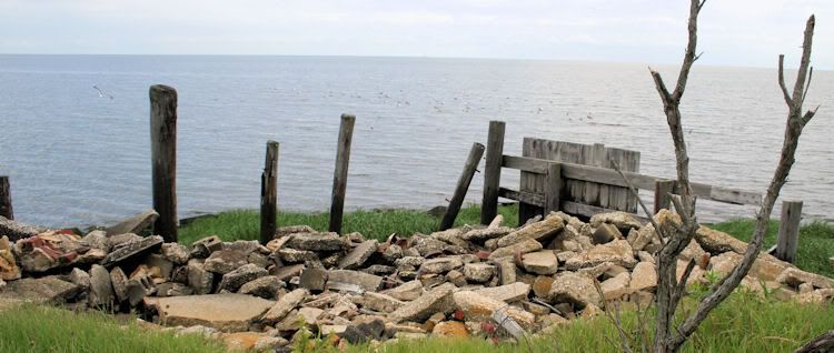
Much in the way of pilings and debris was the call of the day, but this fireplace is the one structural remnant that remains intact.
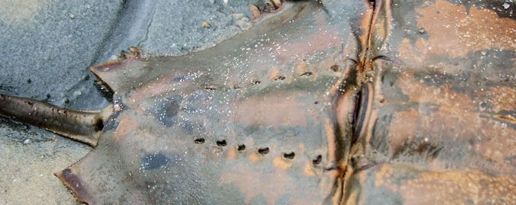
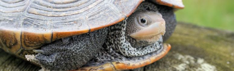
Fret not about the kids seeing this horseshoe crab. It was the only one on the beach that wasn't making whoopie. As a matter of fact, it was dead.
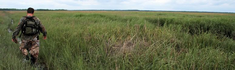
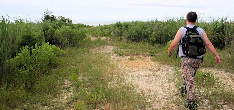
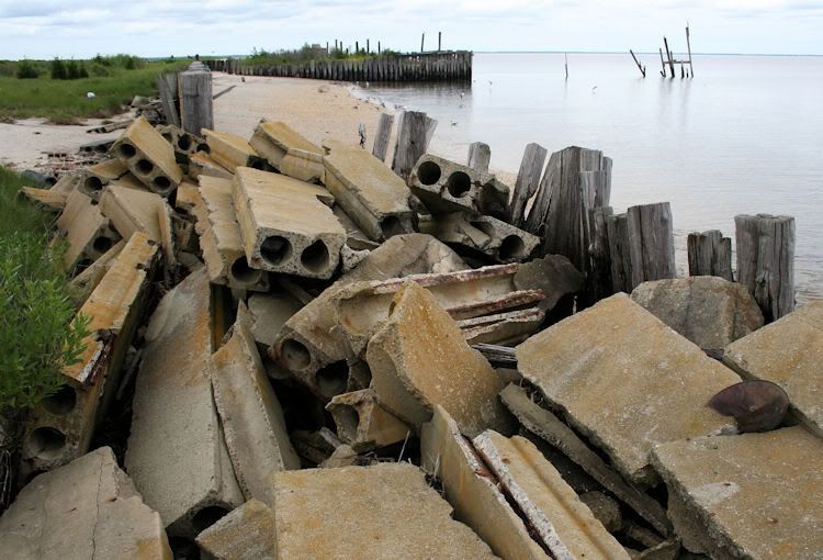
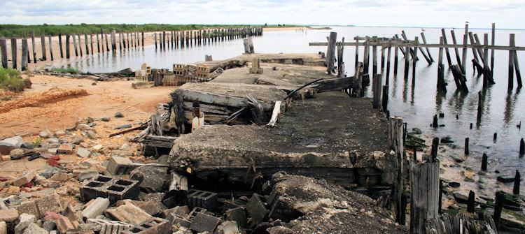
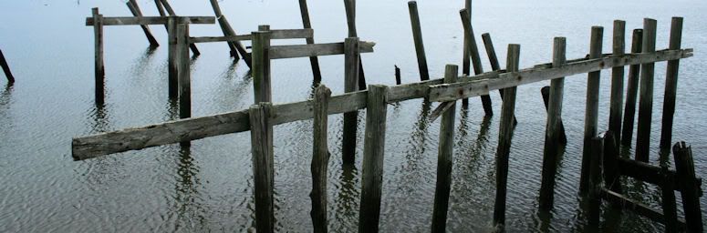
The following photos were taken in north Thompson's Beach, where explorers are invited to kill themselves in rougher terrain. The choices were to either risk breaking one's leg on rocks close to shore, or to be eaten alive by evil insects in off-bay brush. Never gents to be making responsible decisions, we decided to risk our ankles.
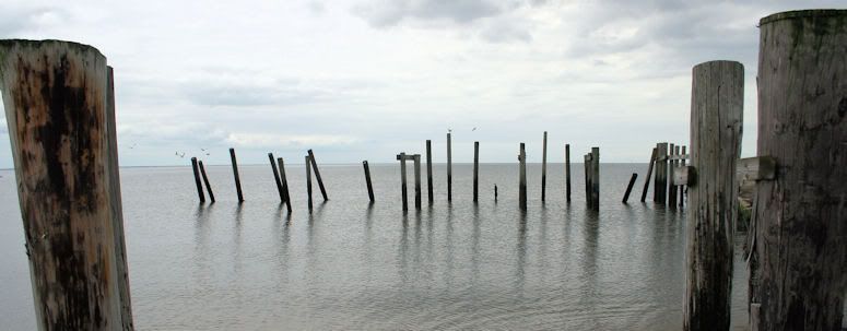
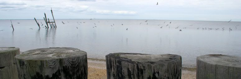
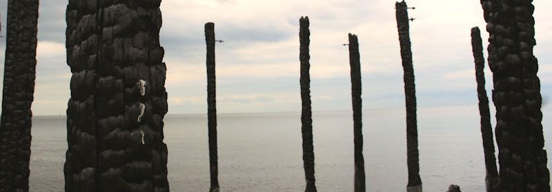
More pilings, etc.
Thompson's Beach's final resident.
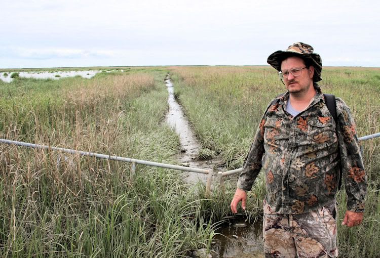
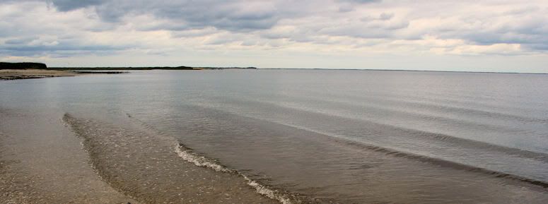
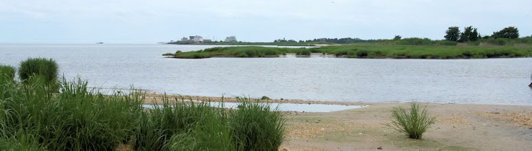
East Point is almost in crying-for-help distance.
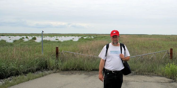
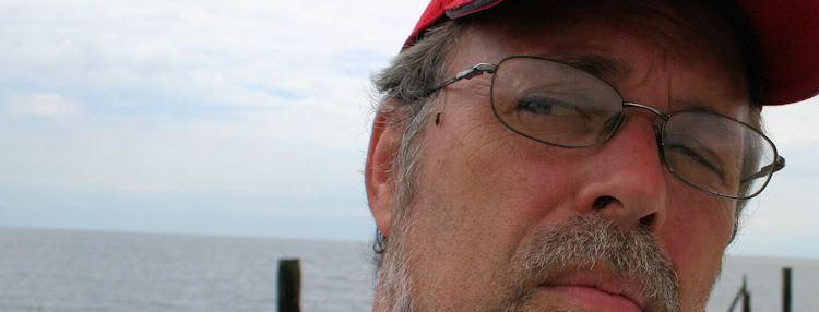
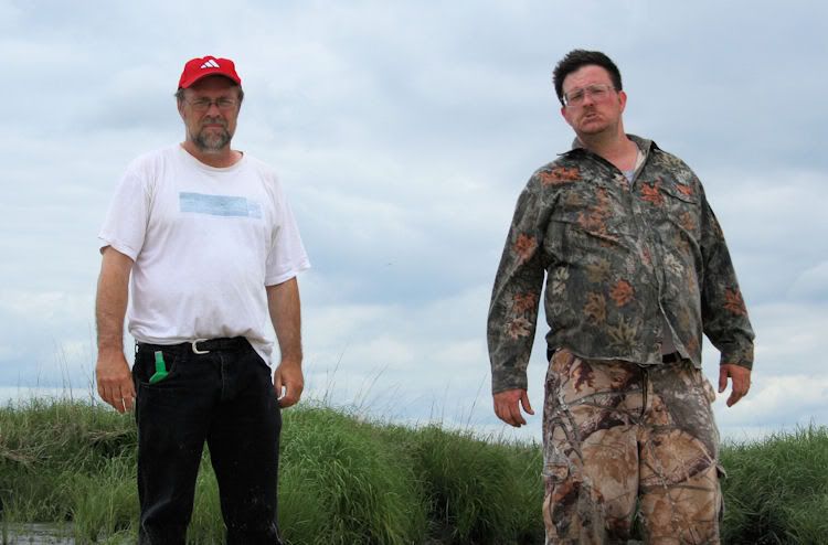
God, I'm ugly.
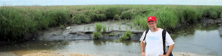
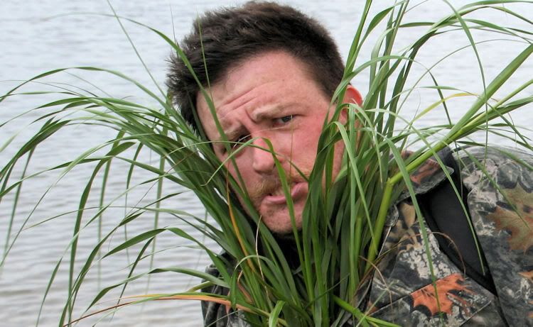
Alfie McMullen
God, he's handsome.
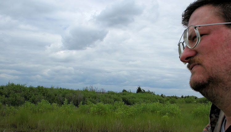
Insect attack.
I'll be leaving trip comments to a minimum here ... it's been a long (though wonderful) day.
Alfie and I finally took the walk out to the Delaware Bay abandoned community of Thompson's Beach this afternoon; yeah, the bugs feasted in drenching humidity... but watching all the horseshoe crab sex kept us going. (Photos of these critters in action have been withheld). Here we are embarking from the parking lot, past the gate, and hiking the old road (now a mud slog) to the bay and Thompson's Beach.
Thompson's Beach accessed
The old road entered Thompson's Beach at the center of the community. We walked south first.
Much in the way of pilings and debris was the call of the day, but this fireplace is the one structural remnant that remains intact.
Fret not about the kids seeing this horseshoe crab. It was the only one on the beach that wasn't making whoopie. As a matter of fact, it was dead.
The following photos were taken in north Thompson's Beach, where explorers are invited to kill themselves in rougher terrain. The choices were to either risk breaking one's leg on rocks close to shore, or to be eaten alive by evil insects in off-bay brush. Never gents to be making responsible decisions, we decided to risk our ankles.
More pilings, etc.
Thompson's Beach's final resident.
East Point is almost in crying-for-help distance.
God, I'm ugly.
Alfie McMullen
God, he's handsome.
Insect attack.
Great trip guys, was the tide dead low when you went ?, was the walk about about a mile ? Any asphalt at all left on the old road ?
Jim
Jim
Billy,
you are directionally incompetent though quite competent with a camera.when we got to the beach we headed east first.if we had headed south we would have walked into the bay.thompsons beach runs east west not north south. so to all concerned when we hit the beach we turned left first and headed east then we retraced our steps upon reaching the end and headed west to the other end where we could see east point.
you are directionally incompetent though quite competent with a camera.when we got to the beach we headed east first.if we had headed south we would have walked into the bay.thompsons beach runs east west not north south. so to all concerned when we hit the beach we turned left first and headed east then we retraced our steps upon reaching the end and headed west to the other end where we could see east point.
Great trip guys, was the tide dead low when you went ?, was the walk about about a mile ? Any asphalt at all left on the old road ?
Jim
Jim,
we scouted this and my belief is you can walk it as long as your back is feeling ok that day.it took us 17 minutes to walk to the beach from the parking area.the eastern leg of the beach is a very nice walk and no problem at all.the western leg is a suicide mission.as bill said you have two choices,stay closer to the water and break your leg in the concrete jumble or go up into the brush and the deer flies will carry you away.we saw not one greenhead or horsefly so it may be a bit early for them yet.the trip across the marsh was no problem bug wise.the flies were in the brush at the beach.the mud out there is a max of slightly over ankle deep so knee highs are sufficient.under the mud you can still feel the hard gravel of the old road.at certain places the road is still visible with no mud.the worst stretches are in the begfinning and the last two hundred yards to the beach.the center sectio is the most elevated.this is where i got stuck by the tide when me and my wife were crabbing out there in 97.you could drive out there then but the road flooded every tide and we had to wait on high ground till it dropped.their were maybe two families still living out there i believe at that time or at least their were still some houses standing.
Al
How many hours did you spend on the Beach ?
Do you think the walk can be made at half tide or less, going from high to low, or does the road start getting covered ?
17 minute walk, i'll double that.")
Did you see Guy there ?
Jim
Do you think the walk can be made at half tide or less, going from high to low, or does the road start getting covered ?
17 minute walk, i'll double that.
Did you see Guy there ?
Jim

How many hours did you spend on the Beach ?
Do you think the walk can be made at half tide or less, going from high to low, or does the road start getting covered ?
17 minute walk, i'll double that.
Did you see Guy there ?
Jim
jim,
we were out there about 3 hours.you could actually walk out there at high tide no doubt even with knee highs.if it was a full/new moon tide you might be pushin it with knee highs.it really is not a bad walk,the mud is like soup not like bog mud that sucks at you.it was not tiresome at all it just really looks bad but it's not.the road underneath is easily felt as you sink in about 8 inches.we went out an hour after high tide and came back it was a couple hours shoprt of low but it looked dead low from everything you could see in the marsh.their was no difference.their was still water pooled on top of the mud but it wasn't bad unless you have an irrational fear of fiddler crabs,then you might want to wait for winter.thousands of em giving us the fiddler version of the no no finger as they scurried off.
Al
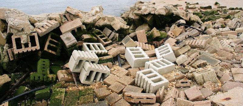
That place looks like a mess.
As usual, a great report! And no Jim I was not there. If I owned the place I would have cleaned it up
Guy
Guy,
yes it is a mess.if anyone wants wild bayshore i suggest you walk the strip from false egg island to egg island point.me and a friend once swam from raybin beach across fishermans creek and walked to false egg point.then got in a mud fight on the flat and then swam straight creek and walked the remaining 2 miles to egg island point.it was awesome.so many king (horseshoe) crabs and diamondback on the beach and in the small streams crossing the beach we had to walk on their backs in spots.i found an indian arrowhead which was went we went looking for but that was the only one we found that day.the area is truly wild.You can look north from the point on a clear day and barely see treeline six to seven miles away.fortescue is out of sight because false egg blocks it and east point was barely discernible six miles across the cove.this is south jersey big sky country but you either need a boat or be young and stupid and like to swim with sharks and jellyfish.
Al
I would like to go there in the Winter especially after a freeze up, i just looked at the road to Moore's Beach on Bing Maps, the amount of washouts we went through that day seems real close to what the map is depicting.
Jim
Jim
so to all concerned when we hit the beach we turned left first and headed east then we retraced our steps upon reaching the end and headed west to the other end where we could see east point.
Nice write-up and excellent photographs. The west end is treacherous. I had my own plight there a few years ago.
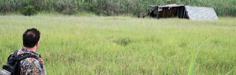
Bill, you know that shot of Al looking at that shack is the best. The eye loves it.
I'd like to come back down Al to that big sky country in the future.
PS: What are the Glades like? That area looks crazy!
I'd like to come back down Al to that big sky country in the future.
PS: What are the Glades like? That area looks crazy!
Bill, you know that shot of Al looking at that shack is the best. The eye loves it.
I'd like to come back down Al to that big sky country in the future.
PS: What are the Glades like? That area looks crazy!
the Glades are boat country Bob.their very mazy as the map and aerials show.those large ponds you see such as sheepkill and wallens are actually large (eat outs) by snow geese.the geese settle in huge flocks like tens of thousands strong and eat out large areas of salt grass (spartina alterniflora) and you end up with large todal flats of mud at low tide and shallow ponds at high tide.not a place to be when the tides dropping.their are duck shacks out in the middle of the glades that you can birds eye.theseweree grandfathered in when the state took over.as long as their repaired and used they can stay.they make a nice stop to get out and stretch your legs when your kayaking because their is absolutely no place else out there you can do this.Their is supposed to be an old stone out there along oranoaken creek but since i got this info i haven't been back to check.i can't imagine a stone lasting in the mud very long without sinking.also the crabbing out here is generally excellent if you can crab from a canoe
their is an island near turkey point where you could always go in the daytime and see barn owls roosting on it.haven't been out there in a few years though.
I always wanted to yak from tueky point to egg island point.about 12 miles one way.camp overnight on the beach and yak back the next day.of course camping on wma property is illegal so i would never do that
Al
I would like to go there in the Winter especially after a freeze up, i just looked at the road to Moore's Beach on Bing Maps, the amount of washouts we went through that day seems real close to what the map is depicting.
Jim
you still goin the 5th jim? wanna walk?it's easier then depending on the tides like would in a canoe.
Al
you still goin the 5th jim? wanna walk?it's easier then depending on the tides like would in a canoe.
Al
I'm in, the junk left on Thompson's makes Moore's Beach seem empty.
Jim
I'm in, the junk left on Thompson's makes Moore's Beach seem empty.
Jim
yes definitely a junkier beach but the sections that are nice are even nicer then moores.their are little spits at each end that are right down beautiful and a couple of nice stretches along the main beach too.the western spit can be seen from east point.
Al
hey all
i just was checking out one of Guy's favorite sites the historical aerials and it appears back in the 40's you could drive to thompsons beach from east point.now theiris a stream coming out.must be where the state ripped through the dykes to flood the area.thompsons and moores appear to have been settled in the 40's since in the 30's no houses are present.in the 40'50's and 60's the beaches seem to be hoppin and then in the 70's they appear to decay.by the 90's evrything but ruins is gone.very awesome site those historical aerials are.
Al
I bet that some of those homes may have been army barracks as was my grandparents at Reeds Beach. Right after the war many of them were sold and moved to shore communities such as Reeds Beach.
Guy
Do you have any old pics of your Reeds Beach days that you could post ?
Jim