That is the corporation name for one of the sand plants I think.Brick Wall Road? Who names these roads?
Fire in Greenwood Forest Ocean County Near Jones Road
- Thread starter Teegate
- Start date
You are using an out of date browser. It may not display this or other websites correctly.
You should upgrade or use an alternative browser.
You should upgrade or use an alternative browser.
Maybe a bottle in this field, or an illegal camp?I've mentioned it in other posts, but NASA FIRMS / VIIRS is very useful for tracking fires.
View attachment 24714
There is one satellite image from yesterday at 12:01 ET which may possibly show the starting point, or at least a starting point, just off of Jones Road, here.
View attachment 24715
Imagery copyright Planet Labs, Inc.
I recall about 7 years ago, two guys were off Jones road firing an automatic weapon and they were arrested. Can't find the article.
The 1995 fire in Greenwood Forest was spawned in hell. It barrelled through that forest like a hurricane. I think it was 19,000 acres. Have to look it up.This fire makes me rethink some of my thoughts on nj forest fires. This moved violently and fast. Also reminds me of the thread of how much time you have to get out of forest if a fire breaks out. Def humbling…

Wildfire Update from Ocean Township Police Department : Nixle
WILDFIRE UPDATE: Jones Road Wildfire - Ocean & Lacey Townships, Ocean County New Jersey Forest Fire Service continues to make progress containing a wildfire burning in Ocean & Lacey Townships, Ocean ...
Log into Facebook
Log into Facebook to start sharing and connecting with your friends, family, and people you know.
 www.facebook.com
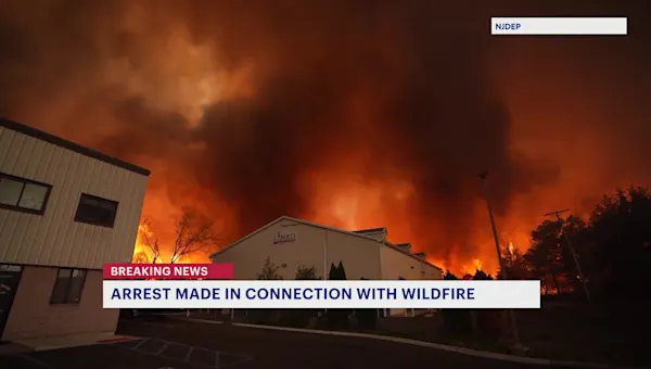
Officials: Ocean County wildfire 50% contained; man charged with arson
Joseph Kling was charged with arson and aggravated arson.
newjersey.news12.com
I can remember when we use to stealth camp on the Forked River Mountains we would be chasing embers down the hill trying to keep them from starting fires. It never entered my mind that they could have burned all the way across the county. We lucked out.
I was saying the same thing to my co worker. In my teens we had bin fires out in the woods. We were alway super careful and extinguished the best we could with all the coolers but it still could have lit back up the next day.I can remember when we use to stealth camp on the Forked River Mountains we would be chasing embers down the hill trying to keep them from starting fires. It never entered my mind that they could have burned all the way across the county. We lucked out.
Instead of plotting the origin via GPS, set up a direct line to Stiltzkin. He has tricks up his sleeve. Put him on your payroll.
I had to go to a doctor in Forked River, and so drove home past wells mills. This is the north side of the road. If a backfire can do this, the woods are extremely flammable.

Got Him!

 njbiz.com
Ocean County man charged in 15K-acre wildfire - NJBIZ
A Waretown man has been charged with arson in connection with the 15,000-acre Jones Road Wildfire in Ocean County.
njbiz.com
How many times have you heard me say fire is fire. Backfires can burn as hot as the main fire and it’s impossible to tell the difference just by heat. That was a very HOT fire.I had to go to a doctor in Forked River, and so drove home past wells mills. This is the north side of the road. If a backfire can do this, the woods are extremely flammable.
View attachment 24735
Pine barrens for another generationHow many times have you heard me say fire is fire. Backfires can burn as hot as the main fire and it’s impossible to tell the difference just by heat. That was a very HOT fire.
")
Just think. 15k tick free acres right nowPine barrens for another generation
And that is why if any want to explore now is the time.Just think. 15k tick free acres right now
And for botanical interest when it regenerates. Throw all that carbon on the ground, and you have a real riot of growth.And that is why if any want to explore now is the time.
I'd be interested to hear how they determined he's the man. Had to be a snitch.Got Him!
Ocean County man charged in 15K-acre wildfire - NJBIZ
A Waretown man has been charged with arson in connection with the 15,000-acre Jones Road Wildfire in Ocean County.