Goshen in Camden or Burlington?

Neil in SJ

Scout
May 22, 2006
32
0
63
Cherry Hill, NJ
www.freewebs.com
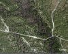
I have been searching on and off for a community known as Goshen. According to an 1846 map, Goshen was located in Camden County on the south side of the Mullica RIver, at Goshen Bridge. According to earlier maps, including one from 1826 and another from 1812, Goshen was located on the north side, in Burlington County. In the past I have found the 1846 map to be very inaccurate.

I spent Saturday searching many possible sites, includiing a clearing further southeast off of Goshen House Road. I have been unable to find any of the typical signs of early communities. No cellar holes, clam shells, etc. I did however find a few broken bits of brick on the south side, but this may be fill from repairs to the road made by the Dept. of Forestry.

I have not been able to find out anything about the people or community of Goshen, other than the fact that there was once a mill there. It seems to appear around 1812, and disappear after 1846. Can anyone shed some light on Goshen? Has anyone seen the remains?

I would be very cautious if venturing there. This part of the Wharton Tract is not maintained like the Quaker Bridge/Batso areas. It cost me 3 hours and $85 for a tow.
 

Attachments

  • Jeep.jpg
    Jeep.jpg
    23.7 KB · Views: 472

LARGO

Piney
Sep 7, 2005
1,552
132
53
Pestletown
I had always believed it to be on the Camden County side, darn close to the boundaries of which may have not been well defined. That boundary thing is not exactly my area of expertise though. Couple other guys on the site are good with that stuff. Maps & surveying and such.
Following my interests in Jersey shore history I always wondered if it had a connection to Goshen/Cassville down past Dennisville. To give a similar example, some texts have that Goshen in Ocean County and others in Cape May County. I take it to be Cape May County but that is only if the original town location is accurate. That being the case it would give credence to the innacuracies that you are facing.
The name Goshen... a biblical reference. Now down the shore that seemed more common. Up here, who knows. Your Goshen Bridge was once a topic of thread here as Ephraim's Bridge, a reference that Guy found on an old map. Maybe with an Ephraim's Tavern I found reference to very nearby the Goshen up this way might not have been so biblically sound.
 

LARGO

Piney
Sep 7, 2005
1,552
132
53
Pestletown
I always assumed it was near where Goshen campsite is. There is evidence of man made canals in that area.

Even your Gordon's 1833 map on this site has it on the Rariton Ave side or the "South" side if you prefer. Of course that map and others of it's era have their share of misses if you will.
The campsite... I think that's all it is. Just a campsite accessed easily from Atsion road. That's just my take. Did I not read on a thread from some time ago that Guy was out on the side I am speaking of stomping around looking for monuments or markers? I believe that day my daughter and I were out at the bridge and missed them by a couple hours.
 

Teegate

Administrator
Site Administrator
Sep 17, 2002
25,627
8,228
I am confident that Ben and I found the location of the remains of the dam at Goshen. We also found the remains of a lock of some sort at that location. It is as Ben said in the vicinity of the campground. Aerial photo's show a quite large raceway for this dam.

The remains of the dam are in this photo. The hill is on both sides of the stream as is common with the remains of all dams.

http://www.njpinebarrens.com/teegat...DownloadItem&g2_itemId=1997&g2_serialNumber=1

And here is the remains of a wooden lock that still is in good shape.

http://www.njpinebarrens.com/teegat...DownloadItem&g2_itemId=1999&g2_serialNumber=1

It is an interesting place that I have neglected to explore more. I am planning a hike with the man I work with after Thanksgiving and may suggest we explore there.


Guy
 

RMICKLE

Scout
Oct 3, 2005
86
0
Carson City, NV
I am confident that Ben and I found the location of the remains of the dam at Goshen. We also found the remains of a lock of some sort at that location. It is as Ben said in the vicinity of the campground. Aerial photo's show a quite large raceway for this dam.

The remains of the dam are in this photo. The hill is on both sides of the stream as is common with the remains of all dams.

http://www.njpinebarrens.com/teegat...DownloadItem&g2_itemId=1997&g2_serialNumber=1

And here is the remains of a wooden lock that still is in good shape.

http://www.njpinebarrens.com/teegat...DownloadItem&g2_itemId=1999&g2_serialNumber=1

It is an interesting place that I have neglected to explore more. I am planning a hike with the man I work with after Thanksgiving and may suggest we explore there.


Guy

I thought that there may have been two dams at different times for the same mill. Guy’s first picture may be of the first dam (which shows up on some of the older maps as a pond). There appears to be a second dam at the up stream end of the canal or race that is visible during low water. Maybe the first dam was too much maintenance, whereas the second dam has very little earthwork to erode.

Here’s a picture of the lower dam at the stream. It looks like there is a timber in the water still. The picture is in stereo. Left eye, left side, right eye, right side.

http://forums.njpinebarrens.com/gallery/displayimage.php?album=345&pos=0

Picture of the upper dam:

http://forums.njpinebarrens.com/gallery/displayimage.php?album=345&pos=2

Roy
 

Teegate

Administrator
Site Administrator
Sep 17, 2002
25,627
8,228
That second photo is a nice one.

It would be interesting to explore there more. We did not spend too much time there.

Guy
 
Neil:

You've identified one of my favorite places in the Pines. It is a location steeped in antiquity that succumbed to a relatively early death. The first mention of Goshen, or, more properly, Goshen Neck, can be found in colonial deeds and surveys going back as early as 1737 (the earliest document I have found with reference to Goshen Neck, but I have not looked at them all yet!!). Such prominent early figures as Charles Read, George Marple, John Burr, and John Inskeep can be associated with the location. During most of the eighteenth and into the early nineteenth century, Goshen was a very busy place with several sawmills running in the area beginning as early as the 1720s by “Haines and Company.” While I would tend to agree with LARGO about the settlement’s location being primarily in Camden County, I think it very plausible that the community straddled the boundary between Burlington County and, at that time, Gloucester County. I have not been there for a while, (BEN—we still need to make that trip!!), but I can describe to you what I remember about the location. As you cross the bridge over the Mullica River on Old Jackson-Atsion Road, look into the river and you will see wood framing attached to the river bottom that once supported a mill. On the Burlington County side of the river, a power canal leaves the Mullica near the bridge and runs south parallel to a primitive road. On this power canal is the foundation of one, if not two, sawmills. If you cross the bridge from Burlington into Camden County and make the first left turn (4-wheel drive only, please!!!!), and travel south until you reach a road coming in on the left or east side. Take that left turn and go a little distance and the road will terminate at a long low sand dam that once impounded water for another sawmill. As I recall, if you look over the edge of the sand dam you will see the foundation for another sawmill. The dam shows up as a black dotted line on the Medford Lakes, N.J. 7.5-minute USGS topo quad. Below the dam representation on the same map is a straight, broken blue line that likely represents a tailrace for the sawmill.

Some people believe that Charles Read’s Penzance Mill operated within Goshen Neck. In 1742, John Burr made his first attempt to sell the tract of land by placing a newspaper advertisement in which Burr described the parcel as “…About 400 Acres call’d Goshan’s Neck….” Two years later, Burr again advertises the land again, only this time he describes it as “A Tract of Land called Goshen Neck, 700 Acres.” A man named Samuel Goforth, a Methodist minister, operated a school in Goshen during the 1820s and 1830s. I have found no concrete information on the community’s population or the number of buildings, but I would guess the settlement to have contained no more then 15 or 20 dwellings—and perhaps that number is even a bit inflated! As the timber surrounding the settlement became increasingly scarce, possibly as early as the 1840s, the sawmills shut down and Goshen lost its raison d’être. It became yet another ghost town of the Pines. However, the 1860 Lake & Beers Map of the Vicinity of Philadelphia pays homage to the location by labeling the Mullica River in the area as the “Goshan Creek.”

The pond at Goshen Pond campground powered another mill operation and should not be confused as the location of the older settlement of Goshen or Goshen Neck.

Best regards,
Jerseyman

P.S. I would be interested in learning what errors you have found on John Clement’s 1846 Map of Camden County. Clement was good surveyor, although I have also found some errors on this particular map.
 

LARGO

Piney
Sep 7, 2005
1,552
132
53
Pestletown
Very informative post thank you Jerseyman. Makes simple sense it would have straddled both counties if it was a community the likes of which you describe. ** I do like to pick up new bits of info though which keeps me on the site. I honestly always thought the Goshen camp location was just that, a campsite. Now I know better.
OK. now my question.
I noticed you had a different spelling in there. Just curious, in your opinion given that liberties were frequently taken with spelling, is it likely that Goshen is named for a person rather than taken from the biblical place in Egypt?
I only ask thinking of other Goshens then as I would other Mullicas for instance. Named after the same persons if you will. Of course the Goshen referenced biblically has been spelled differently as well.
What's in a name?

LARGO:

I think the spelling variations stem from "ear-conditioning," but the name along the Mullica does refer to the Biblical location and not a reference to an individual or a family.

Best regards,
Jerseyman
 

Neil in SJ

Scout
May 22, 2006
32
0
63
Cherry Hill, NJ
www.freewebs.com
Goshen aerial views

Here are some Google Earth images. Goshen House Rd, on the Burlington side looks like it would make a perfect spot for the community, hence the name, Goshen House Rd. If you extend a line directly from the end of Goshen House Rd, across the river, you will see the dam. Could it possibly have been the original location of the bridge, or possible a second crossing?

The second picture is the spot on the south side of the bridge, where Clement's map shows the location to be. Notice the sand paths where his structures are on the map? There are striking similarities, yet I could find no evidence of civiliazation. My copy of the map is more than 7 meg, so I am unable to post it. Here is the link from Rutger's historic map collection:

Camden County 1846
 

Attachments

  • Image-0000.jpg
    Image-0000.jpg
    92 KB · Views: 452

Neil in SJ

Scout
May 22, 2006
32
0
63
Cherry Hill, NJ
www.freewebs.com
I find it interesting that Elizabeth Drinker in her diary said "13 April Went this Morning in Lawrence Salter’s Waggon to Goshen 2 miles from the Iron Works". It is almost exactly 2 miles to the Sandy Causway crossing, near the Goshen Campground. It is FOUR miles to Goshen Bridge. Is it possible that the names "Goshen Bridge Road" and "Goshen House Road" are grossly inaccurate???? It would then make sense that the community of Goshen was located 2 miles from the furnace (Atsion), which would be very close to the campground.
 

Oriental

Explorer
Apr 21, 2005
253
133
I have only driven through the "Goshen" area a few times and have been dying to get out there and explore. A few years ago I picked up an old journal of a man named William Sorden and dated in the 1890's. It is a financial journal for a cranberry company that operated in Indian Mills at Goshen. Old maps from the time clearly depict bogs there as well. I wonder to what degree the canals, dams, spillways had to do with the cranberry operation that followed the earlier sawmills there. Make no mistake, the cranberry operation in that area was fairly extensive. Records in the journal indicate 1200+ bushels shipped in 1893. Knowing the average production of bogs in those days would put the actual bogs at dozens of acres. The records are fascinating as they mention many local family names like Sorden, Cotton, Small, Crain, Brown, etc. It discusses carting the pickers from the [staishon], paying for [seeder] planking, paying men to hand out picker tickets, carting 32 [lode] of berries and the like. Some payments were made to men for carting berries to Atsion and to Medford (which was quite the cranberry center in those days). I'm just guessing that Joseph Wharton may have acquired the area shortly after this time and continued to grow berries there. Does anyone who explored the area believe there is any evidence of the cranberry industry that was at Goshen?
 
Oriental:

I suspect your journal, which, by the way, sounds fascinating, is from the Sorden farm. Here is a newspaper notice from 22 November 1905:

By virtue of an order to sell real estate to pay debts of the estate of John H. Sorden, deceased, issued out of the Orphans' Court of Burlington county, on the 14th day of October, last, I shall sell at public vendue at the late residence of John H. Sorden, near Indian Mills, on Thursday the Twenty-first Day of December, A. D., 1905, at 2 o'clock in the afternoon, all the following described tracts of land and premises with the appurtenances, being same described in said order, that is to say: No. 1. A farm and tract of land and premises known as the John H. Sorden farm, situate in Shamong township, Burlington county, on the south side of the public road leading from Indian Mills to Dingletown, beginning at a stone in the middle of the public road leading from Joseph LeMunyon's place to a farm belonging to John J. Gardiner, and is corner to late Mahlon Prickitt's land and John R. Wilkinson's land, and runs thence, (1) along the middle of the road the several courses and distances thereof to this place of beginning, containing one hundred and forty acres, more or less; also about fifty acres of uncultivatable cranberry land, to be sold separately, in lots, to suit purchasers, a part of the original farm tract. No. 2. A tract of land of thirty-nine acres and thirty-two one-hundredths, comprising two cultivated cranberry bogs, known as the Fish Pond and Baker's Island cranberry bogs. Beginning at a stone in the late Mahlon Prickitt's line and runs thence, (1) north twenty eight degrees and fifty minutes east, the several courses and distances to the place of beginning. These bogs to be sold separately. No. 3. A tract of land of three acres and two one-hundredths of an acre, known as the Spring bog bounded as follows: beginning at a stone that is corner to the Slab Bridge cranberry bog, a quarter of a mile from the homestead, and runs (1) by said bog south the several courses and distances to the place of beginning. No. 4. A lot of land (cranberry bog) eleven acres and seventy-eight one-hundredths of an acre known as Sorden's old bog, near the aforesaid land, beginning at a stone in David Evans' line by which it runs (1) north through the several courses and distances to the place of beginning. No. 5. A lot of land (cranberry bog) five acres and twenty one-hundredths of an acre, adjoining the last above described piece of land, known as the Than. Brown cranberry bog. No. 6. All that undivided two-thirds of a tract of land in Shamong township, aforesaid, situate near Dingletown, containing thirteen acres and forty one-hundredths of an acre. The whole to be sold, the other third owner William P. Sorden, consenting. People interested in cranberry land will do well to call on James Wills at Indian Mills or at the farm. I. ELY PRICKETT,Administrator of John H. Sorden, deceased. JACOB C. HENDRICKSON, Proctor for Petitioner.

As you can see in this notice, a William P. Sorden is a 1/3 owner of the operation being sold.

Best regards,
Jerseyman
 

Teegate

Administrator
Site Administrator
Sep 17, 2002
25,627
8,228
So the bogs are closer to Dingletown and not at Goshen I would say. I saw no evidence of bogs there, and looking over aerial photo's I don't see any either.

Guy
 

Teegate

Administrator
Site Administrator
Sep 17, 2002
25,627
8,228
I see the Evans and Wills name mentioned also. They were the owners of Friendship Bogs and I believe Oriental said the bogs at Kings Grant.

Guy
 
So the bogs are closer to Dingletown and not at Goshen I would say. I saw no evidence of bogs there, and looking over aerial photo's I don't see any either.

Guy

Guy:

Looking at historic 15-minute USGS topo quads, I see the West Jersey Cranberry Meadows north of Goshen along the Mullica, but based on the advertisement, the Sorden Bogs were definitely over towards Dingletown.

Best regards,
Jerseyman
 

Oriental

Explorer
Apr 21, 2005
253
133
Jerseyman,

Thanks for the information on the Sorden Bogs. I can hardly wait to get some maps out and try to pinpoint the locations of those bogs. My initial guess is that they are located not far from where Stokes Road (541) crosses 206. I say that because John Gardner (US Congressman) owned hundreds of acres right in that area and the LeMunyon family had land adjacent to Gardner's. There was also a Sorden Pond that was among the earliest cranberry meadows in Jersey that was right off of Atsion Road not too far from Oakshade/Jackson Road (Braddock grew berries there). The journal I have states "Tax Paid on Cranberry Bog 1893 at Goshen $21.15". Clearly the bogs described in the notice are not at Goshen. This journal lists William L. Sorden, William P. Sorden, Abraham Sorden, Charles D. Sorden and Sam. J. Sorden as paid workers during that year. Apparently there was quite a few from this family living and working in the area.

Rich
 

Oriental

Explorer
Apr 21, 2005
253
133
So the bogs are closer to Dingletown and not at Goshen I would say. I saw no evidence of bogs there, and looking over aerial photo's I don't see any either.

Guy

The Cook Map of 1887 (1891 Edition) available for viewing on this site clearly depicts the bogs at Goshen. They are not near "Goshen Pond" or the campground but further upstream just below the Plastic Bridge.
 
Top