Lebanon State Forest Project
- Thread starter Teegate
- Start date
You are using an out of date browser. It may not display this or other websites correctly.
You should upgrade or use an alternative browser.
You should upgrade or use an alternative browser.
I have always wondered what WO stands for myself.I see it all over on survey maps.It is marked on one stone along the Muskee and when i found the stone it appears to have a faint WO inscribed on it.Couldn't be certain but it looked like it.
With the weather being so bad lately today was the first day I was able to get in the pines other than changing the batteries on my camera since the middle of January. Jessica was tied up so I headed out to look for a few NJ State Control Monuments that were placed in the woods in 1946. Most of them are underground so it is somewhat of a challenge to find them. Today, I was in the Mt. Misery area looking for two of them and came up with just one. This was last reported found on 5/22/1975. Most of them have not been visted since the 1950s and I hope to find many of them in the coming weeks.
Station 10894 fully underground.


My walking stick is the location. Sometime in the past the road was graded and almost took it out.

Guy
Station 10894 fully underground.
My walking stick is the location. Sometime in the past the road was graded and almost took it out.
Guy
I have the info somewhere on a bunch of monuments we were going to look for that are buried several feet underground. I don't think these are those are they????
Except for one day it has been a few months since I have been able to search in Lebanon so today we decided to spend some time looking for the NJ State Control Stations that are there. Our first stop was near Mt. Misery along Butterworth Road for this one which we found about a foot underground. (I was able to use my new camera for the first time also)


This one had paint on it and it was last reported to be visited in December 1977.


It also came with a concrete reference mark which was concrete poured into some sort of metal can. There was an arrow on the top pointing to the control station.


Then to this one last visited in 1958.


This also was last visited in 1958.


Looking for the next one.


And the final of the day. Notice my camera has the red eye flash still showing. I will have to work on stopping that.


Guy
This one had paint on it and it was last reported to be visited in December 1977.
It also came with a concrete reference mark which was concrete poured into some sort of metal can. There was an arrow on the top pointing to the control station.
Then to this one last visited in 1958.
This also was last visited in 1958.
Looking for the next one.
And the final of the day. Notice my camera has the red eye flash still showing. I will have to work on stopping that.
Guy
I had to. No other way to find them without precision equipment. These were along dirt roads and from the grading over the years some of them were 15 inches underground since they were under the dirt pushed to the edge of the road.
That is pretty amazing how far below ground you can find 'em Guy. There were no physical clues? How did you know to start digging?
It may be hard to believe that there still are clues to find them but there really is. I know the locations but as I have mentioned before the recreational GPS units that we all use really are quite inaccurate for this sort of find. That leaves no choice but to use trees and occasionally the rare concrete reference mark as in the photo above. Yesterday, the info I had told me there was a 3 inch oak tree with three blazes on it at one location.
So I walked around and found a huge rotted oak and sure enough there were marks on the side which I believed to be blazes from the 1950s. So I measured off and started poking with a poker I made at work years ago. It is a quarter inch steel rod bent on the end for a handle with the long end sharpened to a point. I just poke away until I hit something. I am getting pretty good at distinguishing bottles, tree roots and other things from something harder. You can see it on the right in the semi middle of this photo about a foot to the right of the shovel. Without that I would never attempt to look at all.
So to really answer your question .. the age old trick of triangulation is the answer to finding them.
Guy a lot of these down my way are listed as metal rivets.Do you have any picture of what a metal rivet looks like? Does it have anything written on it or is it just a bolt imbedded in concrete?
I guess I"ll find out.I have printed all the info for the Cedarvilla/Dividing Creek quad map and have gps'ed all the locations.There were as you said plane coords to the monuments but the rivets just have written descriptions with no maps or coords but their location is shown on the big map so that will get me close and hopefully the write ups will get me there. Many of them seem to be in concrete embankments where creeks go under roadways so they should be easy to find as long as I recognize a rivet when i see one.I have heard frogs make them before but never actually have I seen a Rivet.
This morning we had a few hours and ventured into the woods far behind the pig farm off of 72. It was fairly early and very quiet and I actually mentioned to Jessica that we were all along back there. Would you believe that when we were getting close to our intended location there was a truck parked at an intersection and looking down the road there was a man about the exact spot we wanted to go and he was walking towards us. He was just spending some time apparently enjoying the morning walking with two water bottles in his hand. I bet we were the only people out there most of the day and he was where I wanted to go. Odd!
Anyway, our goal was to find another Control Station that we had looked for back in 2007. This one should have been flush with the ground right in the middle of a road. Arriving there today I noticed this clue.

A close inspection showed a large nail in it.

Looking around the area we came up with other blazes and eventually I was able to find the station about 8 inches underground.


It really interested me as to why it was so deep when it should have been flush with the ground. It was on the top of a whoop-de-do which got me to thinking. I believe that the lower portions of a whoop-de-do are actually the original road height and the upper portions have had the sand pushed up onto them making them higher. This would explain as to why this one was deep underground.
I took this before I found it underground.

Guy
Anyway, our goal was to find another Control Station that we had looked for back in 2007. This one should have been flush with the ground right in the middle of a road. Arriving there today I noticed this clue.
A close inspection showed a large nail in it.
Looking around the area we came up with other blazes and eventually I was able to find the station about 8 inches underground.
It really interested me as to why it was so deep when it should have been flush with the ground. It was on the top of a whoop-de-do which got me to thinking. I believe that the lower portions of a whoop-de-do are actually the original road height and the upper portions have had the sand pushed up onto them making them higher. This would explain as to why this one was deep underground.
I took this before I found it underground.
Guy
Found a few more recently. This one placed there in 1940.

This one also had two reference monuments in a can as I call it")


These made the next one easier to find.


This one had to be upside down.

For this one we traveled to Atsion.


Guy
This one also had two reference monuments in a can as I call it
These made the next one easier to find.
This one had to be upside down.
For this one we traveled to Atsion.
Guy
Man yours really are in the woods! Almost all of mine are roadside.I"m out of commission right now anyway.Momma broke my GOS,knocked it off the counter and now I have to wait for it to come back from the shop.Still on warranty and had the service repair contract or else it would have been 80 bucks.
Guy
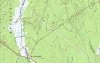
I know that the symbols on a topo map with a square with a dot in the center or a triangle with a dot in the center means a monument has been put there.Now with the info you gave me I see that anyplace on the topo that has an X and BM next to it for benchmark also has a monument there or did at one time.I see on the topo x's with no BM but just elevation in feet next to the X.Do these places have monuments as well? I see many of these down my way back in the woods but most of the BM X,s are along roads.
I know that the symbols on a topo map with a square with a dot in the center or a triangle with a dot in the center means a monument has been put there.Now with the info you gave me I see that anyplace on the topo that has an X and BM next to it for benchmark also has a monument there or did at one time.I see on the topo x's with no BM but just elevation in feet next to the X.Do these places have monuments as well? I see many of these down my way back in the woods but most of the BM X,s are along roads.
http://www.google.com/url?sa=t&rct=...=gmQcmIgJhsIZjPwn-W94gw&bvm=bv.90491159,d.cWc
some of them apparently are monumented but some appear to be "spot elevations" Are these monumented?
some of them apparently are monumented but some appear to be "spot elevations" Are these monumented?