Pine Barren History Shorts

Teegate

Administrator
Site Administrator
Sep 17, 2002
25,603
8,181
All,

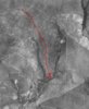
Jonathan Godfrey was a businessman who along with his wife owned thousands of acres of cranberry bogs in the Chatsworth area. His wife was the great grandchild of Joseph Beers, of Bears Reality, who owned the Jones Mill Tract, 5000 acres which included the Chatsworth Club and much of what today is the Parker Preserve. And it is obvious Jonathan oversaw her holdings. By 1928 he had accumulated even more, and on at least one occasion he had a confrontation over ownership of his land.

10/27/1928

CHATSWORTH MAN, 67, JAILED AFTER QUARREL

Chatsworth, Oct. 27.- John Recchia, 67 years old, of this place, was sent to the Mt. Holly jail for 90 days yesterday by Justice of the Peace Curran, after being found guilty of disorderly conduct.

He was arrested by Trooper Campbell, of the Columbus barracks, on the complaint of Jonathan Godfrey, 250 Park Ave, New York City. The later charged Recchia struck him in the face after an argument over cranberry lands near Chatsworth.

Godfrey owns extensive cranberry bogs near Chatsworth and Recchia claimed that some of his land had been invaded by the New York man. Surveyors proved that Recchia's claim was unfounded. Then he and Godfrey had an argument.


As Godfrey turned to walk away form the old man, the latter, it was charged, struck him in the face. It was testified that Recchia is in the habit of "slapping people down" when they disagree with him. He was put away from civilization for 90 days.


We visited Mr. Recchia today to ask him for clarification but he wasn't talking. But the turkey's in the woods nearby sure were.

IMG_5031a.jpg
 
Last edited:

Teegate

Administrator
Site Administrator
Sep 17, 2002
25,603
8,181
The article had it spelled wrong. I used my computer to try and change all of the incorrect spellings but must have missed them as I typed them wrong. I fixed it.
 

Teegate

Administrator
Site Administrator
Sep 17, 2002
25,603
8,181
This is an interesting one, and we can all try and figure out where the ending location was.


Edited

June 27, 1933

CHARLES L. CARSLAKE MISSING IN WOODS

Former Dry Agent and Undersheriff Left Columbus Home Thursday

Game wardens and state troopers were combing the pine plains and bog lands in the vicinity of Harrisia, Jenkins Neck and Sim Place today for Charles L. Carslake, former undersheriff and prohibition enforcement agent.
He was seen Friday on the Harrisia/Speedwell/New Gretna road, where he bought some gasoline at a filling station operated by Harry Leeks. (This could be Micks Canoe Rental today)
State Trooper Joseph McCormack of Columbus, said today that Trooper James Scotland and William Carslake, a son, who is a game warden, had been in the deer woods since early yesterday with his brother, seeking some trace of the former official. Carslake is now a justice of the peace and was said to have been in ill health for some time.
One report was that Carslake was seen near Sim Place, a cranberry settlement south of Martha Furnace and Calico. Friends said he might have gone out in search of wild huckleberries and became stranded when his car ran out of gasoline. The pine barrens are interlaced with tiny trails passable by automobile, but leading through deserted village sites.

June 28, 1933

More than 200 State troopers, game wardens and resident are combing cranberry bogs and pine barrens near Chatsworth, seeking Carslake. A Navy plane from the station at Lakehurst circled over the area all day yesterday. The Navy blimp ZNC-2 left Lakehurst today to aid in the search.
Yesterday afternoon his coupe was found abandoned in the dense woods off Goose Pond Road, five miles from Chatsworth, so deeply rutted in bog ooze that it could not be moved. In it were some of his clothing and his gun holster with the gun missing.

June 29, 1933
Edited
A human fine-toothed comb stretched through the fastness of the woods and swamps in the Goose Pond and Spring Hill roads sector from three to eight mile south of here Swamps and thickets in the direction of Winding Hill (????????), where buzzards were sighted yesterday, were subjected to a foot by foot scanning.
Numerous footprints, made by galoshes evidently worn by Carslake were followed until they seemingly ended.
After his car became mired in the mud, about 5 miles from Chatsworth on Goose Pond Road, he aparenty tried to push on to Warren Grove afoot. An empty holster in his car and the absence of his 45 calibar gun from home lwd his sons to believe he had the weapon on his person. The former dry crusader is forest-wise, his sons said, and with a firearm would be able to subsist.

On the other hand, he had been ill and may have wandered dazedly until he dropped from exhaustion his friends believe. They pointed out that he knows this territory and would have found a way out of the maze before this late date.

July 3, 1933
Edited

Since he had told his family he intended to spend several weeks at Warren Grove, it was felt possible that he may have stopped at some wilderness cabin unaware that a search was in progress.

Various

He stopped at the home of George Green, who resides on Goose Pond Road about two miles from Chatsworth, to ask for directions. A short time later he returned to Green's home and again asked for directions. (It is important to note that what they call Goose Pond Road is most certainly Baptist Road. Baptist Road back then crossed Long Causeway and traveled just north of Goose Pond and eventually to Warren Grove. It is pretty obvious Carslake drove through Chatsworth to Dukes Bridge and turned left onto Baptist where he stopped at George Green's house to ask directions.)

July 5, 1933

MISSING SQUIRE IS FOUND DEAD IN PINE WOODS

The thick underbrush of the pine county today gave up the body of Charles L. Carslake, Columbus justice of the peace, missing since Jun22.
Lying face downward in the cranberry bogs of the West Papoose swamp, seven miles from Chatsworth, Carslake was found by a group of searchers headed by his two sons, Edward and William Carslake. Death they said was due to natural causes.(Later said exhaustion and lack of nourishment and later acute cardiac dilatation)

Exhausted and bewildered, Carslake is believed to have wandered into the thicket-he was found a good two miles off any beaten track-until he was unable to continue further.

Corporal Wood stated the body was found on dry land a short distance from Papoose Creek. A 45 pistol he was thought to have been carrying was not found.


July 7, 1933
Edited
Carslake Funeral Held At Columbus

Last rites for Charles L. Carslake, 58, of Bordentown road, were held today from his home. Internment was in Columbus Cemetery.


I visited the Columbus Cemetery this late afternoon and early evening and found it to be an interesting place. With McMansions closing in the old time feel is still there. Mr. Carslake had a great view of a farm field for almost 80 years. The view today at his location are giant evergreen trees and a high fence designed to keep the view of the McMansions away from the view of gravestones.


IMG_5050a.jpg
 
Last edited:

Teegate

Administrator
Site Administrator
Sep 17, 2002
25,603
8,181
So after reading everything I have it appears to me that his car got stuck along Goose Pond Road(Baptist Road) near Sooy two miles from the Papoose branch. That would be about here.


And he was found in this general area along the Papoose.


Teegate

Administrator
Site Administrator
Sep 17, 2002
25,603
8,181
I forgot to add half of the article Boyd so you may want to read it again.
 
  • Like
Reactions: Boyd

bobpbx

Piney
Staff member
Oct 25, 2002
14,154
4,258
Pines; Bamber area
Very interesting Guy. A couple blatant errors in the reports. They said at one point, he was found lying face downward in the cranberry bogs of the West Papoose swamp, but then later Corporal Wood stated the body was found on dry land a short distance from Papoose Creek. Well, was it in a bog or dry upland? I don't see a lot of cranberry bogs in the Papoose Branch in the 1931 aerials, but somebody tried something on the main branch near where the east and west branch come together. And if he had taken the wrong fork in the road (the right fork), he'd end up near here in the thumbnail.

Also, this statement is way off base: "One report was that Carslake was seen near Sim Place, a cranberry settlement south of Martha Furnace and Calico."
 

Attachments

  • clearwe.JPG
    clearwe.JPG
    78.9 KB · Views: 254
  • Like
Reactions: Menantico

Teegate

Administrator
Site Administrator
Sep 17, 2002
25,603
8,181
Bob,

There were many articles I did not add to that. He was reported to be at Woodmansie and everyone headed over there to look. A large groups crashed through the thicket to get to the location where Carranza crashed looking for him there. He was everywhere :) This was 1930s reporting.
 
Last edited:
  • Like
Reactions: bobpbx and Boyd

Teegate

Administrator
Site Administrator
Sep 17, 2002
25,603
8,181
In 1930, about two years after Beck started his exploring, he teamed up with Warner Hargrove again for a visit to the Pasadena area. Along on the trip was a man named Charles Remine of Wrightstown. I don't really know how Remine came to be involved with Beck but I I would guess he was involved with Warner Hargrove. Both of them helped Beck with various projects including the "Murder at Bamber" research. Anyway, Beck, Hargrove, Remine and Hargrove's dog Tip visited the Pasadena area together and the photo below was the result. Beck is in the cab of the donkey engine with Remine on the left at the bottom.

In 1936 while recovering from appendicitis surgery a blood clot ended his life. Along with other members of his family he was interred in the Methodist cemetery in Wrightstown. I visited there late this afternoon and found the church abandoned and falling apart, with the cemetery itself not well taken care of. In 1936 it may have been a good place to spend the rest of eternity; however, today it is questionable.

charlesR.jpg


IMG_5075a.jpg


IMG_5080a.jpg


IMG_5082a.jpg
 

Teegate

Administrator
Site Administrator
Sep 17, 2002
25,603
8,181
5/3/1923

Want Village Name Changed

Residents of Mount Misery, near Browns Mills, want to change the name of their village to Mount Bard, in honor of the Frenchman who founded the settlement in 1720. The present name, they claim, is a barrier to progress, despite the fact it is historic and figures in much romantic history of the Jersey pines.

How the place got it's name the oldest residents do not know. One tradition says that he barren appearance of the surroundings after the original forests were cut won it the appelation from natives. Families who have recently moved into the district are leading the movement to give the place a more appealing name.

Residents who want to see the old names of the pine belt preserved fear the movement in Mount Misery may lead to similar requests from Double Trouble, Ong's Hat, Bed Bug Corner, Green Apple Pie Hill, Hog Wallow and other famous cross-roads centres in the Jersey wilderness.


Green Apple Pie Hill?????
 

Teegate

Administrator
Site Administrator
Sep 17, 2002
25,603
8,181
Cranberry Crop Short In Winslow Section

Notice the month.

6/28/1913

Winslow, June 28- The prospect for this years cranberry crop is poor and less than a third of the normal crop is looked for in South Jersey, In looking over Atsion and Chatsworth, which are among the chief producing bogs near here, growers find very little that is encouraging. Thousands of acres have been affected by the cold spell. Among these are the Friendship bogs, 500 acres, owed by Evans & Wills: the Ruspalia bogs, about 100 acres; John Applegate's bogs and Victor Ritzendollar's bogs, 50 acres, all in the neighborhood of Chatsworth.

In this vicinity, a strip of about one mile in width and several miles in length was affected by the cold.
 

Wick

Explorer
Mar 6, 2016
408
296
Forked River
Cranberry Crop Short In Winslow Section

Notice the month.

6/28/1913

Winslow, June 28- The prospect for this years cranberry crop is poor and less than a third of the normal crop is looked for in South Jersey, In looking over Atsion and Chatsworth, which are among the chief producing bogs near here, growers find very little that is encouraging. Thousands of acres have been affected by the cold spell. Among these are the Friendship bogs, 500 acres, owed by Evans & Wills: the Ruspalia bogs, about 100 acres; John Applegate's bogs and Victor Ritzendollar's bogs, 50 acres, all in the neighborhood of Chatsworth.

In this vicinity, a strip of about one mile in width and several miles in length was affected by the cold.
Is this suggesting there was a cold spell in June? Cranberries are not harvested until fall, So was the fruit damaged or the vines?
 

PINEY WARDEN

Explorer
Jan 13, 2012
260
262
Is this suggesting there was a cold spell in June? Cranberries are not harvested until fall, So was the fruit damaged or the vines?
Probability that is was a late spring frost/freeze killing back the fruit bud and or hooks forming bloom.
 

PINEY WARDEN

Explorer
Jan 13, 2012
260
262
So it occurred before June??
Or it could’ve been in early June! The cranberry buds which are hooks normally by June are very vulnerable to cold exposure. Every year on our farm the first two weeks of June we always get at least two to three evenings and early morning frosts in the bogs which now of course we irrigate to protect. Back then they lived on hopes frost wouldn’t get them.
 

Tom

Explorer
Feb 10, 2004
231
9
5/3/1923

Want Village Name Changed

Residents of Mount Misery, near Browns Mills, want to change the name of their village to Mount Bard, in honor of the Frenchman who founded the settlement in 1720. The present name, they claim, is a barrier to progress, despite the fact it is historic and figures in much romantic history of the Jersey pines.

How the place got it's name the oldest residents do not know. One tradition says that he barren appearance of the surroundings after the original forests were cut won it the appelation from natives. Families who have recently moved into the district are leading the movement to give the place a more appealing name.

Residents who want to see the old names of the pine belt preserved fear the movement in Mount Misery may lead to similar requests from Double Trouble, Ong's Hat, Bed Bug Corner, Green Apple Pie Hill, Hog Wallow and other famous cross-roads centres in the Jersey wilderness.


Green Apple Pie Hill?????

The Jones Tract map surveyed by Joseph Cox in the 1850s has this area named Mt. Relief. I thought I had heard that the original name was a non-english word which meant relief, but sounded similar to misery. I don't recall where I had heard this, though.
 
  • Like
Reactions: Boyd
Top