Property Stones And More... Fall 2022/ Winter Spring 2023

Teegate

Administrator
Site Administrator
Sep 17, 2002
25,627
8,228
All,

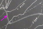
I was looking over aerials to search for more of Bill Haines property lines and saw this.

What.jpg


We headed out early and after a short walk down a wet dim road we found this. It looks like someone is trying to attract snakes. We found nothing under it. They always lay branches across them for some odd reason. The object was really heavy so it was not going anywhere. I always put the branches back in the exact same way so they don't know anyone was checking.

DSC_5124a.jpg


We did find Indian Pipe nearby.

DSC_5141a.jpg


One of the property corners is right near the middle of a cedar swamp. It was fairly easy to walk and not flooded as I was expecting.

DSC_5125a.jpg


When we arrived it was easy to find. It was only a monument with no stone. I have the complete property survey for Bill Haines and try to pick some of the places where I think there may be stones and this was not one of them. The water in the photo is the main channel.

DSC_5126a.jpg


After crossing the swamp we found this corner with an old ax handle being used to mark it.

DSC_5139a.jpg


Jessica straddling the state and Haines property line. The arrows point to my walking stick at the corner.

DSC_5134a.jpg


From there we headed to the Parker Preserve. Back in 2008 Bob, Jessica and myself visited an old building that was there at the time. The wood was so old as we walked across the floor of the building we broke through and stood on the ground. On a visit soon after the building had been demolished.

Here is the building today.

DSC_5142a.jpg


And here is a "Then And Now" showing Jessica back then and today standing where I took the photo almost exactly 14 years ago. I have to admit it was so much nicer back then. It looks so disturbed today.


Jess 10:5:2008_10:8:2022.jpg


The chiggers were terrible. We both sprayed twice.

FYI, if you go by the Tall Pine Gun club in Chatsworth they put a new roof on this morning. By 10 PM when we were heading by there they had the shingles all off of it. It appears the members of the club are doing it themselves.
 
Last edited:

Teegate

Administrator
Site Administrator
Sep 17, 2002
25,627
8,228
We went to Parkdale again today to try and find more state corners. As I mentioned before that place is a mess. Beavers are Wharton's main problem, as well as illegal off-roading. Anyway, we then headed to the location near Friendship Bogs that I mentioned had the plastic posts blocking the entrance. We were there after the controlled burn and could drive right in. We were trying to figure out why the area is now blocked. Well, the answer is easy to see. People have been driving in the pond.

There are 5 posts at the entrance, one a short distance past it that you can see in the below photo, and another post after that. They are trying to save the pond from more damage.


DSC_5156a.jpg


Tearing it up.

DSC_5162a.jpg


DSC_5161a.jpg


For the most part it is dry now and if you like easy strolls in a nice area you should stop by and walk around.

DSC_5159a.jpg


On our way there we went through Friendship and this apparently stolen vehicle was there. It had rolled and was damaged pretty bad. The toe tag had a message on it.

DSC_5154a.jpg


DSC_5153a.jpg


DSC_5150a.jpg


Later we visited Millers Bog near Dave Amato's to check on something that you will read about in the future. They were working the bogs today in the back and had not flooded the front bogs.

DSC_5148a.jpg


DSC_5149a.jpg
 

Teegate

Administrator
Site Administrator
Sep 17, 2002
25,627
8,228
All,

This morning Jessica and I returned to Deep Run to again look for a few property stones after many years of putting it off. Usually it is flooded but I was thinking that now may be a good time to go. In reality we were going to the far northern bog which I have discussed before that the state purchased from Frank Earl Haines and Edith Haines in December 1967.

feh.jpg


The pointer is on the bottom of the property.


feh_.jpg


Jessica on our way there. At a few locations it was a struggle but we found a better way home.

DSC_5168a.jpg


Again, we did not find them so we traveled further to see if after 150 years this post would still be there. :)


post1.jpg


Using other info I have I calculated it to be in the corner of this spung near the Bards Branch.

spung_.jpg


We visited the spung.

DSC_5169a.jpg


And as expected we did not find it. We then traveled as far as we could today along an old road that currently is a dim foot path until we reached the end. I will return soon to look for Wesley Willitts old stone bottom mentioned on old deeds.

bards__.jpg


Where we stopped today.

DSC_5172a.jpg


DSC_5174a.jpg


DSC_5165a.jpg


DSC_5179a.jpg


In the end we traveled about 4.5 miles, chased up a million ducks and had a great time. There are so many nice places to explore in that area that nobody visits which is how I like it. Each time I go I enjoy it even more.
 

Attachments

  • post.jpg
    post.jpg
    54.7 KB · Views: 62

ecampbell

Piney
Jan 2, 2003
2,841
964
There are 6 bogs all of which I have kayaked in 2002. No pics, no digital camera. At that time the bogs drained through a large galvanized culvert. I gave a lot of blood to the briars. It was snapper heaven. I used to hike around them in the 90's, very dense. I still have a flashlight that I found at the northern most point. I also remember ticks. Places like this and Friendship just aren't seeing the traffic to keep them cleared. Do you have your track?

The souh side from Hampton Road is also worth a good explore, up to the tracks. A nice trestle back there.
 

Teegate

Administrator
Site Administrator
Sep 17, 2002
25,627
8,228
We parked on Hampton Road in June 2021 and explored on the South side of Hampton road and while walking up the tracks toward Rider Switch we saw two men coming towards us. Turns out it was dragoncjo and Gibby. A nice surprise.
 
  • Like
Reactions: dragoncjo

Teegate

Administrator
Site Administrator
Sep 17, 2002
25,627
8,228
All,

I spent today with bobpbx in the Stafford Forge area looking for plants and I visited a location that Rooftree told me about a year ago. We met at the entrance to Stafford Forge near the Parkway. But on the way I had to stop at the memorials on 532. I have nothing really to say about how sad this incident is. My photos did not turn out well in the low light.


DSC_5184a.jpg


DSC_5182a.jpg


DSC_5181a.jpg


DSC_5183a.jpg


Anyway, our meeting spot.

DSC_5186a.jpg


I found the monument that Rooftree told me about. Right in the middle of the road as he mentioned.


DSC_5191a.jpg


However, if anyone finds a monument or stone take a look around before moving on. You might find another one.

DSC_5193a.jpg


This is a Gentian plant that did not bloom. It is hard to believe but we found 300 Gentians today on one road with only 20 blooming. We counted them all. This plant is the only one that actually has blue leaves.


DSC_5210a.jpg


We came upon this and I had to take a photo.

DSC_5188a.jpg


This appears unused and has been visited before.


DSC_5196a.jpg


A feeder. A large tube with a slot in the bottom for the corn to fall out.


DSC_5197a.jpg


And we drove past Chevy Pond and saw this. However, when we get permits on our legal vehicles this will all stop... don't you think?

DSC_5213a.jpg
 
Last edited:

Teegate

Administrator
Site Administrator
Sep 17, 2002
25,627
8,228
All,

This morning Jessica and I walked 2 miles from Rockwood to a small tract that in 1859 was passed on from Samuel Lippincott to his son Samuel Jr. Member manumuskin and myself visited there in 2010 and found one of the property stones and we went today to look for more. Unfortunately, we did not find any.

The property.


The Wharton survey showing it.

Lippincott.jpg


Showing manumuskin there in 2010 and Jessica today.


IMG_4389b.jpg


Looking for one of the stones.

DSC_5225a.jpg


DSC_5227a.jpg


Rockwood Road

DSC_5214a.jpg


This video shows us revisiting the stone after 12 years.

Finding The Stone Again

And on our way there on Rockwood road we passed what either were park police or game wardens checking on the hunters at the bog. Notice the warn DEP on the back of the vehicle. Right after we passed and parked a gunshot went off right near us. We though they were shooting at the police. This video shows that encounter as well as the mist on Chew Road.

Rockwood And Chew Road
 

PINEY WARDEN

Explorer
Jan 13, 2012
260
262
All,

This morning Jessica and I walked 2 miles from Rockwood to a small tract that in 1859 was passed on from Samuel Lippincott to his son Samuel Jr. Member manumuskin and myself visited there in 2010 and found one of the property stones and we went today to look for more. Unfortunately, we did not find any.

The property.


The Wharton survey showing it.

View attachment 18414


Showing manumuskin there in 2010 and Jessica today.


View attachment 18415

Looking for one of the stones.

View attachment 18416

View attachment 18417

Rockwood Road

View attachment 18418


This video shows us revisiting the stone after 12 years.

Finding The Stone Again

And on our way there on Rockwood road we passed what either were park police or game wardens checking on the hunters at the bog. Notice the warn DEP on the back of the vehicle. Right after we passed and parked a gunshot went off right near us. We though they were shooting at the police. This video shows that encounter as well as the mist on Chew Road.

Rockwood And Chew Road
Today was the first day of South Zone Duck Season
 

Teegate

Administrator
Site Administrator
Sep 17, 2002
25,627
8,228
Today was the first day of South Zone Duck Season

Yes, I texted Scott after passing through Rockwood and he told me that. Then the gun shot went off and Jessica was ready to bail out.

I don't understand why they would bother the hunters when they had to know their presence there would scare away any ducks that were around. But Scott had said that he was in the area at 6:45 and it sounded like a war going on so I guess hunting was pretty much done by the time we arrived.
 

Teegate

Administrator
Site Administrator
Sep 17, 2002
25,627
8,228
All,

I have posted before about the two purchases of Wharton, and spent some time in the past looking to see if they placed monuments at these locations. So today I headed out alone and again looked to see if they actually were a reality. I should have gone right after the fire that occurred along the JCRR, Hampton Road, and East Stokes road that occurred a few years ago but failed to do so. Because of that the growth is a little beyond ideal conditions.

Anyway, I parked just across the tracks on Quaker Bridge Road, and walk the road parallel to the tracks all the way to the back of the shooting range. After a second search at that location I was not able to find the Fruitland corner. I did get this photo of the Mine Brook which is also called the Halfway Brook on the Wharton survey.

DSC_5230a.jpg


The yellow arrows on the Wharton survey shows us the brook.

IMG_8095a.jpg


And this is the Halfway or Mine Brook.


The blue arrows above shows us that for some reason the Purchase A and Purchase B were tied in with the location of the mileposts on the JCRR. Notice the line going up next to the letter T, and notice the 94.47 next to it if extended reaches the 94.47 milepost on the JCRR. And the 94.47 location next to the letter T was on the other side of the Mine Brook from where I was. The days of crossing logs by myself are long over so I traveled up the brook to the JCRR at the bridge with the large pipes under it.

DSC_5232a.jpg


After crossing over and heading south I came upon two choices. Walk the first photo below or the dry stream in the second photo. It was an easy choice.

DSC_5238a.jpg


DSC_5234a.jpg


My walking stick is at the location of the 94.47 purchase corner. I found nothing on this visit as well.

DSC_5244a.jpg


There is another corner about 750 feet away so I continued on and found nothing there except this male.

DSC_5245a.jpg


My tracks in that area.

purchase.jpg


It was starting to rain so I headed back to the JCRR and walked back to Atsion. As I neared my vehicle I saw two men and a small boy talking along Quaker Bridge road. I immediately recognized the one man from photos of him on Facebook and introduced myself to Robert Barnes Laucks of Bog Iron Outdoors.
 
  • Like
Reactions: John and Boyd

Teegate

Administrator
Site Administrator
Sep 17, 2002
25,627
8,228
We headed out as the sun was coming up to look for property corners along the Haines and state lines. We parked at the corner of Penn State Forest and I decided to take a photo with my new cell phone and my camera at the same location. My camera photos always seem to be dark in the woods when the sun is low so I wanted to compare them.

The top photo is the cell phone and my camera was on auto.

IMG_6847a.jpg


Zoomed in.

IMG_6848a.jpg


We walked 4 miles and found only monuments. Someone made this for motorcycles.

IMG_6850a.jpg


IMG_6862a.jpg


On the way past the Batona trail crossing on 532 there was a table set up with all kinds of refreshments. I assume today may have been the Batona run but am not sure. They usually do that for a run. This was in the 7:30 time frame. Cars everywhere.

Also, passing through the Medford circle they had it closed except for 70. It "appears" someone took out the large steel control box on the corner.
 
Last edited:

stiltzkin

Explorer
Feb 8, 2022
459
618
Medford
Try slower shutter speeds with your camera to avoid under-exposure. A tripod or even just setting the camera down on something may help depending on the amount of available light. Getting out of auto mode is worth it! Your cell phone has the benefit of multiple exposures, image stacking, and a bunch of fancy math to produce that brighter, high dynamic range image you're seeing.
 

Teegate

Administrator
Site Administrator
Sep 17, 2002
25,627
8,228
I do. But I don't always have the time to do that when doing what I do. The auto just should work better.
 

Boyd

Administrator
Staff member
Site Administrator
Jul 31, 2004
9,533
2,792
Ben's Branch, Stephen Creek
The newer iPhones work remarkably well hand-held in low light in auto mode. And I mean really low light... like a dark room. That is what they call "computational photography" and you may not get it on a regular camera, because the phone has a powerful, laptop-class processor and special chips just to handle this kind of thing.
 
Last edited:

Jon Holcombe

Explorer
Dec 1, 2015
967
1,934
Medford
I do. But I don't always have the time to do that when doing what I do. The auto just should work better.
Guy, Boyd is exactly right about computational photography.

Your iPhone will take superior photos most of the time. Newer phones have macro and telephoto options too.

I often take reference shots with my phone to pin a location, then shoot the exact same photo with my Nikon camera and with Nikon lenses. And I often have a very hard time matching the iPhone shot with my Nikon gear.

However, the Nikon has a much larger sensor and the lenses are far superior so if you are looking to take an exhibit quality photo, and want to have complete control over the image, and do not mind spending a lot of time post processing, and are shooting RAW format, than the Nikon is the ticket.

But it is requires hours of extra work sitting in front of your computer.
 
  • Like
Reactions: Boyd

Teegate

Administrator
Site Administrator
Sep 17, 2002
25,627
8,228
We spent the morning again looking for the Haines property corners. We found quite a few including this one hidden away right next to a tree. The tree had been hacked down by the surveyors to place their equipment over the monument. Most likely GPS.

IMG_6915a.jpg


The property around it was part of the Spring Hill Tract and here is one of the state corners right along the edges of Goose Pond. Jessica is checking out the pond which is owned by Haines.


IMG_6891a.jpg


We then visited this pond which is fully dry.


IMG_6907a.jpg


Bob, there are some plants growing in it.

IMG_6910a.jpg


In the end we walked 3.5 miles according to Jessica's watch. We averaged about 35 minutes per mile and Jessica's heart ranged from 95 BPM to 157. I am setting mine up now so I know what it is in the future. I checked it when I felt it was at its highest and it was only 115. Jessica has always had a high rate.
 
Last edited:
  • Like
Reactions: John and Boyd

Teegate

Administrator
Site Administrator
Sep 17, 2002
25,627
8,228
Guy, Boyd is exactly right about computational photography.

Your iPhone will take superior photos most of the time. Newer phones have macro and telephoto options too.

I often take reference shots with my phone to pin a location, then shoot the exact same photo with my Nikon camera and with Nikon lenses. And I often have a very hard time matching the iPhone shot with my Nikon gear.

However, the Nikon has a much larger sensor and the lenses are far superior so if you are looking to take an exhibit quality photo, and want to have complete control over the image, and do not mind spending a lot of time post processing, and are shooting RAW format, than the Nikon is the ticket.

But it is requires hours of extra work sitting in front of your computer.

I won't spend more than 5 seconds altering a photo. My Graphic Converter program has an auto enhance and that is all I use... if that. The same when taking them. I hit the shutter and move on unless I am not happy with what showed up on the screen.
 

bobpbx

Piney
Staff member
Oct 25, 2002
14,195
4,293
Pines; Bamber area
All those photos on my post this morning were taken with an Iphone. I too just snap and go. Sometimes I'll edit them at home, but not
on these. I may still get a new pocket camera. I wore my Sony RX 100 out.

Guy, that one I think I made it to, but it was wet at the time. That's a xyris you are holding.
 
Last edited:
Top