RAIN?
- Thread starter dogg57
- Start date
You are using an out of date browser. It may not display this or other websites correctly.
You should upgrade or use an alternative browser.
You should upgrade or use an alternative browser.
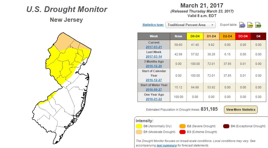
I would say we're moving in the wrong direction at the moment. For awhile, everything was back in the "below normal" category. Now we have a big area of severe drought again that wasn't there when I checked last week. 

I would say we're moving in the wrong direction at the moment.
We are definitely moving in the wrong direction

The last rainstorm (the snowstorm that wasn't) definitely helped, I got about 4 inches here and the creek levels are much higher now. Let's see how long that lasts though...
High Point SP had an amazing season with 84" of snow, still snow covered.
http://www.spiderturkey.com/SnoCam.html
http://www.spiderturkey.com/SnoCam.html
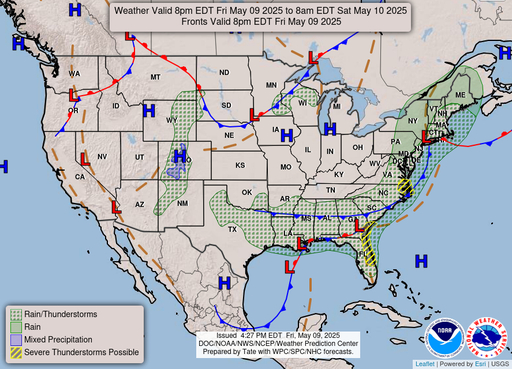
Thunderstorms and/or rain predicted for much of New Jersey today, tomorrow, and Friday. As of now, Friday's rain looks to deliver an inch. Maybe 1.5 inches by the end of the week, if we are fortunate. I'm hoping that this happens, we sure need it...
Forecast still looking good for rain on Friday/Sat and Tuesday....possibly more than 2 inches over the next few days! That would be a blessing.Thunderstorms and/or rain predicted for much of New Jersey today, tomorrow, and Friday. As of now, Friday's rain looks to deliver an inch. Maybe 1.5 inches by the end of the week, if we are fortunate. I'm hoping that this happens, we sure need it...
Would be nice. Had a total of 1/2 inch here over the past few days. That plus the 4 inches we had in the "snowstorm that wasn't" has creek levels looking a lot better.
http://www.weather.gov/media/phi/current_briefing.pdf
Flood Watch
DEZ001-MDZ008-NJZ007>010-012>020-027-PAZ054-060>062-070-071-
101>106-311945-
/O.COR.KPHI.FA.A.0002.170331T1600Z-170401T0600Z/
/00000.0.ER.000000T0000Z.000000T0000Z.000000T0000Z.OO/
New Castle-Cecil-Warren-Morris-Hunterdon-Somerset-Middlesex-
Western Monmouth-Eastern Monmouth-Mercer-Salem-Gloucester-Camden-
Northwestern Burlington-Ocean-Southeastern Burlington-Carbon-
Berks-Lehigh-Northampton-Delaware-Philadelphia-Western Chester-
Eastern Chester-Western Montgomery-Eastern Montgomery-Upper Bucks-
Lower Bucks-
Including the cities of Wilmington, Elkton, Washington,
Morristown, Flemington, Somerville, New Brunswick, Freehold,
Sandy Hook, Trenton, Pennsville, Glassboro, Camden, Cherry Hill,
Moorestown, Mount Holly, Jackson, Wharton State Forest,
Jim Thorpe, Reading, Allentown, Bethlehem, Easton, Media,
Philadelphia, Honey Brook, Oxford, West Chester, Kennett Square,
Collegeville, Pottstown, Norristown, Lansdale, Chalfont,
Perkasie, Morrisville, and Doylestown
342 AM EDT Fri Mar 31 2017
...FLOOD WATCH IN EFFECT FROM NOON EDT TODAY THROUGH LATE
TONIGHT...
The National Weather Service in Mount Holly has issued a
* Flood Watch for portions of northern Delaware, northeast
Maryland, New Jersey, and Pennsylvania, including the
following areas, in northern Delaware, New Castle. In
northeast Maryland, Cecil. In New Jersey, Camden, Eastern
Monmouth, Gloucester, Hunterdon, Mercer, Middlesex, Morris,
Northwestern Burlington, Ocean, Salem, Somerset, Southeastern
Burlington, Warren, and Western Monmouth. In Pennsylvania,
Berks, Carbon, Delaware, Eastern Chester, Eastern Montgomery,
Lehigh, Lower Bucks, Northampton, Philadelphia, Upper Bucks,
Western Chester, and Western Montgomery.
* From noon EDT today through late tonight
* Low pressure moving through the Mid Atlantic will lead to a
swath of heavy rainfall along and to the northwest of the I-95
corridor. Widespread rainfall amounts of 2 to 3 inches are
expected with localized amounts to 4 inches possible. The
heaviest rain is expected to move through the area from
southwest to northeast this afternoon and evening.
* The heavy rainfall may result in flooding along area stream and
creeks as well as urban and poor drainage flooding.
PRECAUTIONARY/PREPAREDNESS ACTIONS...
A Flood Watch means there is a potential for flooding based on
current forecasts.
You should monitor later forecasts and be alert for possible
Flood Warnings. Those living in areas prone to flooding should be
prepared to take action should flooding develop.
&&
$$
Another 1.5 inches currently predicted for next Monday night/Tuesday.
T
Toothy Critter
Guest
Again I have to be the putz and warn everyone. Watch the numbers. This water will quickly soak into a hungry aquafer and leave the Pines dry in no time. Normal spring rains won't save it. It will take a few years of abnormally high rainfall. Start dancing 

So, in other words, we're doomed?  I got at least 1/2" rain last night and the forecast is calling for 1 to 2 inches on Thursday, all of which is good. I don't know about the larger issue but have a creek on my property and wander down there every day, so I'm pretty aware of typical water levels during the 11 years I've lived here. We are working our way back to what I'd consider "normal" for this time of year.
 I got at least 1/2" rain last night and the forecast is calling for 1 to 2 inches on Thursday, all of which is good. I don't know about the larger issue but have a creek on my property and wander down there every day, so I'm pretty aware of typical water levels during the 11 years I've lived here. We are working our way back to what I'd consider "normal" for this time of year.
That's good to hear and I hope it continues. We are still at very low water levels in western Camden county hopefully these next few storms get us back to a historical average. The USGS gages are invaluable resources for looking at gage height and CFS streamflow data. Starting my rain dance!So, in other words, we're doomed?I got at least 1/2" rain last night and the forecast is calling for 1 to 2 inches on Thursday, all of which is good. I don't know about the larger issue but have a creek on my property and wander down there every day, so I'm pretty aware of typical water levels during the 11 years I've lived here. We are working our way back to what I'd consider "normal" for this time of year.

I heard spring peepers today but not in my pond. I just checked and it's bone dry. This is the first spring in 10 years there is no water at all in it. In 2010 it was 3+ feet deep. The ground water is low even with this rain. The lack of snowfall this year is likely the culprit. These heavy rains raise the streams for a bit but aren'thelping the water table as much.


