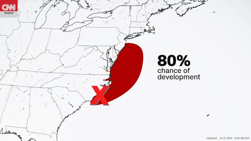
Tropical Storm Fay Local Statement Advisory Number 5
National Weather Service Mount Holly NJ AL062020
1137 AM EDT Fri Jul 10 2020
This product covers NEW JERSEY and DELAWARE
**Tropical Storm Fay Continues To Impact the Region**
NEW INFORMATION
---------------
* CHANGES TO WATCHES AND WARNINGS:
- None
* CURRENT WATCHES AND WARNINGS:
- A Tropical Storm Warning is in effect for Atlantic, Atlantic
Coastal Cape May, Cape May, Coastal Atlantic, Coastal Ocean,
Delaware Beaches, Eastern Monmouth, Inland Sussex, Middlesex,
Ocean, Southeastern Burlington, and Western Monmouth
* STORM INFORMATION:
- About 70 miles south of Atlantic City NJ or about 70 miles
southeast of Dover DE
- 38.4N 74.5W
- Storm Intensity 60 mph
- Movement North or 5 degrees at 12 mph
SITUATION OVERVIEW
------------------
Tropical Storm Fay is currently centered east of Fenwick Island, and
will continue to track to the north over New Jersey today. Heavy rain
will lead to flash flooding, mainly across Delaware and New Jersey, but
flash flooding will also occur over southeast Pennsylvania. The threat
for tropical storm force winds will mainly occur along the New Jersey
and Delaware coasts. Isolated tornadoes are also possible, especially
in eastern New Jersey. Tropical Storm Fay will depart this evening,
with impacts diminishing late tonight.
POTENTIAL IMPACTS
-----------------
* FLOODING RAIN:
Potential impacts from the flooding rain are still unfolding across
coastal New Jersey and Delaware. Remain well guarded against dangerous
flood waters having additional significant impacts. If realized, these
impacts include:
- Moderate rainfall flooding may prompt several evacuations and
rescues.
- Rivers and tributaries may quickly become swollen with swifter
currents and overspill their banks in a few places, especially
in usually vulnerable spots. Small streams, creeks, canals,
arroyos, and ditches overflow.
- Flood waters can enter some structures or weaken foundations.
Several places may experience expanded areas of rapid
inundation at underpasses, low-lying spots, and poor drainage
areas. Some streets and parking lots take on moving water as
storm drains and retention ponds overflow. Driving conditions
become hazardous. Some road and bridge closures.
* WIND:
Potential impacts from the main wind event are now unfolding across
coastal New Jersey and Delaware. Remain well sheltered from dangerous
wind having additional limited impacts. If realized, these impacts
include:
- Some damage to roofing and siding materials, along with damage
to porches, awnings, carports, and sheds. A few buildings
experiencing window, door, and garage door failures. Mobile
homes damaged, especially if unanchored. Unsecured lightweight
objects become dangerous projectiles.
- Several large trees snapped or uprooted, but with greater
numbers in places where trees are shallow rooted. Several
fences and roadway signs blown over.
- Some roads impassable from large debris, and more within urban
or heavily wooded places. A few bridges, causeways, and access
routes impassable.
- Scattered power and communications outages, but more prevalent
in areas with above ground lines.
* TORNADOES:
Potential impacts from tornadoes are still unfolding across coastal
New Jersey. Remain well braced against a tornado event having possible
limited impacts. If realized, these impacts include:
- The occurrence of isolated tornadoes can hinder the execution
of emergency plans during tropical events.
- A few places may experience tornado damage, along with power
and communications disruptions.
- Locations could realize roofs peeled off buildings, chimneys
toppled, mobile homes pushed off foundations or overturned,
large tree tops and branches snapped off, shallow-rooted trees
knocked over, moving vehicles blown off roads, and small boats
pulled from moorings.
Elsewhere across NEW JERSEY...DELAWARE...SOUTHEASTERN PENNSYLVANIA
AND NORTHEAST MARYLAND, little to no impact is anticipated.
* SURGE:
Potential impacts from the main surge event are now unfolding across
coastal New Jersey and Delaware. Remain well away from locally
hazardous surge having possible limited impacts. If realized, these
impacts include:
- Localized inundation with storm surge flooding mainly along
immediate shorelines and in low-lying spots, or in areas
farther inland near where higher surge waters move ashore.
- Sections of near-shore roads and parking lots become overspread
with surge water. Driving conditions dangerous in places where
surge water covers the road.
- Moderate beach erosion. Heavy surf also breaching dunes, mainly
in usually vulnerable locations. Strong rip currents.
- Minor to locally moderate damage to marinas, docks, boardwalks,
and piers. A few small craft broken away from moorings.
PRECAUTIONARY/PREPAREDNESS ACTIONS
----------------------------------
Rapidly rising flood waters are deadly. If you are in a flood-prone
area, consider moving to higher ground. Never drive through a flooded
roadway. Remember, turn around don`t drown!
If a Tornado Warning is issued for your area, be ready to shelter
quickly, preferably away from windows and in an interior room not
prone to flooding. If driving, scan the roadside for quick shelter
options.
Closely monitor weather.gov, NOAA Weather radio or local news outlets
for official storm information. Be ready to adapt to possible changes
to the forecast. Ensure you have multiple ways to receive weather
warnings.
Do not be a thrill seeker or risk your life for senseless photos or
videos.

 .
.


