DEP Announces Virtual Public Meeting to Launch Wharton State Forest Visitor and Vehicle Use Survey
- Thread starter RednekF350
- Start date
You are using an out of date browser. It may not display this or other websites correctly.
You should upgrade or use an alternative browser.
You should upgrade or use an alternative browser.
Wait, after further consideration, I'm gonna guess the Forked River Mountains
California. Mt Whitney is in the background. I was just there a few weeks ago.Colorado?
All: Thanks to Ben, the Google Earth .kmz files are now available for download here:
You'll need to install Google Earth for these
really digging the low opacity of the “map” with the satellite view in the background.
Is it possible to do one for the #8 map showing both closed and open roads?
I can take a look, but you might have to wait awhile. These things aren't georeferenced, and that's a process that must be done "by hand".
Not a lawyer, but I was on a jury once.The gate is legal in the sense that Miller went through an official process with the town of Hammonton to obtain an exclusive license for vehicle use on that road; or at least, it seems so. The license he was granted is actually for "the unpaved roadway known as Paradise Drive," which is somewhat ambiguous, since multiple roads are known as Paradise Drive. Assuming that it refers to the Paradise Drive shown on tax maps, that would be a segment of the road that we are calling West Mill Road. The issuance of this license, and the pretenses under which it was granted, are a different matter, and I think it can plainly be shown that most of the assertions in the resolution granting the license are simply untrue.
Additionally, there is a legal question to be resolved here over whether the Town of Hammonton's contention that it has an interest in controlling the right of way on a road on state land, just because it falls within the borders of the town, actually holds up. I cannot really comment further on that.
") My impression from looking into this last year is that once a public road is established in New Jersey, either explicitly by ordnance or implicitly by the creation of a prescriptive easement, it has to be abolished by legislation. That is, the elected freeholders or whatever you call them nowadays, or the elected state legislature, have to abolish the right-of-way to close the road. It can't be done by decree by an executive or their subordinates; but if the elected officials close it to public use, it's closed.
My impression from looking into this last year is that once a public road is established in New Jersey, either explicitly by ordnance or implicitly by the creation of a prescriptive easement, it has to be abolished by legislation. That is, the elected freeholders or whatever you call them nowadays, or the elected state legislature, have to abolish the right-of-way to close the road. It can't be done by decree by an executive or their subordinates; but if the elected officials close it to public use, it's closed.In general this makes sense, but of course small-town politics has its shortcomings. I have no idea what goes on in Hammonton specifically, but people in those kind of positions tend to forget that there are rules beyond "do what you think best", and do things like approve variances and so forth because they go deer hunting with the applicant and they think he's great company and don't grasp the concept that they're still supposed to do due diligence.
You have made a good point, but it may not be just the town council making loose decisions. I heard through the grapevine, that after the petition was read by the DEP, they discussed the issue with Hammonton. Nobody knows what that conversation was like, but if it was as easy as the DEP attorney calling up the local state legislator and pointing out that Hammonton simply can't do what they did, then Hammonton would have reversed course (or should have).Not a lawyer, but I was on a jury once.
In general this makes sense, but of course small-town politics has its shortcomings. I have no idea what goes on in Hammonton specifically, but people in those kind of positions tend to forget that there are rules beyond "do what you think best", and do things like approve variances and so forth because they go deer hunting with the applicant and they think he's great company and don't grasp the concept that they're still supposed to do due diligence.
Perhaps we should make a new thread specifically for the latest updates on West Mill Road. There is a lot to say but I don't want to detract from the focus on the new vehicle map here. This is one road that is actually listed as legally drivable (even if in point of fact it currently isn't) and it's important to not lose sight of the 200+ miles of other roads that they do plan to close.
Perhaps we should make a new thread specifically for the latest updates on West Mill Road.
We already have this one:
Closing West Mill Road
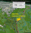
Was on my way to Hammonton tonight and went out Chew Rd to 206. Made the right and had to turn around to be sure what I saw. Pics below, 2 LARGE I-beams on either side of West Mill. Looks like the beginning gate?
 forums.njpinebarrens.com
If this map is adopted as proposed, there will be no point in Wharton State Forest(125k acres of 600k+ acres of public land in the Pinelands National Reserve) greater than approximately 1.1 miles from a mapped motorized route. This compares with over 1.5 miles away in Acadia National Park (47k acres), 2 miles in Shenandoah National Park (100k acres), 7 miles in the Smokey Mountains NP (550k acres). in the Adirondacks(approx 3 million acres public) the furthest out you can get is about 8 miles.
Although I think all the conservation groups would have accepted a range of versions, as long as they didn't expand on what the Pineland's Commission adopted, this map seems to permit much denser motorized traffic than any other major public land area on the east coast.
Although I think all the conservation groups would have accepted a range of versions, as long as they didn't expand on what the Pineland's Commission adopted, this map seems to permit much denser motorized traffic than any other major public land area on the east coast.
Attachments
Translation: We shouldn't complain about loss of freedom since there are other places that have even less freedom. Solid argument, Jason.If this map is adopted as proposed, there will be no point in Wharton State Forest(125k acres of 600k+ acres of public land in the Pinelands National Reserve) greater than approximately 1.1 miles from a mapped motorized route. This compares with over 1.5 miles away in Acadia National Park (47k acres), 2 miles in Shenandoah National Park (100k acres), 7 miles in the Smokey Mountains NP (550k acres). in the Adirondacks(approx 3 million acres public) the furthest out you can get is about 8 miles.
Although I think all the conservation groups would have accepted a range of versions, as long as they didn't expand on what the Pineland's Commission adopted, this map seems to permit much denser motorized traffic than any other major public land area on the east coast.
Jason,If this map is adopted as proposed, there will be no point in Wharton State Forest(125k acres of 600k+ acres of public land in the Pinelands National Reserve) greater than approximately 1.1 miles from a mapped motorized route. This compares with over 1.5 miles away in Acadia National Park (47k acres), 2 miles in Shenandoah National Park (100k acres), 7 miles in the Smokey Mountains NP (550k acres). in the Adirondacks(approx 3 million acres public) the furthest out you can get is about 8 miles.
Although I think all the conservation groups would have accepted a range of versions, as long as they didn't expand on what the Pineland's Commission adopted, this map seems to permit much denser motorized traffic than any other major public land area on the east coast.
Not sure what you mean when you say....."as long as they didn't expand on what the Pineland's Commission adopted"....
Could you clarify?
The Pinelands Commission, at the urging of Pinelands Advocates over the need for a Visitor Map, adopted the USGS topographic mapped double lined routes 1954-997 as the maximum baseline for motor vehicle usage in Wharton, barring endangered species or other issues like Natural Areas, campsites, streams and rivers, etc..Jason,
Not sure what you mean when you say....."as long as they didn't expand on what the Pineland's Commission adopted"....
Could you clarify?
That doesn't mean the DEP is limited to that, but it does mean they can never go beyond it by the standards of the Comprehensive Management Plan that governs the state Pinelands area.
1,000,000+ yearly visitors and 50% less roads.
I'm at a loss to understand why this even matters. The Pine Barrens isn't Acadia or the Smokey Mountains, it has its own set of roads and trails, what's the point in comparing it to other parks? Plus was there ever a situation in those places where there was an existing set of trails already agreed to in their management plans and then an outside group came along and lobbied to close half of them while simultaneously starting their own eco-tourism business?If this map is adopted as proposed, there will be no point in Wharton State Forest(125k acres of 600k+ acres of public land in the Pinelands National Reserve) greater than approximately 1.1 miles from a mapped motorized route. This compares with over 1.5 miles away in Acadia National Park (47k acres), 2 miles in Shenandoah National Park (100k acres), 7 miles in the Smokey Mountains NP (550k acres). in the Adirondacks(approx 3 million acres public) the furthest out you can get is about 8 miles.
Although I think all the conservation groups would have accepted a range of versions, as long as they didn't expand on what the Pineland's Commission adopted, this map seems to permit much denser motorized traffic than any other major public land area on the east coast.
Ugh. And every time someone wants to park to walk to a place they used to drive to, there will be no parking spot. In the Forked River Mountain county park, right now they are negotiating for a snake study before being allowed to make a parking spot right next to Lacey Road.1,000,000+ yearly visitors and 50% less roads.
This is apples to oranges. Those parks also allow ATVs and snowmobiles. Should I be pushing for that like other parks do?If this map is adopted as proposed, there will be no point in Wharton State Forest(125k acres of 600k+ acres of public land in the Pinelands National Reserve) greater than approximately 1.1 miles from a mapped motorized route. This compares with over 1.5 miles away in Acadia National Park (47k acres), 2 miles in Shenandoah National Park (100k acres), 7 miles in the Smokey Mountains NP (550k acres). in the Adirondacks(approx 3 million acres public) the furthest out you can get is about 8 miles.
Although I think all the conservation groups would have accepted a range of versions, as long as they didn't expand on what the Pineland's Commission adopted, this map seems to permit much denser motorized traffic than any other major public land area on the east coast.
What baffles me the most is all of the time, money, and energy dedicated to this fight while development continues to happen all around the area. If we're shutting things down, why not put effort into limiting growth in the growth zones? Once a house or building goes up that area is pretty much permanently destroyed.