My map project

Boyd

Administrator
Staff member
Site Administrator
Jul 31, 2004
9,506
2,768
Ben's Branch, Stephen Creek
Here's a sneak peek at the next version. The map now includes landcover information so forested areas are a pale green color and cleared areas will appear white, just like they do on the USGS topo maps. State forests and WMA's are a somewhat darker shade of green.

typ02.jpg


When viewed on the Garmin Nuvi, my goal is to bring the overall appearance more in line with the USGS topo maps:

usgs01.jpg

USGS Topo


typ01.jpg

Boyd's Map on the Nuvi

I will soon look at ways to make the 60csx screen look more like the USGS topos too, but that is a bit more of a challenge because there just aren't enough pixels to show the detail, and it is limited to 256 colors. Nevertheless, I think I can make the maps more readable, and the default yellow background color has definitely got to go! :)

If all goes well, I will have an update before New Years. :dance:
 

Boyd

Administrator
Staff member
Site Administrator
Jul 31, 2004
9,506
2,768
Ben's Branch, Stephen Creek
Another update

Here's a comparison of Garmin's US Topo on the left and my latest version on the right (as seen on the Oregon)

goosepond.jpg


I keep finding more interesting data to roll into the map, and the challenge now is finding a way to present it all in an attractive and readable way. Take a look at the following example, which is a pixel-for-pixel crop from the screen of the Nuvi 5000

v33.jpg


The white represents areas which have been cleared (such as fields). Wetlands are indicated by the marsh grass icons. They are defined as subsurface water in the National Hydrology Database from which I got all the data for the lakes and streams as well.

But I've included some other stuff from the NJDEP Landscape Project (http://www.nj.gov/dep/fgw/ensp/landscape/index.htm). The pale green areas of the map are forests: "The Forest data set depicts critical area maps for forest dependent species". And the darker green are forested wetlands: "The Forested Wetland data set depicts critical area maps for forested wetland dependent species". There's a lot of other cool stuff in the Landscape Project, but I'm starting to suffer from data overload :)

I am using some advanced techniques to make all of these things coexist on a Garmin GPS in a readable form, but to take full advantage of them you will need a model with a decent screen which would be the Nuvi, Oregon or Colorado. As I mentioned above, I'll do my best to make it work on the 60csx, but don't expect this kind of quality. Now that Christmas is over, I think we will see some blowout specials on the Nuvi line since the larger stores seemed to have a huge inventory going into the holidays. I've already seen the Nuvi 200 for about $130 and wouldn't be surprised to see it drop under $100.

I don't think you will see all this detail when viewing my maps on your computer (with Mapsource) either. The special data types and layers I'm using are designed to work on the GPS itself, not your computer.

We'll see how all this goes when I put it together, but I'm pretty happy with it so far and think I'm on track for an update around New Years.
 

Teegate

Administrator
Site Administrator
Sep 17, 2002
25,603
8,181
Very nice Boyd! It looks so much more like a normal topo.

Guy
 

MartGBC

Scout
Sep 10, 2008
79
0
Glendora
Will you be able to create a track of where you have been? In the Brenden Byrne Forest the roads on the Nuvi205W end when you cross over into Manchester Township.There are no roads for Greenwood Management area. I had to map that with Streets & Trips program.
 

Boyd

Administrator
Staff member
Site Administrator
Jul 31, 2004
9,506
2,768
Ben's Branch, Stephen Creek
After I get the basic map together I would like to start looking at details like roads. I'm hoping that Guy (Teegate) will have some time to help with this (he is already contributing a lot of points of interest and placenames).

Yes, I can take tracks (typically as .gpx files) and turn them into roads on the map, or use them to correct existing roads. So if you have any info like this it will be great, but please don't start sending it to me yet. I'll post more about this later.

Also, to answer your question, you can always record your own tracks on your GPS while viewing my map. But there is no easy way for you to turn them into "roads" on your copy of the map.
 

Teegate

Administrator
Site Administrator
Sep 17, 2002
25,603
8,181
After I get the basic map together I would like to start looking at details like roads. I'm hoping that Guy (Teegate) will have some time to help with this (he is already contributing a lot of points of interest and placenames).

Yes, I can take tracks (typically as .gpx files) and turn them into roads on the map, or use them to correct existing roads. So if you have any info like this it will be great, but please don't start sending it to me yet. I'll post more about this later.
.


Boyd,

One of my biggest complaints with topo's is they don't show all the roads, so I am ready and willing to work on that with you. I will look through my tracks and see if there are any roads I can pass along to you. I am looking forward to more roads on the topo.

Guy
 

Boyd

Administrator
Staff member
Site Administrator
Jul 31, 2004
9,506
2,768
Ben's Branch, Stephen Creek
"Classic" version for the 60csx

I've spent quite awhile tweaking the appearance of the map on the 60csx and have gotten to a point I like pretty much. What do you think?

60-v34.jpg


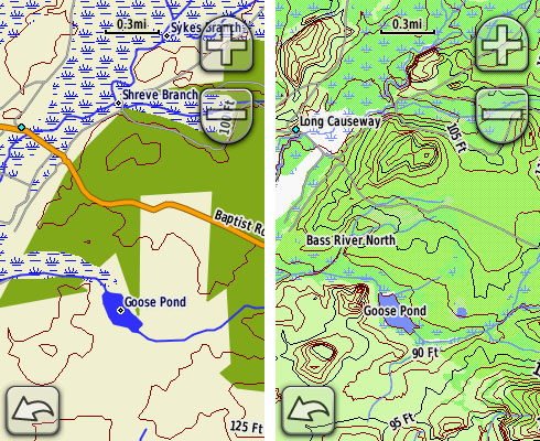
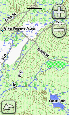
The traditional Garmin mustard yellow background is gone (note that it surrounds the map scale). Sorry if you were a fan of the yellow... personally I never cared for it. I've worked within the 256 "legal" colors for the 60csx screen and tried to produce the best readability.

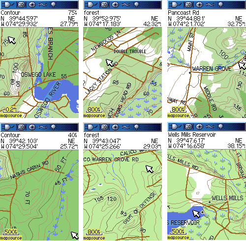
But I ran into another issue. The 60csx has a rather underpowered CPU by todays standards... I never realized this before pushing it with the complexity of my map, the Garmin maps are not as demanding. I just couldn't get usable performance with all the layers of landcover data. Scrolling the map took forever, and I had some crashes resulting in a blank map screen.

So the only choice was to eliminate a couple layers. The "classic" version will not have the forested wetlands or grasslands layers unfortunately. This gives acceptable, albeit a little sluggish, performance.

I also had an issue with the tricks I am using for layer transparency on the other version. The limited color palette and low resolution screen became very hard to read. In the other version the park landcover is semi-transparent, allowing you to see clearings, grasslands and forested wetlands within the park boundaries. The classic version has solid color parks, which doesn't seem like much of a trade-off.

So to clarify, the Classic version has the following layers of data (stacked from top to bottom):

1. Roads/Elevation Contours/Place Names
2. Swamps/Lakes/Streams/Ocean
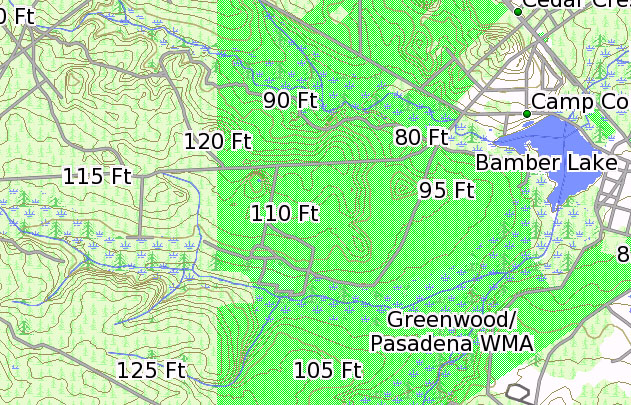
3. National/State/County Parks (solid fill)
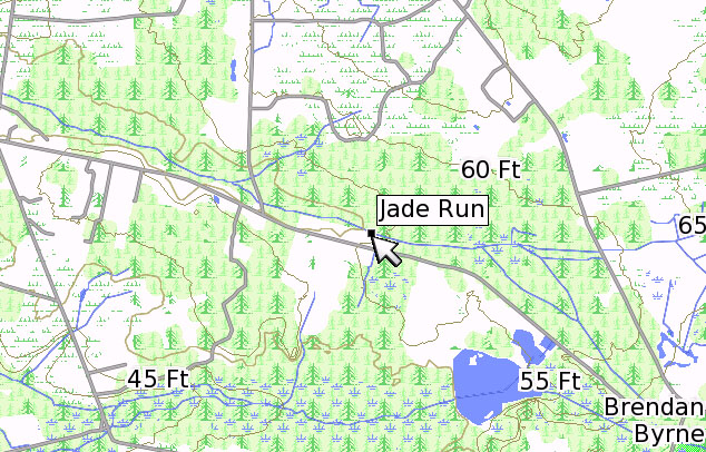
4. Forest Cover
5. Cleared Areas (white background)

And the Nuvi version has these layers:

1. Roads/Elevation Contours/Place Names
2. Swamps/Lakes/Streams/Ocean
3. National/State/County Parks (transparent)
4. Grasslands
5. Forested Wetlands (transparent)
6. Forest Cover
7. Cleared Areas (white background)

After I do a bit of editing to fix a few glitches and compile both versions I should be ready to release. Hopefully it will be online by New Years, but definitely in time for the weekend!
 

Teegate

Administrator
Site Administrator
Sep 17, 2002
25,603
8,181
If anyone hiked the Batona and kept their tracks, I would assume Boyd can add that also. One might have to edit out some obvious detours from the trail though.

Guy
 

Boyd

Administrator
Staff member
Site Administrator
Jul 31, 2004
9,506
2,768
Ben's Branch, Stephen Creek
Boyd,

One of my biggest complaints with topo's is they don't show all the roads, so I am ready and willing to work on that with you. I will look through my tracks and see if there are any roads I can pass along to you. I am looking forward to more roads on the topo.

Guy

Excellent! I went out for a short hike in Wharton today and was noticing some little roads not on the map. It's pretty easy for me to overlay the USGS topo quads on my map, so I should also be able to add roads from them.

This is going to be a long term project :)
 

Boyd

Administrator
Staff member
Site Administrator
Jul 31, 2004
9,506
2,768
Ben's Branch, Stephen Creek
If anyone hiked the Batona and kept their tracks, I would assume Boyd can add that also. One might have to edit out some obvious detours from the trail though.

Guy

The best way to make "roads" from "tracks" will be for me to import the track, then draw a line on top of it. That way I can smooth things out and also create a shape which the software will recognize as a road and will match the look of the existing map.
 
Jul 12, 2006
1,318
307
Gloucester City, NJ
Reading this and looking forward to this software may be the excuse I've been looking for to upgrade my handheld 60CS (not 60CSx) to a Nuvi. I just looked at Garmin's site and there has to be a dozen or so Nuvi versions. I don't want bells and whistles like traffic reports, MP3 player capability or any of that stuff. I just want a good GPS system to use in the truck for general travels and when on the trails. Can any recommend a version of the Nuvi?
 

Boyd

Administrator
Staff member
Site Administrator
Jul 31, 2004
9,506
2,768
Ben's Branch, Stephen Creek
I would suggest one of the widescreen models if it fits your budget. If you want the largest screen, check out the Nuvi 5000 - that's what I use. It's fairly expensive, but I've seen it on sale for $350.

If that's too much, see if you can find a Nuvi 750. These units are a bit older but still one of Garmin's best and you can often find good prices. 760 and 780 are basically the same but add some of those extra features you don't want. But maybe you will find a good deal.

Otherwise, see about the Nuvi 205w or 255w. They have newer chips which are faster. For the most bang for the buck, look at the Nuvi 205. It has a smaller screen but is on sale at Best Buy now for $140. It will fit in your pocket for short hikes too.
 

Boyd

Administrator
Staff member
Site Administrator
Jul 31, 2004
9,506
2,768
Ben's Branch, Stephen Creek
I am already working on the next version, which will be another major change. I was inspired by the style of the historic topo maps, and also think this approach makes it easier to read the different layers of information contained in the data. In these screenshots (from the Nuvi 5000) you can see state owned land, forest, clearings, grasslands, wetlands and forested wetlands.

newstyle001.jpg


newstyle003.jpg


Here's a screenshot from the Oregon which also shows a variety of landcover types:

newstyle002.jpg


This is all still work in progress, so we'll see where it leads. Unfortunately I won't be able to support this map style in the classic version.
 

46er

Piney
Mar 24, 2004
8,837
2,143
Coastal NJ
I will second Boyds recommendation of the 750. Like you, I wanted something without the bells and whistles with a wide screen. The 750 was the one I picked. It does have the traffic capability, but it is optional and by a subscription should you ever change your mind; I don't use it. I found a very good price online at this site last summer, the store prices may now be just as good.

http://www.tvnav.com/nuvifamily.htm
 

Boyd

Administrator
Staff member
Site Administrator
Jul 31, 2004
9,506
2,768
Ben's Branch, Stephen Creek
This is a good time to be shopping for GPS'es I think. The stores had huge inventories going into the holidays and didn't sell as many as they'd hoped. There seem to be a lot of price swings on different products from day to day. At Best Buy you will even find the same thing for different prices depending on which store you go to.

BTW, you might want to avoid the new 765/785 series. Garmin. They seem to have a lot of cool new features, but in order to improve performance they don't render the full map details depending on the zoom setting. This might be a problem for the Pines Map if you want to see full map detail when zoomed out. There's been some discussion of this issue in the various GPS forums.
 
Top