All,
I have started making a new series of Maps of the Pines, and have mentioned them in a few other threads, but this seems like a better place to consolidate the discussion.
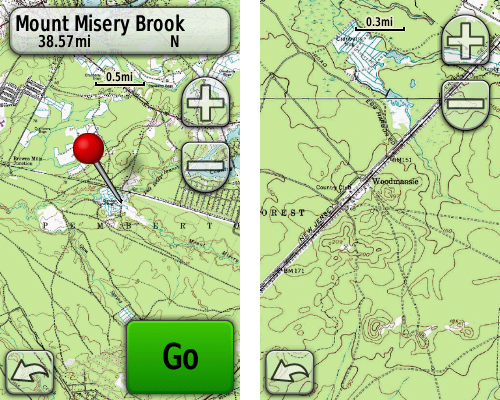
Traditional Garmin maps are vector-based, meaning they consist of geometric objects defined by a collection of coordinates which the GPS connects. Garmin has recently announced a new type of map which they call "custom maps". These are raster-based maps, which means they consist of images that are geo-referenced - calibrated to display in the correct proportions based on their location. These images can consist of anything, but the main attraction for us will probably be scans of real USGS 24k topo maps and the New Jersey 2007 digital orthophotography (aerial imagery).
These new "custom maps" are only compatible with the Garmin Oregon, Colorado and Dakota series of GPS'es. In order to use them, you must update your GPS to the newest firmware. It's easy: download, install and run Garmin WebUpdater from this link. It will guide you through the process: http://www8.garmin.com/support/collection.jsp?product=999-99999-27
Since they are geared to do this sort of thing, I have been uploading these new maps to GPSFileDepot. You will find all of my maps there (including maps for other places) at this link: http://www.gpsfiledepot.com/maps/byuser/282/
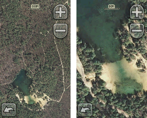
Here's a quick rundown of my maps of the pines (screenshots are from the Oregon):
Wharton State Forest (USGS 24k topo):
http://www.gpsfiledepot.com/maps/view/242/

Belleplain State Forest (USGS 24k topo AND NJ 2007 orthophotography):
http://www.gpsfiledepot.com/maps/view/246/


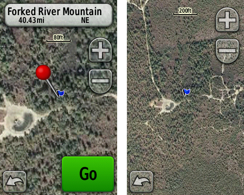
Forked River Mountain (USGS 24k topo AND NJ 2007 orthophotography):
http://www.gpsfiledepot.com/maps/view/241/

What areas would you like to have mapped? Post your suggestions here and I will try to work on them - time permitting! But first take a minute to understand the limitations of this map format. For USGS 24k topo's, I find that 10 feet per pixel is the lowest resolution I can use and still get high quality results. This will limit the maximum size of the map to a little smaller than 400 square miles (for example: ~20 miles x 20 miles).
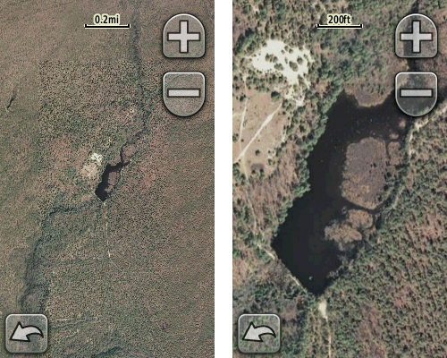
The 2007 orthoimagery is another matter. If I use the native resolution of these photos - 1 foot per pixel - I can only map a very small area, a bit less than 4 square miles (for example: ~2 miles x 2 miles). Maps at this resolution look terrific, but you have to carefully choose your target. I can reduce the resolution of the images and still get pretty nice results at about 4 feet per pixel, which would allow coverage of almost 64 square miles (for example: ~8 miles x 8 miles). They can also be sampled at lower resolutions, but of course the details will suffer. I suggest you look at some of the examples above at GPSFileDepot. I have indicated their resolution on each map's page there.
The map area must be rectangular, so visualize a box drawn around your area of interest, and the entire area inside that box is used in the calculations above.
Finally, you can make your own custom maps as well. The info on Garmin's site will get you started: http://www.garmin.com/garmin/cms/site/us/onthetrail/custommaps. Also look at this freeware program: http://moagu.com/?page_id=155
These maps don't work in mapsource, but they can be opened directly in Google Earth, or any other program which can read .kmz files. To install them on your GPS, create a folder named CustomMaps inside your Garmin folder, then simply drop the .kmz file into it. Unfortunately, you can only have ONE .kmz file stored on the gps. You will need to swap them with your computer, or place them on separate SD cards to change maps. You can enable and disable them on the GPS however. If you enable a topo map or City Navigator map at the same time, the roads and any other line or point features will be drawn on top of the custom map. Area features (like lakes or park boundaries) will be hidden by the custom map.
Enjoy, and let me know what areas you would like me to do next !
I have started making a new series of Maps of the Pines, and have mentioned them in a few other threads, but this seems like a better place to consolidate the discussion.
Traditional Garmin maps are vector-based, meaning they consist of geometric objects defined by a collection of coordinates which the GPS connects. Garmin has recently announced a new type of map which they call "custom maps". These are raster-based maps, which means they consist of images that are geo-referenced - calibrated to display in the correct proportions based on their location. These images can consist of anything, but the main attraction for us will probably be scans of real USGS 24k topo maps and the New Jersey 2007 digital orthophotography (aerial imagery).
These new "custom maps" are only compatible with the Garmin Oregon, Colorado and Dakota series of GPS'es. In order to use them, you must update your GPS to the newest firmware. It's easy: download, install and run Garmin WebUpdater from this link. It will guide you through the process: http://www8.garmin.com/support/collection.jsp?product=999-99999-27
Since they are geared to do this sort of thing, I have been uploading these new maps to GPSFileDepot. You will find all of my maps there (including maps for other places) at this link: http://www.gpsfiledepot.com/maps/byuser/282/
Here's a quick rundown of my maps of the pines (screenshots are from the Oregon):
Wharton State Forest (USGS 24k topo):
http://www.gpsfiledepot.com/maps/view/242/
Belleplain State Forest (USGS 24k topo AND NJ 2007 orthophotography):
http://www.gpsfiledepot.com/maps/view/246/
Forked River Mountain (USGS 24k topo AND NJ 2007 orthophotography):
http://www.gpsfiledepot.com/maps/view/241/
What areas would you like to have mapped? Post your suggestions here and I will try to work on them - time permitting! But first take a minute to understand the limitations of this map format. For USGS 24k topo's, I find that 10 feet per pixel is the lowest resolution I can use and still get high quality results. This will limit the maximum size of the map to a little smaller than 400 square miles (for example: ~20 miles x 20 miles).
The 2007 orthoimagery is another matter. If I use the native resolution of these photos - 1 foot per pixel - I can only map a very small area, a bit less than 4 square miles (for example: ~2 miles x 2 miles). Maps at this resolution look terrific, but you have to carefully choose your target. I can reduce the resolution of the images and still get pretty nice results at about 4 feet per pixel, which would allow coverage of almost 64 square miles (for example: ~8 miles x 8 miles). They can also be sampled at lower resolutions, but of course the details will suffer. I suggest you look at some of the examples above at GPSFileDepot. I have indicated their resolution on each map's page there.
The map area must be rectangular, so visualize a box drawn around your area of interest, and the entire area inside that box is used in the calculations above.
Finally, you can make your own custom maps as well. The info on Garmin's site will get you started: http://www.garmin.com/garmin/cms/site/us/onthetrail/custommaps. Also look at this freeware program: http://moagu.com/?page_id=155
These maps don't work in mapsource, but they can be opened directly in Google Earth, or any other program which can read .kmz files. To install them on your GPS, create a folder named CustomMaps inside your Garmin folder, then simply drop the .kmz file into it. Unfortunately, you can only have ONE .kmz file stored on the gps. You will need to swap them with your computer, or place them on separate SD cards to change maps. You can enable and disable them on the GPS however. If you enable a topo map or City Navigator map at the same time, the roads and any other line or point features will be drawn on top of the custom map. Area features (like lakes or park boundaries) will be hidden by the custom map.
Enjoy, and let me know what areas you would like me to do next !
")


 Found what I needed.