That's a very valid point, but I spent 37 years as an artist and designer and you can certainly lose your audience with information overload. Finalizing a design is often more about removing the unnecessary elements than adding new ones.
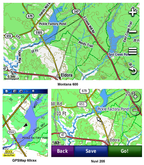
Garmin's handheld units do offer a good selection of menues to control the map appearance, but unfortunately you can't directly influence the display of contour lines. If you set map detail lower, they will disappear at a lower zoom level, but this may also have adverse effects on other map elements. In an ideal world, your point would be right on target, and the software would give the user full control of how to interpret the map data. I can do exactly that with powerful GIS software like Globalmapper or arcPAD, but not on a garmin GPS.
I think there's a way for me to influence at what zoom level the minor contour lines will disappear, but this gets a bit complicated and I haven't experimented with it. That would probably be the best of both worlds - showing all contour lines below .3 miles and dropping the minors at higher levels. In fact, that's how my Nuvi 3790 already behaves by default, but not my Oregon. I'm definitely going to look into this, but probably not for this coming version since it would involve a lot of re-compilation.


")